Japan reports Chinese Navy intelligence ship 796 moving south near Kumejima toward the Pacific
What happened
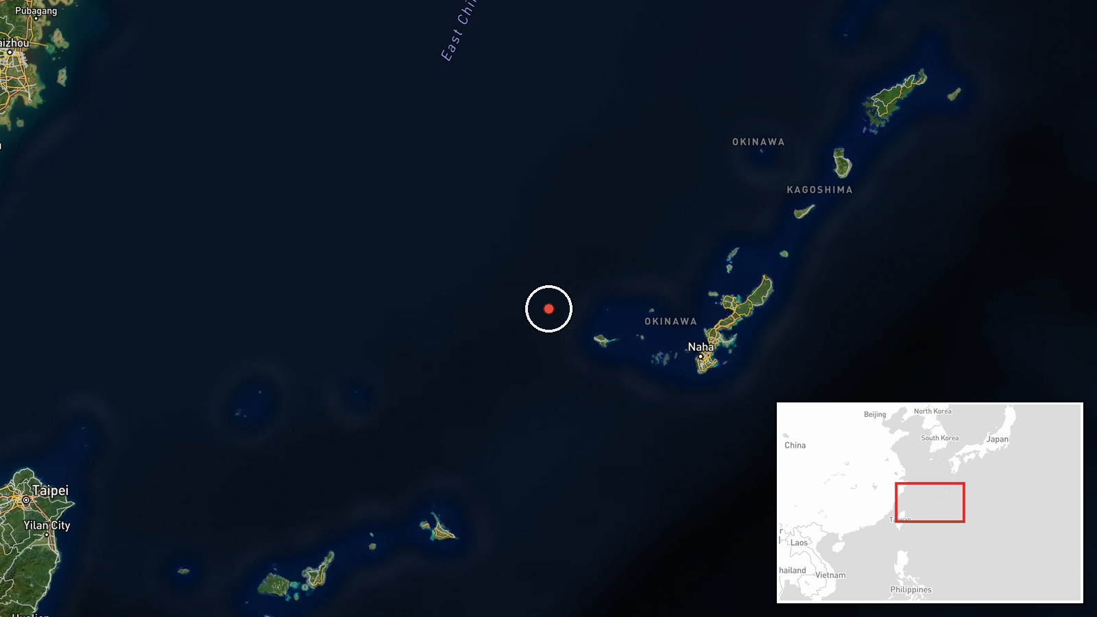
Japan's Joint Staff Office reported that at about 11:00 local time on Saturday, 17 October 2026, Maritime Self-Defense Force personnel confirmed a People's Liberation Army Navy Dongdiao-class intelligence collection ship, hull number 796, sailing south in waters roughly 80 kilometres northwest of Kumejima, Okinawa Prefecture. The statement says the vessel was then confirmed transiting the sea between Okinawa main island and Miyako Island and continuing toward the Pacific. Ministry of Defense surveillance was carried out by a P-1 patrol aircraft of the 5th Air Wing based at Naha. The report is worded in terms of observation and confirmation. It does not describe any incident, contact, or interference with Japanese vessels or aircraft.
Context and assessment
The Dongdiao class is generally described in open sources as a signals and electronic intelligence collection vessel, and it is one of several PLA Navy platforms that Japan has tracked repeatedly through the Ryukyu island chain. The routes between Okinawa and the Miyako Islands, and the wider Miyako Strait, are among the main passages connecting the East China Sea with the western Pacific, so ships transiting here are a recurring subject of Japanese public reporting. The feed attached to this event contains no related events, so no recent pattern can be drawn from it, and any comparison with earlier transits would have to rest on general background rather than on documented incidents here. Operationally, a southward track that moves through the gap between the main island and Miyako toward open water is consistent with a vessel heading into the Pacific, which may reflect a deployment, a routine transit, or a monitoring task. The report does not say which, and nothing in it indicates an intent beyond passage. Japan's decision to publicize the sighting with a named aircraft and base suggests a deliberate effort to document such movements.
Sources and confidence
The report comes from a single channel, the official X account of Japan's Joint Staff Office, which relays a Japanese-language government statement. No second outlet, Japanese defence ministry press release mirror, or independent maritime tracking record is attached in the dataset, so cross-confirmation is absent. The confidence score of 6.1 reflects a credible official source with a clear, specific description, offset by the single-channel basis and the lack of independent corroboration. The recorded timestamp of 19 October 2026 differs from the 17 October local date in the original text, which likely reflects a processing or publication delay and should be checked. Confidence would rise with a matching Japanese government release, a second national outlet, or AIS or satellite data. It would fall if the hull number or track could not be matched elsewhere.
Location
The location is an approximate sea position about 80 kilometres northwest of Kumejima, a small island in Okinawa Prefecture, and the listed coordinates of roughly 26.6 N and 126.3 E are a reference point derived from that description rather than a precise fix. The vessel was at sea, so no settlement or facility was involved. The setting is the East China Sea and the southern Ryukyu chain, with Okinawa main island and Miyako Island forming the channel the ship reportedly used. Yonaguni lies further west and the open Pacific lies to the east.
▶ View this event on the live map

Intel Mapper aggregates open-source reports from monitored Telegram and X channels, geolocates them, cross-checks duplicates across sources and assigns a confidence score. Entries are updated as new confirmations arrive. Read how we verify events.