Saudi defenses reportedly stop most Houthi missiles; over half of attacks hit uncovered areas
What happened
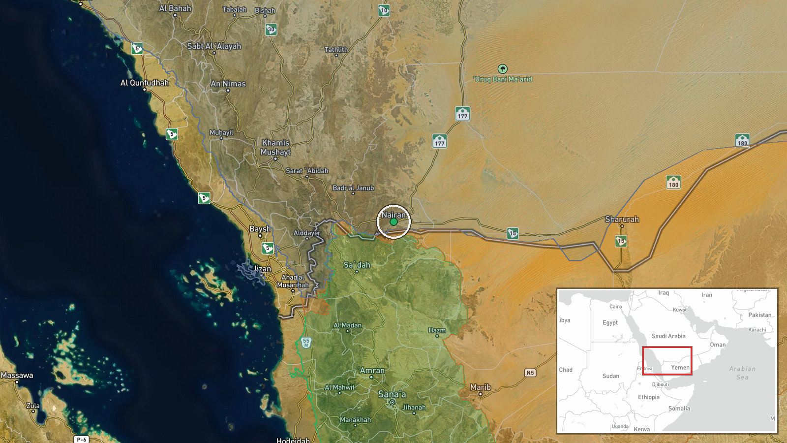
A report relayed by the X account @Osint613 says, citing the Wall Street Journal, that renewed Houthi attacks are exposing gaps in Saudi Arabia's military defenses. According to the post's wording, Saudi air defenses have reportedly intercepted more than 90 percent of Houthi missiles aimed at protected areas, while more than half of the attacks struck locations without air defense coverage. The post also states that the United States resumes its war with Iran next month, which it describes as leaving Saudi Arabia facing simultaneous threats from several directions without adequate defensive capabilities. The event is geolocated to the Saudi-Yemen border belt around Najran, with a recorded date of 19 October 2026 at 12:16 UTC. The underlying WSJ article was not available in the data, so the figures are secondhand and should be read as reported rather than independently verified.
Context and assessment
Najran is a border province of southwestern Saudi Arabia, and the area has repeatedly been exposed to cross-border fire from Yemen since the Houthi conflict widened. The most relevant related event is a hostile projectile that reportedly struck Najran on 18 October 2026, injuring six citizens and damaging three homes and three vehicles, according to Saudi Civil Defense; that report notes attribution was presumed rather than confirmed. Roughly two hours earlier, the Saudi National Early Warning Platform had issued an emergency warning for Najran Province, telling residents to follow official instructions. Taken together, these events suggest a sequence of warnings followed by impacts in populated areas, which fits the claim that some strikes landed where defensive coverage was thin. Operationally, the reported pattern may indicate that attackers are probing or exploiting coverage gaps rather than relying only on interception-resistant targeting, though the data does not establish intent. The reference to a renewed US-Iran confrontation, if accurate, would add a regional dimension, because it could stretch Saudi defensive resources across several fronts at once. These are inferences from a single relayed report and should be treated as hypotheses.
Sources and confidence
The event rests on a single channel, X account @Osint613, with a source count of one and no independent corroboration of the interception figures in the data. The adjacent October 18 Najran events come from official Saudi channels, Civil Defense and the early warning platform, which strengthen the picture of recent attacks but do not confirm the interception percentages or the coverage claim. The confidence score of 6.6 reflects that the attack pattern is plausible and partly backed by official reporting, while the core statistics remain unverified and secondhand. Confidence would rise with the original WSJ article, a Saudi or Houthi statement, or independent debris and impact imagery. It would fall if the WSJ piece is not found or if the figures cannot be traced to a named source.
Location
The location is recorded at region level, with coordinates near 17.55 N, 44.22 E, placing the event in the Saudi-Yemen border belt rather than at a specific settlement or facility. The high location confidence in the data reflects that Najran is named consistently across related reports. The area is largely mountainous and dissected by wadis, terrain that complicates radar coverage and low-altitude interception. The border with Yemen lies only a short distance to the south.
Related events nearby
- Saudi civil defense issued an alert over potential danger in Najran; residents reported hearing explosions in 2026-10-19 12:23 UTC · Siren · Najran, Saudi Arabia
- Hostile projectile struck Najran, Saudi Arabia, injuring six citizens and damaging three homes and three vehic2026-10-18 15:33 UTC · Ballistic Missile · Najran, Saudi Arabia
- Houthi forces destroyed numerous PLC armored vehicles and trucks on the Al-Jawf front using Kornet-E ATGMs and2026-10-19 13:48 UTC · Tank · Al-Jawf Front, Al Jawf Governorate, Yemen
▶ View this event on the live map

Intel Mapper aggregates open-source reports from monitored Telegram and X channels, geolocates them, cross-checks duplicates across sources and assigns a confidence score. Entries are updated as new confirmations arrive. Read how we verify events.