Unverified single-source report describes Iranian F-5 jet activity over Dezful, Khuzestan
What happened
A single social media post reports Iranian F-5 Tiger fighter jet activity over Dezful, a city in Khuzestan Province in southwestern Iran, on the morning of 20 October 2026 (06:12 UTC timestamp). The original text reads 'Iranian F-5 Tiger fighter jet activity detected over Dezful this morning' and credits the contribution to @Conflict_Radar, while the event record lists the channel as X (@Osint613). The post does not describe the aircraft's altitude, heading, number of aircraft, or whether any weapons were carried or fired. No imagery, video, or official statement accompanies the report in the data provided. The sighting is therefore recorded as unverified.
Context and assessment
Dezful is a city of significant size in Khuzestan, a province bordering Iraq and the Persian Gulf that has repeatedly been central to Iran's military and energy geography. Iranian air units have long operated older Western-origin aircraft, and the F-5 family, which Iran acquired before 1979, remains part of its inventory according to widely published order-of-battle assessments. Because no related events are attached to this record, it cannot be placed within a recent sequence of incidents on the map, and nothing in the data links it to strikes, cross-border activity, or clashes elsewhere. Operationally, a single report of fighter activity over a populated area is most often consistent with routine training, transit, or air patrol flights, which are common and rarely newsworthy. A reported sighting alone does not indicate combat, an attack, or a change in posture, and any such reading would require corroboration from additional, independent sources.
Sources and confidence
The event rests on one channel, and the record is internally inconsistent about attribution: the quoted post credits @Conflict_Radar, while the channel field names X (@Osint613). No second outlet, imagery service, or official source has been logged against it, so cross-confirmation is absent. The confidence score of 6.0 reflects a plausible but unverified report from a single origin with no geolocated media. Confidence would rise with a photograph or video showing the aircraft and its location, metadata that matches the timestamp, or independent corroboration from a second monitoring account. It would fall if the original poster is shown to have recycled older footage or if the attribution discrepancy cannot be resolved.
Location
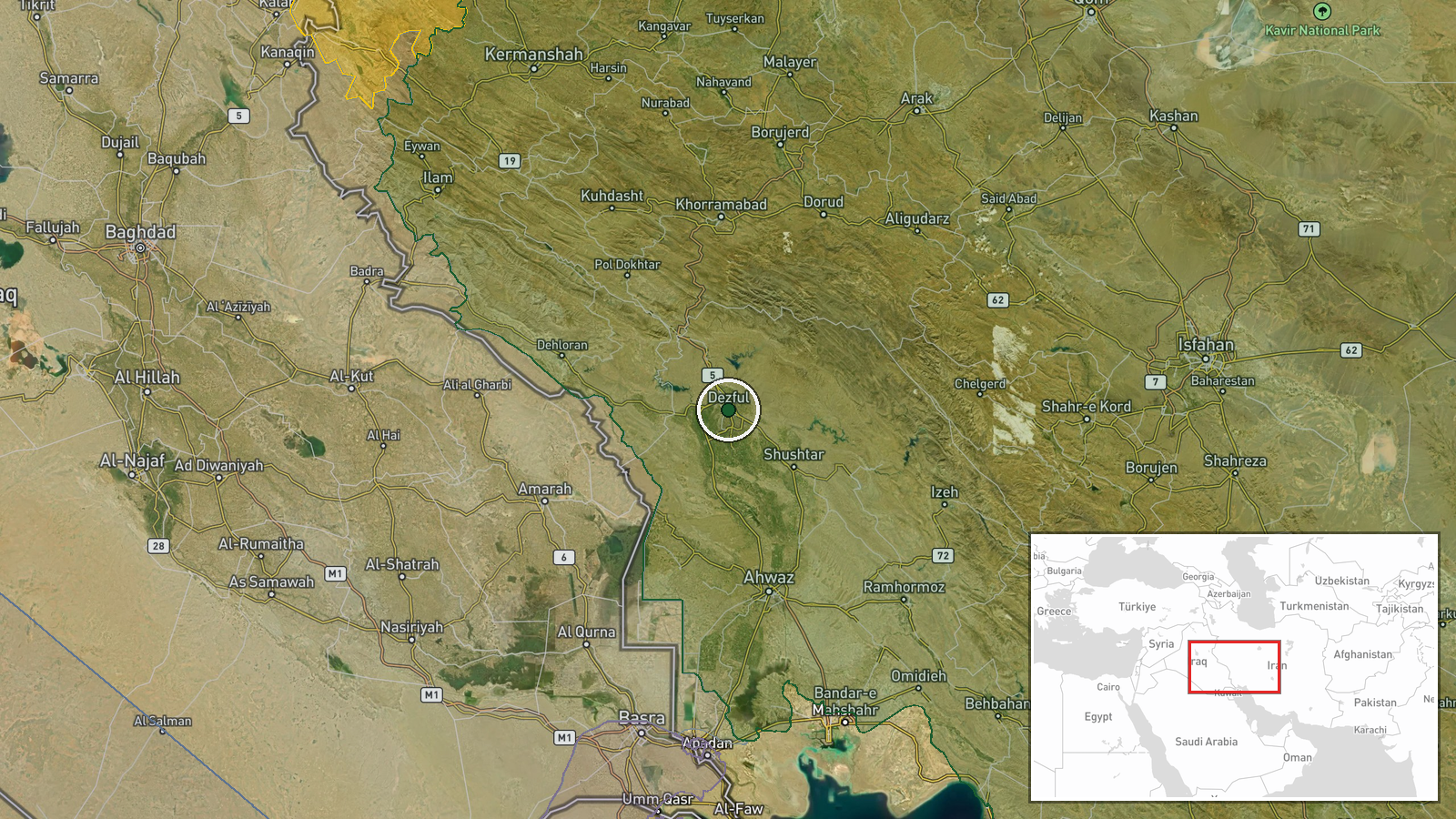
The location is recorded at settlement level, with coordinates of 32.38 N, 48.40 E placed on Dezful as a whole rather than on any specific airfield or facility. The data does not state that the sighting was tied to a particular site, so the pin should be read as the city area only. Dezful sits on the Dez River in the Khuzestan plain, with the Zagros foothills to the north and east. Several dams and water works on the Dez River lie upstream of the city and are notable features of the surrounding terrain.
▶ View this event on the live map

Intel Mapper aggregates open-source reports from monitored Telegram and X channels, geolocates them, cross-checks duplicates across sources and assigns a confidence score. Entries are updated as new confirmations arrive. Read how we verify events.