Reported Ukrainian drone shot down over Pasvalys district, Lithuania; single unverified source
What happened
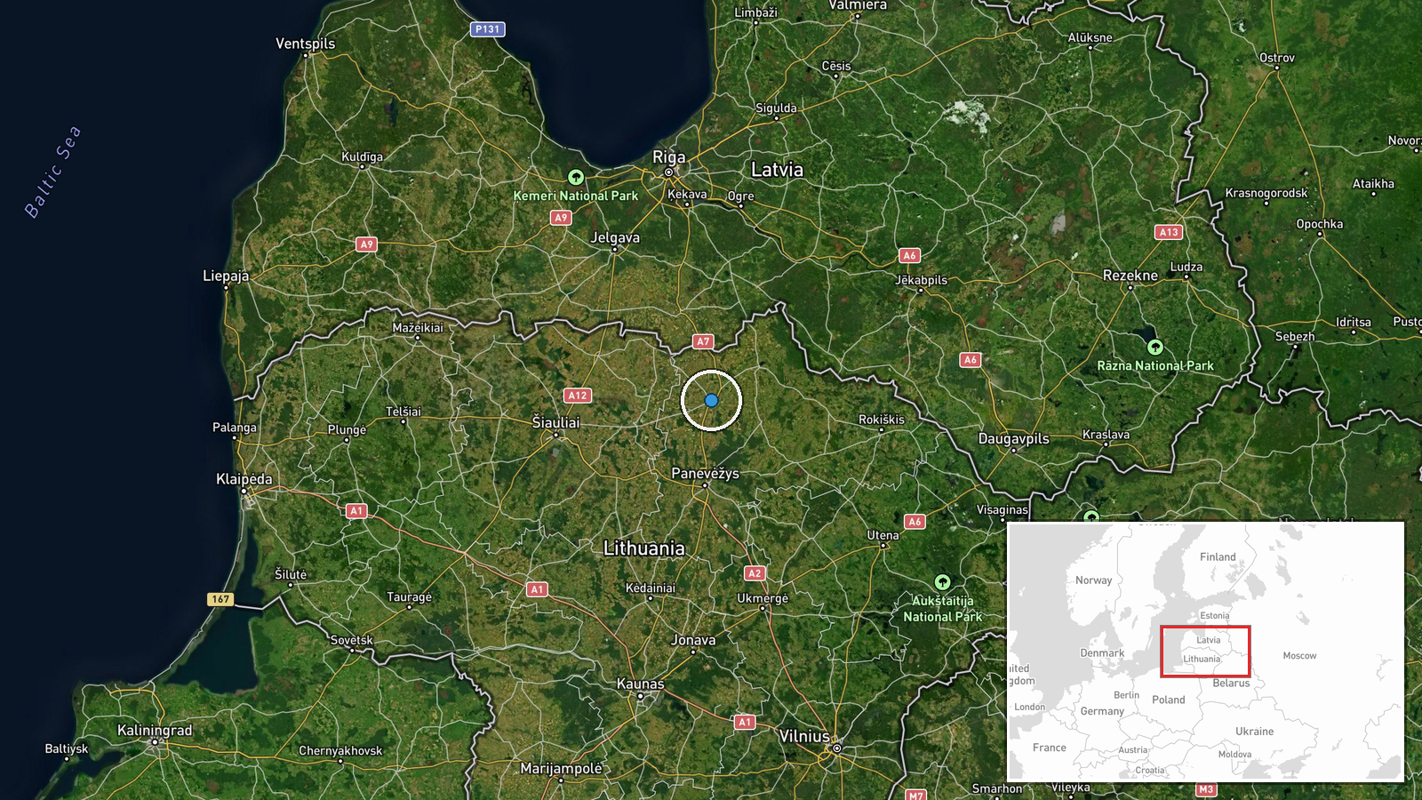
A single social media account, X (@WarMonitor3), reported that a Ukrainian drone entered Lithuania from Polish territory on October 18 and was shot down over the Pasvalys district in Panevėžys County, exploding on impact. The post, labelled as breaking news, said the drone was headed for St Petersburg in Russia but was using Baltic air cover. The wording relies on attribution without detail: the account says it 'has been revealed' but names no official source, military statement, or wreckage evidence. The event record is dated October 20, 2026, two days after the date given in the post, so the timing should be read as reported rather than confirmed. No Lithuanian, Ukrainian, or Russian official statement appears in the available material.
Context and assessment
Lithuania sits on NATO's eastern flank, and any airborne object crossing its airspace draws immediate attention from allied air policing and national defence authorities. The reported route, from Poland across Lithuania toward Russia's northwest, runs through a corridor that has seen repeated incidents involving stray drones, electronic interference, and airspace violations since the wider war in Ukraine began. A related unverified Telegram claim, also dated October 19, alleged that Oreshnik missiles were launched from Latvia during a recent attack. That source dismissed a Ukrainian launch origin and reported no impact or damage. Taken together, the two reports show how quickly unconfirmed claims about Baltic airspace circulate and how they can point in contradictory directions. Operationally, a drone transiting Baltic airspace toward St Petersburg would suggest a long-range strike profile that depends on routing around air defences, though a single account cannot establish intent, route, or whether the object was even a drone. Analysts would weigh any debris recovery and official confirmation before treating the account as a meaningful pattern.
Sources and confidence
The event rests on one channel, X account @WarMonitor3, with no cross-confirmation from a second outlet, wire service, or official body in the record. The confidence score of 5.4 reflects that single-source status, the absence of a named official source, and the date discrepancy between the post and the record. Confidence would rise if Lithuanian or Latvian authorities, NATO air command, or a major wire service corroborated the shootdown, or if photographs or wreckage tied to the location were verified. It would fall if the account were found to have recycled older footage or if no official statement emerged within a reasonable window.
Location
The location is recorded at region precision, meaning the coordinates mark the general Pasvalys district rather than a specific village, field, or impact site. The record places it in Panevėžys County in north-central Lithuania, not far from the Latvian border. The area is largely flat, rural, and agricultural, with farmland, small settlements, and scattered forest. The lack of a precise impact point means the location reflects the report's own wording and should not be treated as a verified crash site.
Related events nearby
- Unverified Telegram claim that Oreshnik missiles were launched from Latvia during a recent attack; the source 2026-10-19 15:27 UTC · Report · Riga, Latvia
▶ View this event on the live map

Intel Mapper aggregates open-source reports from monitored Telegram and X channels, geolocates them, cross-checks duplicates across sources and assigns a confidence score. Entries are updated as new confirmations arrive. Read how we verify events.