Drone strikes across Sudan reportedly kill over 100, including 80 in West Kordofan
What happened
According to a post by the X account @sudanwarmonitor, drone attacks across Sudan since Sunday evening killed more than 100 people. The reported toll includes 80 deaths in a strike on a gathering of civilians in West Kordofan State, 17 in Nyala in South Darfur, and four in Khartoum, three of them children. The post is a repost of a Radio Dabanga item, whose Arabic wording says the Rapid Support Forces accused the army of being behind the strikes in western areas, while a military source accused the RSF of launching drones at the capital. The entry classifies the attack as a UAS strike by unattributed operators. The post is the only source attached, so the figures and attribution remain unverified.
Context and assessment
Western Sudan and Darfur have been central to the war between the army and the Rapid Support Forces since fighting began in April 2023. Kordofan sits between Darfur and the Nile valley, and control of its roads and towns has shifted repeatedly, making it a contested corridor rather than a fixed front. Nyala, the capital of South Darfur, has long been an RSF stronghold, so a strike there fits a wider pattern of long-range attacks on urban areas. Khartoum, by contrast, has seen repeated drone and artillery exchanges as both sides have sought control of the capital and its key infrastructure. The report's framing, in which each side blames the other, mirrors earlier episodes where neither party has claimed specific drone launches. No related events are linked to this entry, so it cannot be placed within a documented sequence. Operationally, strikes across three distant cities in one night could suggest multiple launch sites or a long-range platform, though they could equally reflect separate actors or an aggregated account of unrelated incidents. Attribution remains the key open question.
Sources and confidence
The entry rests on a single channel, the X account @sudanwarmonitor, whose post repeats a Radio Dabanga report written in Arabic. Radio Dabanga is an established Sudan-focused outlet, but this copy is secondhand and the original article is not separately linked. No independent wire, UN, or government confirmation is recorded, and the casualty split is not matched by a second outlet. The confidence score of 6.0 reflects single-source status, the partisan nature of the claims, and unverified attribution. Confidence would rise with corroboration from Radio Dabanga's own site, local health or hospital tallies, or UN and Sudanese civilian reporting. It would fall if the figures prove to combine separate incidents.
Location
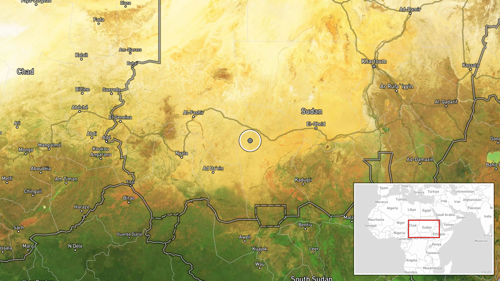
The coordinates, 12.7N and 27.6E, form a region-level point in West Kordofan State rather than a named settlement or facility, which explains the low location confidence. The state lies in western Sudan, adjoining Darfur, and is largely flat, semi-arid savanna with few paved roads. El Fula, the state capital, lies in the general area. Nyala and Khartoum are not geolocated by this entry and the coordinates do not represent them.
▶ View this event on the live map

Intel Mapper aggregates open-source reports from monitored Telegram and X channels, geolocates them, cross-checks duplicates across sources and assigns a confidence score. Entries are updated as new confirmations arrive. Read how we verify events.