Japan scrambles fighter jets over East China Sea and Pacific on possible airspace violations
What happened
Japan's Joint Staff, the public affairs account of the Ministry of Defense and Self-Defense Forces, posted on X that fighter aircraft from the Air Self-Defense Force's Western Air Defense Force and other units were urgently scrambled to respond to possible airspace violations over the East China Sea and the Pacific. The post describes the action as occurring 'yesterday,' so the exact date is inferred from the posting time, recorded here as 21 October 2026 at 08:40 UTC. The statement does not name the aircraft or the foreign state involved, nor does it give the number of jets or their flight paths. It says the forces will maintain round-the-clock readiness to protect Japanese territory and citizens. The post carries hashtags referencing F-15 fighters and states that the accompanying photograph is a file image.
Context and assessment
The area lies between Japan's southwestern Nansei island chain and the open Pacific, an approach that connects the East China Sea with routes toward the Western Pacific. Japan's air defense zones and nearby airspace are monitored closely because they sit between China's coast, the Korean Peninsula and Russia's Far Eastern military districts. Scrambles of this kind are a routine part of Japan's air defense and are typically used to identify, track and, when needed, intercept aircraft approaching or entering sensitive airspace. Intel Mapper's records contain no related events for this report, so a recent pattern cannot be established from the dataset itself. Based on general background, the wording 'possible' suggests the aircraft were not confirmed to have violated sovereign airspace at the time of the post. Operationally, such a statement may indicate that foreign military aircraft were operating close to Japanese airspace in a way that triggered detection thresholds. Without the flight tracks, the identity of the aircraft or any follow-up statement, the significance of the event cannot be judged beyond routine air defense activity.
Sources and confidence
The report rests on a single channel, the X account of Japan's Joint Staff, which is an official government source and the primary origin of the statement. No independent outlet, Japanese media repeat, or second official source appears in the data. The confidence score of 6.1 reflects a single official but unverified post, vague wording about 'possible' violations, and an approximate regional location. Confidence would rise with a fuller Joint Staff press release giving time, aircraft type and track, with corroboration from Japanese national media, Defense Ministry briefings, or civil flight-tracking data. It would fall if a correction or retraction appeared, or if the post were later found to refer to a different date or incident.
Location
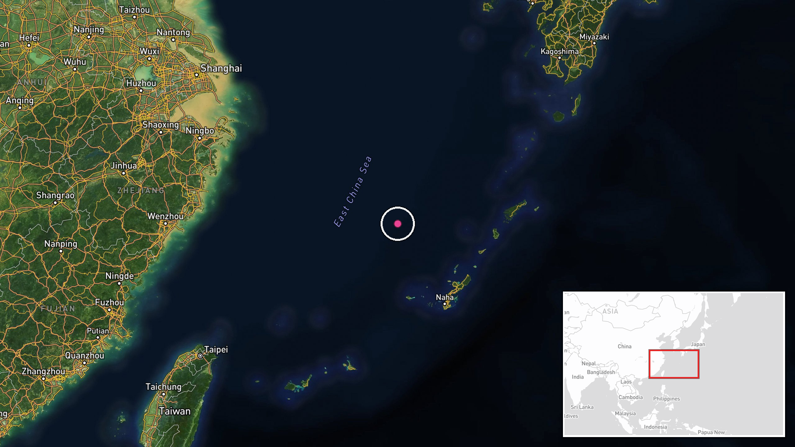
The coordinates, 28.0 N and 126.5 E, are a regional approximate point in the East China Sea, placed by the mapping system rather than tied to an observed intercept. The true location of any scramble is unknown from the source. The area sits between Okinawa's main island and the Amami and Kagoshima island groups, over a shallow continental shelf adjacent to the deeper Okinawa Trough. It is a busy sea and air corridor near Japan's southwestern islands and the Taiwan approaches.
▶ View this event on the live map

Intel Mapper aggregates open-source reports from monitored Telegram and X channels, geolocates them, cross-checks duplicates across sources and assigns a confidence score. Entries are updated as new confirmations arrive. Read how we verify events.