Tanker hit by unidentified fire off Oman; onboard blaze reportedly extinguished
What happened
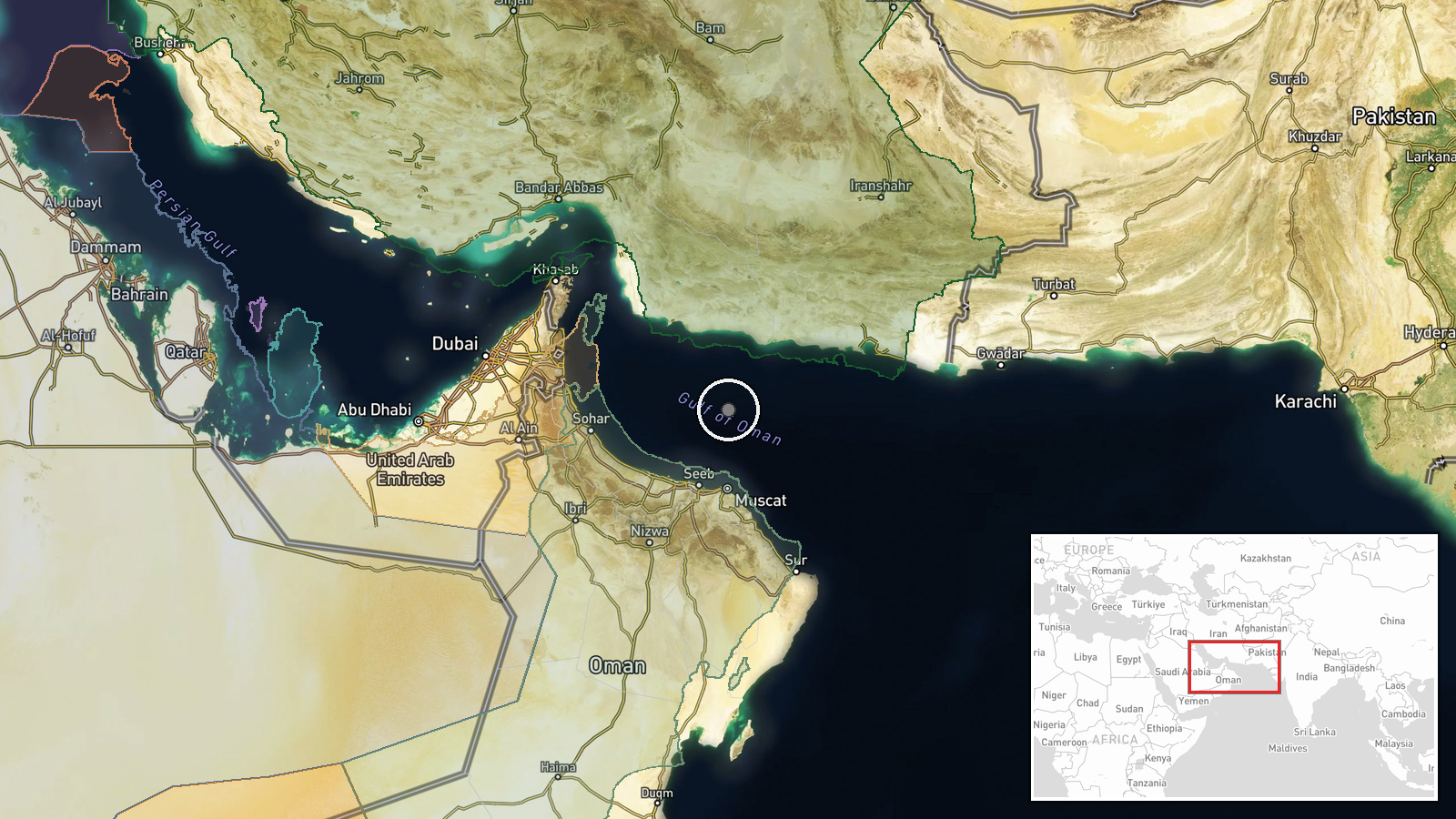
A tanker off the coast of Oman was struck by fire from an unidentified source on 21 October 2026 at about 08:48 UTC, according to the UK Maritime Trade Operations (UKMTO), the maritime security body that tracks incidents in the region. The report says the strike set off a fire on board and that crews have since put it out. The original wording describes the attacker only as unidentified, and no vessel name, flag, casualties, or extent of damage appear in the record. The incident is logged as a combat-type event. The recorded coordinates place it in the Gulf of Oman, but they reflect a broad area rather than a precise position, so the exact location of the strike is not established.
Context and assessment
The Gulf of Oman is one of the busiest energy corridors in the world, serving as the approach to the Strait of Hormuz, through which a large share of seaborne crude and refined products passes. That makes commercial tankers in these waters a sensitive target, both for their economic weight and for the signal a strike sends to insurers, owners, and navies operating nearby. Incidents affecting merchant ships in this region have often been slow to attribute, since projectiles, drones, small craft, and limpet-style devices can all cause a fire aboard a vessel, and early reports frequently describe the damage before the weapon. Intel Mapper has no related events linked to this record, so it cannot be placed within a recent sequence of attacks on shipping from our own data, and any reading of a wider pattern would be speculative. Operationally, an unidentified attacker firing on a merchant ship could point to a deliberate effort to pressure shipping, or to a signal sent in a contested waterway, but it could also reflect an accident or a misidentified incident. Follow-up UKMTO advisories and any statement from Oman or regional navies would help clarify intent.
Sources and confidence
Reporting rests on one X account, @Osint613, which attributes the incident to UKMTO. The record contains no UKMTO notice, wire story, or second outlet confirming the strike, so the UKMTO attribution is not independently verified here. The confidence score of 6.5 reflects a single source with a specific, plausible account and no contradicting reports. It would rise with a published UKMTO advisory, corroboration from the vessel operator or shipping trackers, or wire coverage. It would fall if the vessel cannot be identified or the fire is linked to an onboard accident.
Location
The location is recorded at region level, with coordinates of 24.6 N and 58.6 E in the Gulf of Oman off Oman's coast, and location confidence is rated low. The point appears to be a broad area rather than the actual site of the strike, which the source does not give. The Gulf of Oman lies between the Arabian Peninsula's eastern coast and Iran's southern shore, linking the Arabian Sea to the Strait of Hormuz. Oman's coastline and offshore shipping lanes lie nearby.
▶ View this event on the live map

Intel Mapper aggregates open-source reports from monitored Telegram and X channels, geolocates them, cross-checks duplicates across sources and assigns a confidence score. Entries are updated as new confirmations arrive. Read how we verify events.