UKMTO reports unknown projectile strike on tankers 30 NM southeast of Al Faw, Iraq
What happened
UKMTO, the UK Maritime Trade Operations service, reportedly flagged an incident about 30 nautical miles southeast of Al Faw, Iraq. The post, from the X account @Osint613, says tankers were struck by an unknown projectile late on the previous night. Crew are reported safe, with no damage or environmental impact reported. The source text is hedged, describing the tankers as reporting that they were struck. The event summary adds that up to three vessels may have been involved and that unverified footage from one tanker suggests drones were used. Neither detail appears in the quoted UKMTO text, and the attack type is logged as artillery, so these points conflict and remain unresolved.
Context and assessment
Al Faw sits at the southern tip of Iraq's Faw peninsula, where the Shatt al-Arab meets the northern Persian Gulf. It hosts Iraq's main deep-water port complex and the terminal approaches that Basra's oil exports depend on, which makes the surrounding sea lanes economically significant. Iraq's crude exports move largely through the southern terminals, so any disruption near the approaches can affect commercial traffic well beyond the immediate area. The northern Gulf is also a narrow, busy corridor linking Kuwait, Iran and the Strait of Hormuz to the southeast, where shipping has faced episodic harassment, mines and projectile threats in recent years. No related events are linked in the dataset, so this report cannot yet be placed within a sequence of prior incidents on Intel Mapper. Operationally, a strike roughly 30 nautical miles offshore would point to a stand-off capability, such as drones, anti-ship missiles or long-range fire, rather than a small-boat approach. The artillery classification in the record would fit poorly with a ship that far out and should be treated cautiously. Possible motives range from targeting a specific vessel or owner to wider regional spillover, and the available material supports none of them. Any link to a wider campaign remains speculative until further reporting arrives.
Sources and confidence
The report rests on a single channel, an X post by @Osint613 that quotes or paraphrases a UKMTO notice. No second outlet or matching official alert is in the record, so cross-confirmation is absent. The confidence score of 6.2 reflects that single-source status, the unidentified attacker and the conflict between the quoted text and the summary's drone claim. Confidence would rise with a direct UKMTO advisory, corroborating reports from shipping operators or the vessel's flag state, or independent imagery of damage. It would fall if the vessels cannot be identified or if the footage is shown to predate the incident.
Location
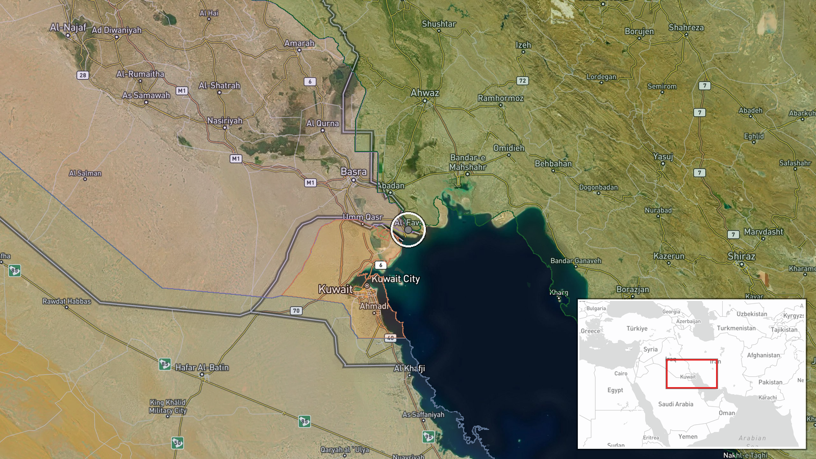
The point was assigned at region precision, with location confidence rated high. The coordinates sit at Al Faw itself rather than at the reported incident site about 30 nautical miles southeast, so the pin marks the reference settlement, not the strike. Al Faw lies on the Faw peninsula at the mouth of the Shatt al-Arab, with flat, low-lying terrain, mudflats and a marshy coastline nearby.
▶ View this event on the live map

Intel Mapper aggregates open-source reports from monitored Telegram and X channels, geolocates them, cross-checks duplicates across sources and assigns a confidence score. Entries are updated as new confirmations arrive. Read how we verify events.