Single-source OSINT report describes Iranian ballistic missile movement at Pouneh tunnel, Khorramabad
What happened
An OSINT monitoring account on X, @Osint613, reported Iranian ballistic missile movement recorded inside the Pouneh tunnel near Khorramabad, in Lorestan province of western Iran, with a timestamp of 21 October 2026 at 18:12 UTC. The post's wording is brief: it describes the activity as recorded movement and does not give the number of missiles, launchers or vehicles, or the direction of travel. The material was contributed by @Conflict_Radar, and the original text also tags @hey_itsmyturn, which appears to be a further contributor or repeater rather than an independent observer. No imagery, video or official Iranian statement is cited in the material available to this desk. The event is classified as a deployment, meaning the report concerns the movement of assets rather than a strike on a target.
Context and assessment
Pouneh is a location of interest in open-source reporting because it sits within the Zagros mountain belt, where Iran has long been reported to maintain underground facilities for missile and other military stocks. Tunnels of this kind are commonly associated with sheltering assets from aerial observation and strike, so movement of ballistic missiles in or out of such a site would typically be read as routine logistics, reposturing between bases, or preparation for exercises. Khorramabad lies on routes linking western Iran with the wider interior, so the area is plausibly part of the network that moves equipment between depots and launch sites. The event has no related events in the desk's database, so this report cannot be placed within a sequence of earlier incidents at the same site, and no pattern of escalation can be established from present data. Operationally, a single reported movement of this kind is most consistent with ordinary force rotation, but it could also indicate a change in readiness, particularly if further reports follow from the same location. Without vehicle counts, route information or corroborating imagery, the report should be treated as an indicator of activity rather than evidence of intent.
Sources and confidence
The report rests on one X account, @Osint613, with material contributed by @Conflict_Radar and a secondary tag to @hey_itsmyturn. No independent outlet, imagery provider or official source has confirmed the movement. The 6.8 score reflects a credible monitoring channel with a stated location and timestamp, offset by single-source reliance and no visual evidence. Confidence would rise with geolocated imagery or video of the vehicles, a second independent analyst, or satellite changes at the tunnel entrance. It would fall if the material is found to be older footage or if the timestamp cannot be reconciled with available imagery.
Location
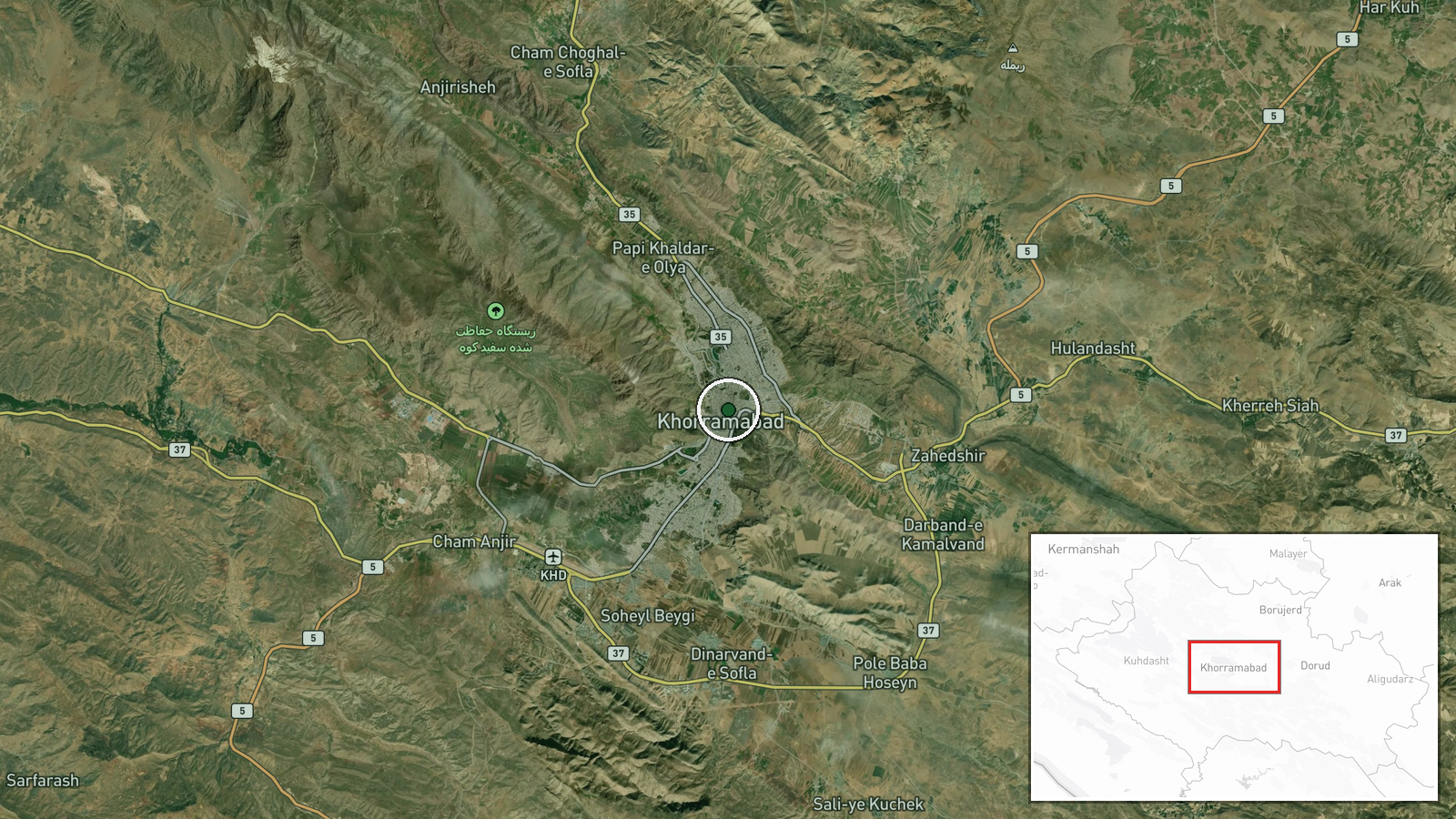
The coordinates are tied to the Pouneh tunnel and assigned at facility precision, so they mark a named site rather than a town centre, though the exact portal may sit a few hundred metres away. The site lies near Khorramabad, capital of Lorestan province, in the Zagros mountains of western Iran. The steep, folded ridge terrain favours underground construction and limits ground-level observation.
▶ View this event on the live map

Intel Mapper aggregates open-source reports from monitored Telegram and X channels, geolocates them, cross-checks duplicates across sources and assigns a confidence score. Entries are updated as new confirmations arrive. Read how we verify events.