Taiwan reports six PLAN vessels and seven official ships around the island as of 6 a.m. UTC+8
What happened
A post on X from the account @MoNDefense, the sole channel recorded for this event, reports that six PLAN vessels and seven official ships were operating around Taiwan as of 6 a.m. local time (UTC+8) on 22 October 2026. The post says ROC Armed Forces monitored the situation and responded, but it does not describe the nature of that response. The same post states that no PLA aircraft were detected around Taiwan in the same timeframe, so no flight path illustration was provided. The event is logged at 01:00 UTC on 22 October 2026. The report is a vessel count rather than a described incident, and it mentions no collision, interception, or casualty.
Context and assessment
Waters around Taiwan are among the most closely watched maritime areas in the region. The Taiwan Strait separates the island from the Chinese mainland across a channel roughly 180 kilometres wide at its narrowest, and both Beijing and Taipei regard the area as politically sensitive. Taiwan's defence authorities have for years published tallies of PLA naval and air activity around the island, and reporting of this kind is generally read as a sign of routine presence and monitoring rather than a discrete clash. The phrase 'official ships' is not explained in the post. In regional reporting it can refer to non-military state vessels such as coast guard or maritime agency craft, but that reading is unconfirmed here. No related events are linked to this record, so it cannot be placed within a recent sequence on the map. Operationally, a count of six naval vessels and seven official ships with no aircraft recorded may suggest a sea-focused posture during that window. A single tally cannot establish intent, duration, or whether activity is changing, so the event is best read as a snapshot of maritime presence rather than evidence of escalation.
Sources and confidence
The item rests on a single channel, the X account @MoNDefense, and no second source is recorded. The confidence score is 6.1, a modest figure. It reflects that the report is specific and attributed to an official-style defence account, and it fits the long-running pattern of Taiwan's published tallies. It is not corroborated by any independent source. The score would rise if Taiwan's defence ministry or armed forces issued matching figures through official channels, or if maritime tracking data or regional monitors recorded comparable vessel counts. It would fall if the account's attribution could not be verified, if the counts were revised, or if other reporting gave materially different numbers.
Location
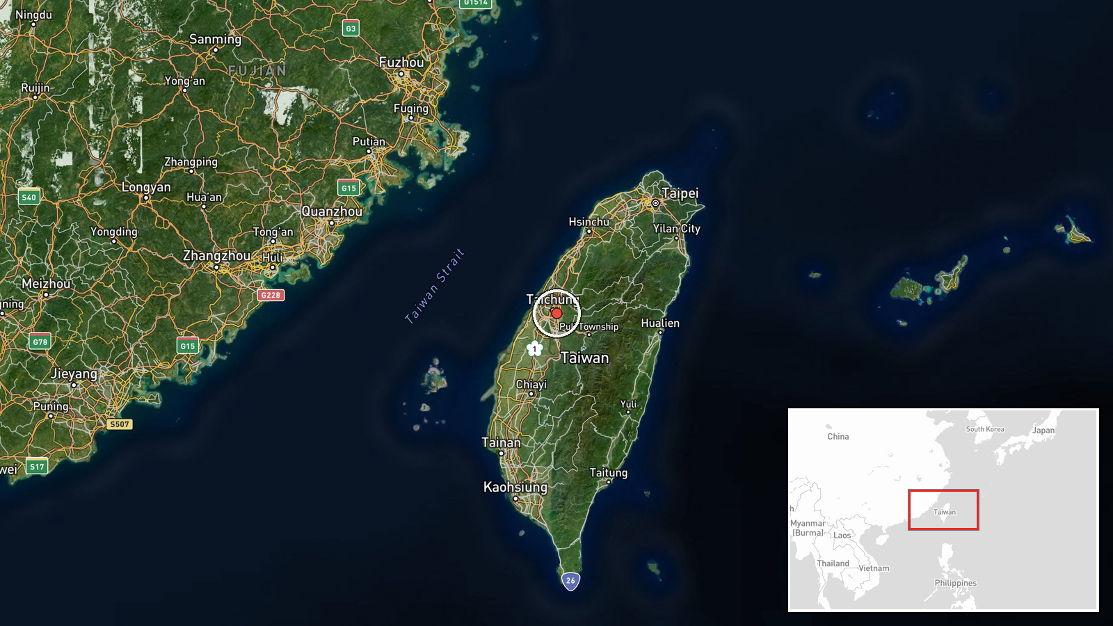
The location is a region-level placement, not a specific settlement, facility, or vessel position. The coordinates fall near Taiwan's west-central coast close to Taichung, which serves as a reference point for the wider strait. Location confidence is recorded as high, but geo-precision is region, so the pin should be read as approximate. The surrounding waters are the Taiwan Strait, with the Chinese mainland to the west and Taiwan's western coastline to the east, and the Penghu islands lie further to the southwest.
▶ View this event on the live map

Intel Mapper aggregates open-source reports from monitored Telegram and X channels, geolocates them, cross-checks duplicates across sources and assigns a confidence score. Entries are updated as new confirmations arrive. Read how we verify events.