Flights to Dammam, Hofuf held amid unconfirmed reports of Houthi attack in Eastern Province
What happened
An account on X, @Osint613, reported at 09:53 UTC on 22 October 2026 that aircraft bound for Dammam and Hofuf airports were flying holding patterns amid reports of a Houthi attack on Saudi Arabia's Eastern Province. The post does not specify a target, casualties or confirmed damage. The record is logged against Dammam Airport, and Hofuf is named only in the source wording. Earlier records describe a separate incident the previous evening: Saudi GACA reportedly said an attack on King Fahd International Airport in Dammam killed at least one person and injured eight, with damage assessment underway. Saudi Aramco reportedly told staff to evacuate its Dhahran headquarters and work remotely, with no reason given.
Context and assessment
The Eastern Province hosts much of Saudi Arabia's oil production and export infrastructure, and Dammam and Dhahran sit at the centre of that industrial base, so disruption there carries economic weight beyond aviation. Airports are a visible and comparatively easy node to disrupt: holding patterns and diversions can follow a credible threat without any physical impact, which is why an airspace closure can be an early indicator of a wider incident. The related records suggest a sequence rather than a single event. A reported attack on King Fahd International Airport the previous evening, which GACA described as causing casualties, was followed by the Aramco evacuation order at Dhahran and then by reports of holding aircraft the next morning. Read together, these may indicate that authorities and operators were responding to a perceived ongoing threat rather than a completed strike. The unverified Persian Gulf vessel video from the same day has no confirmed attacker or location and cannot yet be tied to the Eastern Province events. Attribution to the Houthis currently appears only in the source wording. The pattern would be consistent with the wider Yemen-linked threat environment, but that link remains unestablished in the data.
Sources and confidence
The report rests on a single X account, @Osint613, and has not been independently confirmed in the data provided. The related GACA attack record and the Aramco evacuation record show that official and corporate sources appear elsewhere in the dataset, but they do not corroborate the holding-pattern claim itself. The confidence score of 6.0 reflects a single-source origin with no confirmed impact, partly offset by a plausible connection to the related incidents. Confidence would rise with aviation authority notices, flight-tracking data showing holding patterns, or an official Saudi statement on Dammam and Hofuf traffic. It would fall if airport operators deny disruption or if the holding patterns are traced to a non-attack cause.
Location
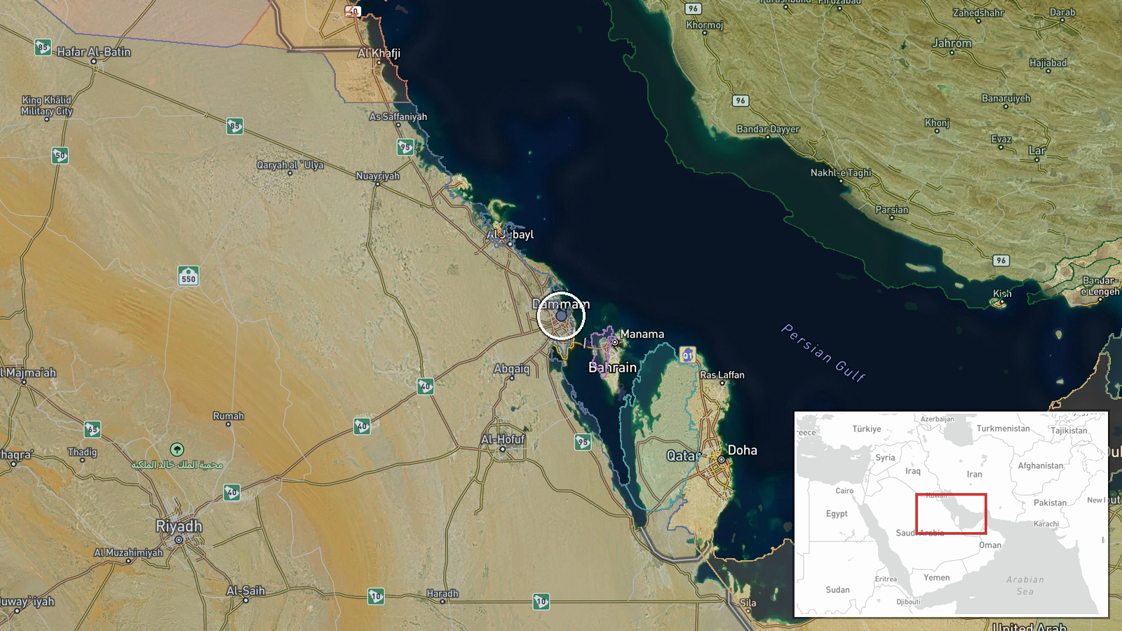
The coordinates, approximately 26.43 N and 50.10 E, are assigned at region precision, so the pin marks the wider Dammam and Dhahran area rather than a specific runway or terminal. The location is taken from the Dammam Airport record and the related King Fahd International Airport entry. The area lies on the Gulf coast of Saudi Arabia, where the Eastern Province's ports, refineries and industrial sites are concentrated. Hofuf lies inland in the Al-Ahsa oasis, southwest of Dammam.
Related events nearby
- Saudi Aramco ordered staff to evacuate its Dhahran headquarters and continue working remotely; reason not stat2026-10-22 09:43 UTC · Security · Saudi Aramco Headquarters, Dhahran, Saudi Arabia
- Saudi GACA reports an attack on King Fahd International Airport in Dammam late Wednesday, killing at least one2026-10-21 22:46 UTC · Artillery · King Fahd International Airport, Dammam, Eastern P
- Unverified video reportedly shows a vessel attacked earlier today in the Persian Gulf; attacker and exact loca2026-10-21 18:20 UTC · Report · Persian Gulf
▶ View this event on the live map

Intel Mapper aggregates open-source reports from monitored Telegram and X channels, geolocates them, cross-checks duplicates across sources and assigns a confidence score. Entries are updated as new confirmations arrive. Read how we verify events.