Russian Il-20 reconnaissance plane flies off Shimane; Japan scrambles fighter jets
What happened
Japan's Joint Staff Office reported, via its official X account, that one Russian Ilyushin Il-20 aircraft flew from the direction of the continent on Thursday 22 October 2026, from the morning into the afternoon. According to the post, the aircraft travelled over the Sea of Japan as far as the waters off Shimane Prefecture, then turned around and flew back toward the continent. The Air Self-Defense Force responded by urgently scrambling fighter jets from its Northern Air Defense Force and other units. The original Japanese wording describes the aircraft as an 情報収集機, an information-gathering aircraft, a term Japanese officials commonly use for surveillance platforms. The report describes no incident beyond the flight path and the response.
Context and assessment
The Il-20 is a militarized derivative of the Il-18 airliner, operated by Russia's air force and used mainly for signals intelligence and electronic reconnaissance. The Sea of Japan lies between Japan, the Russian Far East and the Korean Peninsula, and Japan's approaches to it are closely monitored by the Air Self-Defense Force. The coast off Shimane sits near the Oki Islands and the waters around the Liancourt Rocks, a feature that Japan calls Takeshima and South Korea calls Dokdo, so the area carries political sensitivity. The dataset contains no related events, so this report cannot be placed within a recent sequence on Intel Mapper. It does fit a broader pattern, publicized by Japanese officials over many years, of Russian reconnaissance and long-range flights near Japanese airspace, although frequency cannot be confirmed here. Operationally, a flight that runs out over water and then returns suggests a monitoring or collection mission along the coast rather than a strike profile. Such a mission could aim to observe naval movements or electronic emissions, but the stated purpose is not given. The scramble itself is a routine response, and the report does not indicate any change in posture.
Sources and confidence
The only channel is the official X account of Japan's Joint Staff Office, which is a primary government source for its own scramble and monitoring activity. No independent outlet, Russian statement, radar track or flight-tracking record appears in the data, so cross-confirmation is absent. The confidence score of 6.1 reflects that single-channel basis and the brief wording. It would rise with a fuller Japanese Ministry of Defense release, a flight-tracking or radar record, a Russian Ministry of Defense acknowledgment, or confirmation from South Korean or US sources. It would fall if the report were corrected or retracted.
Location
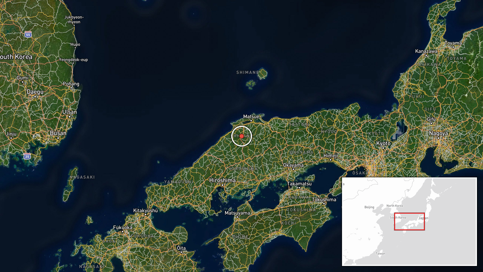
The coordinates, roughly 35.2 degrees north and 132.9 degrees east, are a region-level approximation placed in open water off the Shimane coast, not a fixed point on the flight path. Shimane lies on the western Honshu coast facing the Sea of Japan. The Oki Islands sit farther northeast, and the Korean Peninsula lies across the sea to the west.
▶ View this event on the live map

Intel Mapper aggregates open-source reports from monitored Telegram and X channels, geolocates them, cross-checks duplicates across sources and assigns a confidence score. Entries are updated as new confirmations arrive. Read how we verify events.