USS George Washington reportedly launches EA-18G Growler in support of Arabian Sea blockade
What happened
A post on X from the account @Osint613 reports that an EA-18G Growler took off from the flight deck of the aircraft carrier USS George Washington (CVN 73). According to the post, the carrier is supporting assigned missions that include enforcement of what the text calls America's steel wall blockade against Iranian ports and coastal areas. The event is dated 22 October 2026 at 11:59 UTC. The location is recorded only at regional level in the North Arabian Sea and Arabian Sea. The post includes a link, but no imagery or independent confirmation is attached to the data. The wording comes from a single source and has not been checked against official US Navy or Central Command statements.
Context and assessment
USS George Washington is the United States Navy's forward-deployed carrier, homeported at Yokosuka, Japan, and it can be tasked to the Middle East when required. Its air wing usually includes electronic attack aircraft, and the EA-18G Growler is the Navy's main airborne electronic warfare platform. It is designed to jam radars and communications, suppress enemy air defenses, and support strike packages. Launching a Growler therefore points more toward electronic warfare or air defence support than toward a kinetic strike. The reference to a blockade of Iranian ports places the activity within a maritime pressure campaign, although the source describes no engagement. No related events are linked in the database, so this report cannot be placed against a recorded pattern of similar incidents. Its significance rests on the operational picture the post describes: a carrier-based air component supporting a naval enforcement mission in waters broadly near the Gulf of Oman and the approaches to the Strait of Hormuz. Any inference about intent should be treated cautiously, because one social media post confirms an aircraft movement and a stated mission, but not the scale, duration or rules of engagement of any blockade.
Sources and confidence
The report comes from a single channel, the X account @Osint613, and no other outlet in the dataset corroborates it. The source count is one, which keeps the confidence score at 6.6, a moderate rather than high figure. The score reflects a plausible and specific claim about an identifiable aircraft and a named carrier, but it rests on an unverified account rather than official Navy imagery or statements. Confidence would rise with a published photograph or video geolocated to the carrier, a US Navy or Central Command statement, or matching reports from established wire services. It would fall if the image were found to be older, mislabelled or reused from a different date.
Location
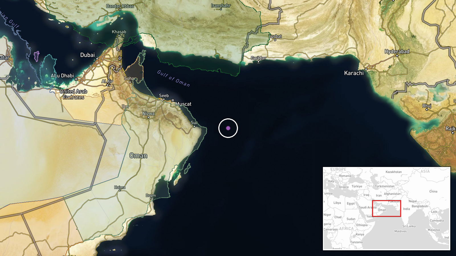
The location is regional rather than a fixed point. The coordinates, 22.5 N and 61.0 E, sit in the broader Arabian Sea, and the precision is recorded as region with low location confidence. The point is not tied to a named port or facility. It reflects the general operating area implied by the source. The Gulf of Oman lies to the northwest, and the Iranian Makran coast is to the north.
▶ View this event on the live map

Intel Mapper aggregates open-source reports from monitored Telegram and X channels, geolocates them, cross-checks duplicates across sources and assigns a confidence score. Entries are updated as new confirmations arrive. Read how we verify events.