Iran fires ballistic missiles at U.S. naval assets in Strait of Hormuz
What happened
Iran reportedly launched ballistic missiles toward U.S. naval vessels operating in the Strait of Hormuz on August 30 at 21:30 UTC, according to Press TV and reports from conflict monitoring channels. The strike was framed as retaliation for U.S. airstrikes that earlier struck Iranian Islamic Revolutionary Guard Corps (IRGC) positions on Larak Island. The Iranian military had issued a formal retaliation announcement approximately two hours before the missile launch.
Context and assessment
The Strait of Hormuz remains one of the world's most strategically critical chokepoints, with roughly one-third of global maritime oil traffic transiting its waters. Iran's ballistic missile capability poses persistent risk to commercial and military shipping in the waterway. This incident follows a rapid escalation: U.S. airstrikes targeted IRGC missile installations on Larak Island earlier on August 30, after Iranian forces struck a crude oil tanker in the strait hours prior. The sequence suggests a tightening cycle of tit-for-tat strikes, with both powers demonstrating willingness to employ kinetic force in contested waters. U.S. air activity remained elevated across Iraq and the Persian Gulf region during the reporting window.
Sources and confidence
Two independent channels—Telegram's @ClashReport and X's @ConflictTR—reported the incident, citing Press TV as the primary source. Confidence level 6.0 reflects dual-source corroboration of the event's occurrence, though specific damage or casualty assessments were not provided. Confirmation through U.S. military statements or independent maritime tracking would strengthen confidence. Photographic or video evidence of missile launches or impacts would materially raise confidence.
Location
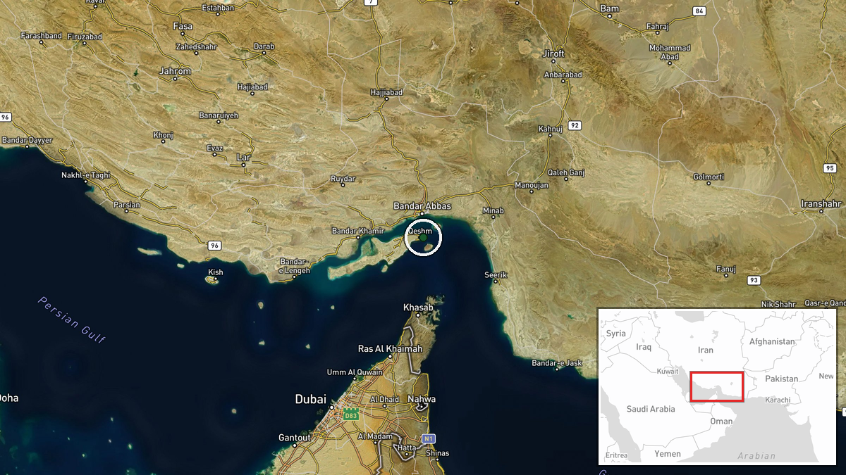
The Strait of Hormuz, lying between Iran and Oman, coordinates approximately 26.95°N, 56.3°E. Larak Island, the origin point of the U.S. earlier strikes and the stated reason for retaliation, sits in Iranian territorial waters within the strait. The waterway narrows to roughly 21 nautical miles at its chokepoint, concentrating maritime traffic and making it a focal zone for regional military operations and pressure points for power projection.
Related events nearby
- Iran fires ballistic missiles in response to U.S. airstrikes on Larak Island IRGC positions. Retaliation follo2026-08-30 21:28 UTC · Ballistic Missile · Strait of Hormuz, Iran-Oman Waters
- Heavy U.S. air activity reported over Iraq and the Strait of Hormuz tonight, following recent U.S. airstrikes 2026-08-30 21:07 UTC · Deployment · Strait of Hormuz, Iran-Oman Waters
- Iran struck a crude oil tanker transiting the Strait of Hormuz, approximately 12 NM north of Khasab, Oman. No 2026-08-30 16:39 UTC · Ballistic Missile · Strait of Hormuz, 12 NM north of Khasab, Oman
- Iran's Islamic Revolutionary Guard Corps (IRGC) announces it will retaliate for U.S. airstrikes on Larak Islan2026-08-30 19:53 UTC · Statement · Larak Island, Strait of Hormuz, Iran
- U.S. airstrikes targeted Iranian missile launcher positions on Larak Island in the Strait of Hormuz. Weapons w2026-08-30 19:30 UTC · Statement · Larak Island, Strait of Hormuz, Iran
▶ View this event on the live map
Intel Mapper aggregates open-source reports from monitored Telegram and X channels, geolocates them, cross-checks duplicates across sources and assigns a confidence score. Entries are updated as new confirmations arrive. Read how we verify events.