Turkish forces deploy floating bridge across Euphrates near Mayadin in Syria
What happened
The Turkish Armed Forces assembled a collapsible ribbon floating bridge across the Euphrates River near Mayadin in Deir ez-Zor Governorate on September 2, according to a report from the conflict monitoring account @ConflictTR on X. The deployment demonstrates Turkish engineering capability and river-crossing infrastructure presence in eastern Syria, though the report does not specify the operational purpose or duration of the installation.
Context and assessment
Mayadin lies in Deir ez-Zor Governorate in Syria's resource-rich east, where Turkish forces maintain a significant military presence. The bridge deployment follows a pattern of infrastructure activity in the region: on September 1, the first international commercial flight in years arrived at Deir ez-Zor Airport, and the Conoco gas facility resumed production of 2.5 million cubic meters daily. These concurrent developments suggest expanding Turkish involvement in eastern Syria's stabilization and reconstruction. River crossings are typically used for supply lines, military mobility, or engineering exercises. The bridge's collapsible design indicates portability, suggesting either temporary operational needs or demonstration of rapid deployment capability.
Sources and confidence
Reported by @ConflictTR on X, a single source with moderate credibility in conflict monitoring. No cross-confirmation from other channels has been identified. The confidence score of 6.0 reflects the single-source limitation. Confirmation from additional independent monitors or Turkish military statements would strengthen confidence. Visual verification or satellite imagery would further validate the deployment.
Location
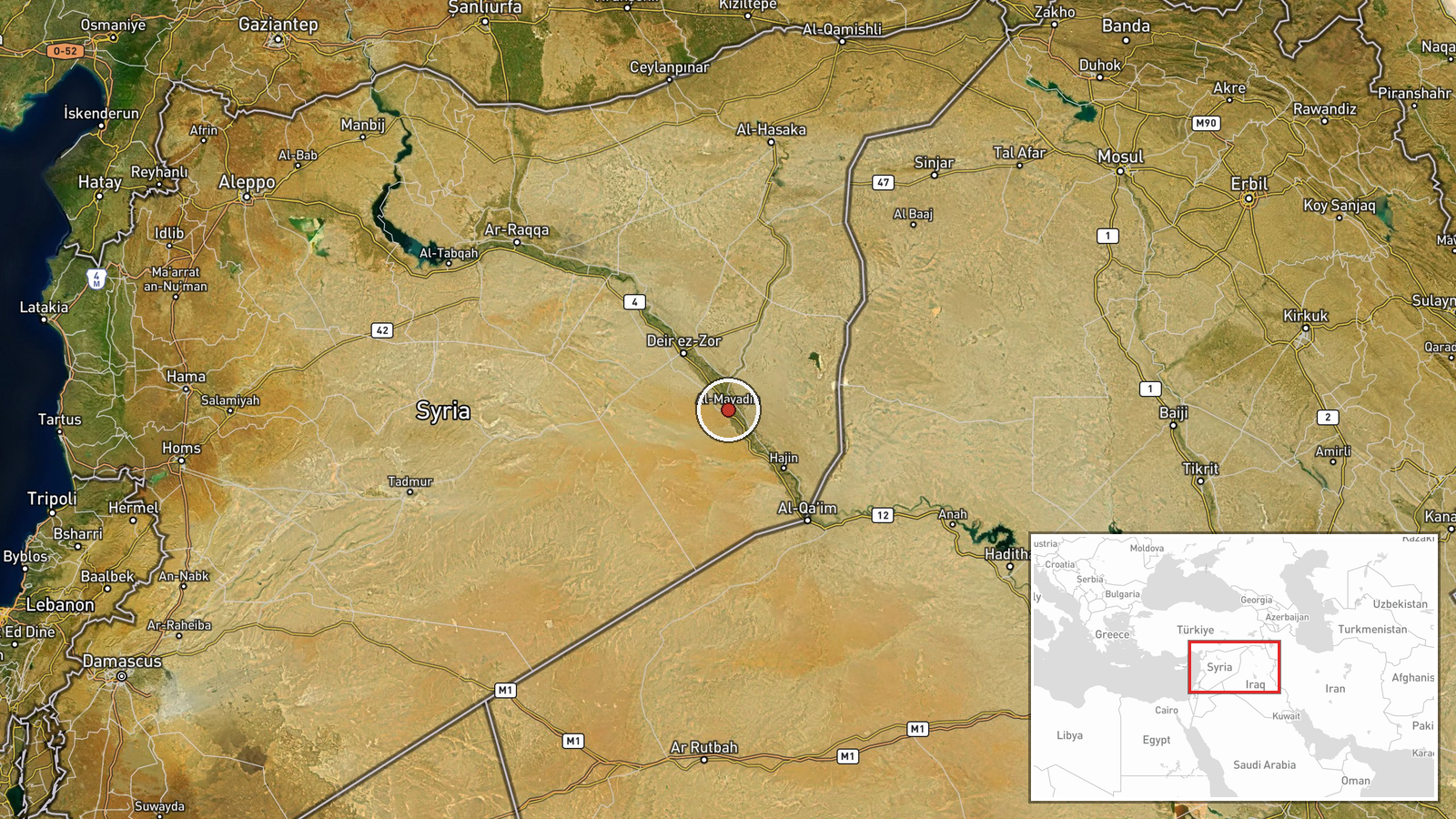
Mayadin settlement in Deir ez-Zor Governorate, eastern Syria, located on the Euphrates River approximately 120 kilometers northeast of the governorate capital. The Euphrates forms a natural geographic barrier in this region. Deir ez-Zor lies in Syria's petroleum-rich interior, near contested zones and areas of Turkish military activity.
Related events nearby
- Conoco gas facility in Deir ez-Zor resumed operations after rehabilitation. Two wells now producing 2.5 millio2026-09-01 14:52 UTC · Humanitarian Aid · Conoco Gas Plant, Deir ez-Zor, Syria
- France Press reports Syria experiences one unexploded ordnance (UXO) casualty every 6 hours. Since December 8,2026-09-02 08:52 UTC · Security · Syria
▶ View this event on the live map
Intel Mapper aggregates open-source reports from monitored Telegram and X channels, geolocates them, cross-checks duplicates across sources and assigns a confidence score. Entries are updated as new confirmations arrive. Read how we verify events.