Russian FPV drone intercepts and shoots down Ukrainian Leleka-100 reconnaissance UAV
What happened
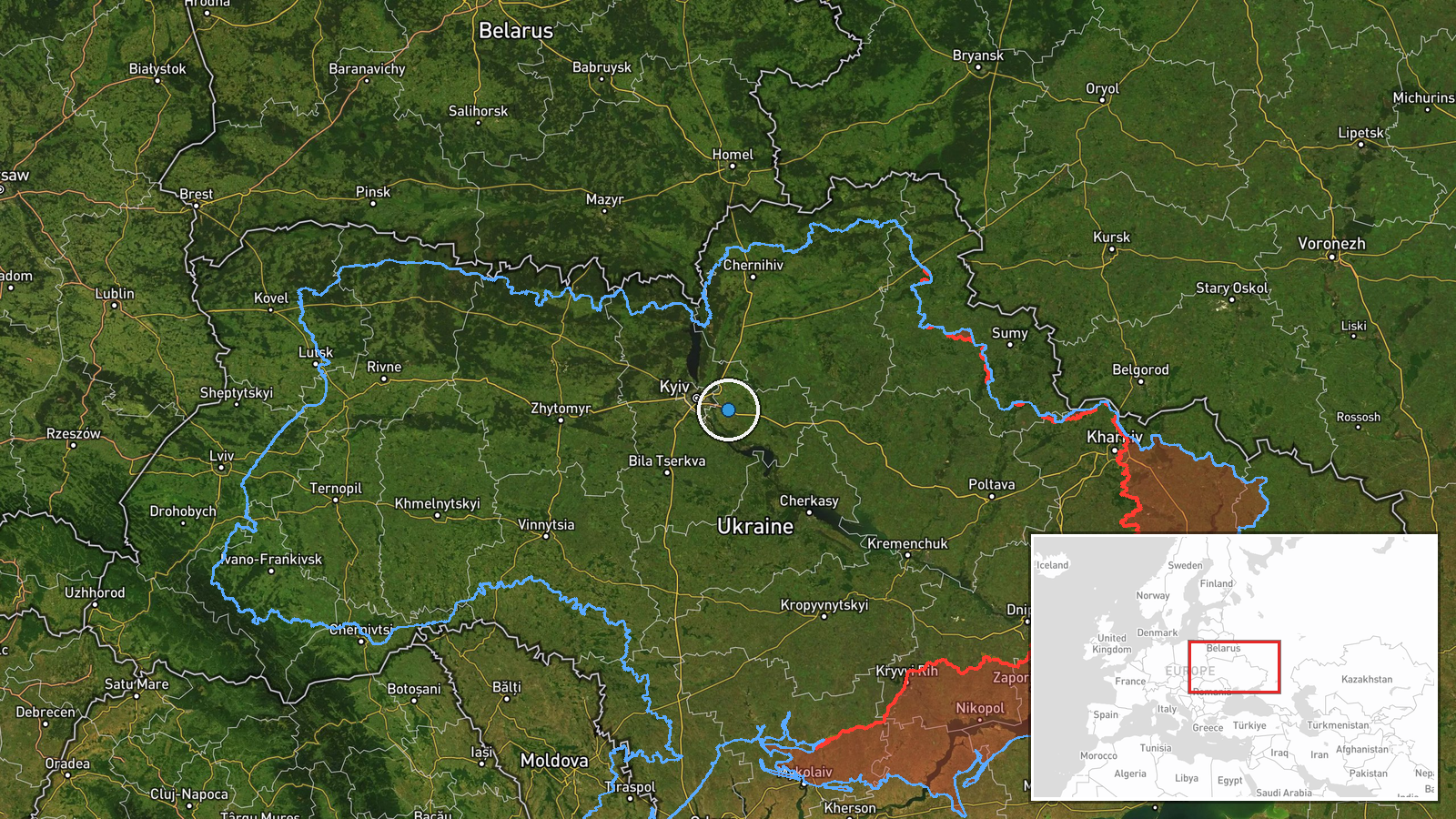
A Russian first-person-view (FPV) drone reportedly deployed a net-based interdiction system to down a Ukrainian Leleka-100 tactical reconnaissance unmanned aerial vehicle during an aerial engagement in the Boryspil area of Kyiv Oblast on September 4. The engagement represents an evolution in drone-versus-drone tactics, with the Russian platform using a capture mechanism rather than explosive detonation. The incident occurred amid intense overnight air activity across Ukrainian airspace.
Context and assessment
Boryspil, home to Kyiv Boryspil Airport and situated southeast of the capital, lies within a heavily contested air defense zone. Ukrainian reconnaissance assets operating in this sector have faced sustained Russian aerial pressure; Ukrainian air defense reportedly neutralized 103 enemy drones overnight, including dozens of Shahed-type cruise missiles and loitering munitions. The loss of a Leleka-100, a medium-range tactical reconnaissance platform, suggests Russian FPV operators are increasingly targeting Ukrainian ISR capabilities. Net-based interdiction represents a technical escalation in unmanned aerial combat, potentially allowing capture of intact systems for exploitation or reducing collateral risk in populated areas near Kyiv.
Sources and confidence
Single report from X (@ConflictTR), a Turkish military conflict monitoring account. No cross-confirmation from Ukrainian official channels or Western defense analysts identified. Confidence score of 6.0 reflects limited corroboration and regional-level geographic precision. Confirmation by Ukrainian General Staff air defense statements or Russian acknowledgment would strengthen confidence; visual evidence from either side would provide definitive validation.
Location
Boryspil, Kyiv Oblast, approximately 35 kilometers southeast of central Kyiv. The town hosts Kyiv's primary international airport and sits along the Dnipro River valley. Geographic precision rated as regional rather than point-specific due to single-source reporting. The location places the engagement within Kyiv Oblast's air defense corridor.
Related events nearby
- Ukrainian air monitoring reports all-clear for Kyiv region. No new drone launches detected; previous air alert2026-09-04 19:19 UTC · Siren · Kyiv Oblast, Ukraine
- Russian Shahed-type kamikaze drones detected transiting Kyiv Oblast near Bilohorodka and Obukhiv sectors, head2026-09-04 10:19 UTC · Drone Transit · Kozyn, Kyiv Oblast, Ukraine
- Two Russian reactive (jet-powered) Shahed-variant kamikaze drones detected transiting from Kozeletsk toward Ve2026-09-04 18:22 UTC · Drone Transit · Velyka Dymerka, Kyiv Oblast, Ukraine
- President Zelensky states Russian strikes on Kyiv airports are retaliatory responses to U.S. diplomatic visits2026-09-05 09:09 UTC · Statement · Kyiv, Ukraine
- Ukraine's General Staff announced that a unilateral ceasefire order (Sept 5-8) issued during U.S. envoy visits2026-09-05 08:45 UTC · Statement · Kyiv, Ukraine
▶ View this event on the live map
Intel Mapper aggregates open-source reports from monitored Telegram and X channels, geolocates them, cross-checks duplicates across sources and assigns a confidence score. Entries are updated as new confirmations arrive. Read how we verify events.