Russian Shahed drones transit Kyiv Oblast toward Ukrainian interior
What happened
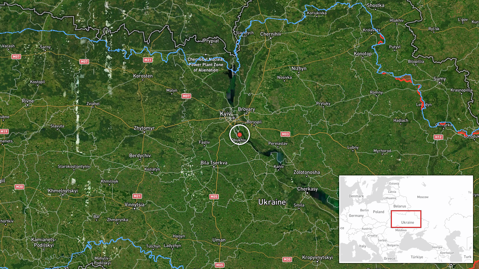
Russian Shahed-type kamikaze drones were detected transiting Kyiv Oblast on the morning of September 4, reportedly passing through the Bilohorodka and Obukhiv sectors while heading inland. The observation was reported by the Telegram channel @war_monitor, which documented the drone movements in the region near Kozyn. The report indicates multiple drone contacts in the area, consistent with ongoing Russian drone operations against Ukrainian territory.
Context and assessment
This transit aligns with an established pattern of Russian drone attacks on Kyiv Oblast over the past 24 hours. Ukrainian air defense reported destroying over 100 enemy drones overnight, roughly half of which were Shahed-type reactive systems. A single Shahed struck Brovary earlier on September 4, and similar drone transits were detected near Ivankov and Myronivka the same morning. These repeated incursions suggest Russia is maintaining sustained pressure on the Kyiv region through waves of drone strikes, testing Ukrainian air defenses that have demonstrated significant interception capability in recent engagements.
Sources and confidence
Reported by Telegram channel @war_monitor with single source confirmation. The confidence score of 6.0 reflects the single reporting source and broad regional precision rather than confirmed strike impact. Cross-confirmation from additional monitoring channels or Ukrainian air defense statements would strengthen confidence. Geolocation verification and drone intercept confirmation would raise assessment certainty.
Location
The observation is geolocated to Kozyn, Kyiv Oblast, at approximately 50.23°N, 30.65°E, with regional precision. The area sits in central Kyiv Oblast between the Bilohorodka and Obukhiv administrative sectors, roughly 30–40 kilometers southeast of central Kyiv. The sector lies within typical drone ingress corridors used by Russian forces approaching the capital region from the east.
Related events nearby
- Russian journalist records moment of being struck by shrapnel while on frontline in Russia-Ukraine conflict.2026-09-05 05:26 UTC · Combat · Kyiv Oblast, Ukraine
- Russian FPV drone deployed net-based interdiction and shot down a Ukrainian Leleka-100 reconnaissance UAV duri2026-09-04 09:25 UTC · Drone Shootdown · Boryspil, Kyiv Oblast, Ukraine
- After CIA Director Ratcliffe's failed Moscow visit, Russia intensified missile and drone attacks on Ukraine. U2026-09-04 21:53 UTC · Statement · Kyiv, Ukraine
- Ukrainian military ordered ceasefire across all frontlines from September 5 00:00 to September 8 in coordinati2026-09-04 21:14 UTC · Statement · Kyiv, Ukraine
- President Zelensky announces U.S. envoys Steve Witkoff and Jared Kushner will visit Moscow and Kyiv on Sunday 2026-09-04 16:14 UTC · Diplomacy · Kyiv, Ukraine
▶ View this event on the live map
Intel Mapper aggregates open-source reports from monitored Telegram and X channels, geolocates them, cross-checks duplicates across sources and assigns a confidence score. Entries are updated as new confirmations arrive. Read how we verify events.