Iran claims capture of advanced U.S. unmanned underwater vehicle in Strait of Hormuz
What happened
Iran announced on September 9 that it captured an advanced unmanned underwater vehicle (UUV) belonging to the U.S. Navy in the Strait of Hormuz. The report, initially from a Turkish conflict monitoring account on X, provides no confirmed details about the vessel's specific type, operational status, or circumstances of the alleged capture. Iranian authorities have not yet released photographic or technical evidence substantiating the claim.
Context and assessment
The claim emerges amid a sharp escalation of military tensions in the strategically vital Strait of Hormuz, through which roughly one-third of globally traded seaborne oil passes. Over the preceding 24 hours, Iran's Islamic Revolutionary Guard Corps (IRGC) launched multiple waves of anti-ship ballistic missiles at U.S. Navy destroyers, issued threats against commercial tankers in regional ports, and asserted enhanced surveillance capabilities. The alleged UUV seizure, if confirmed, would represent a significant intelligence gain for Iran and fits an apparent pattern of asserting operational dominance in the waterway. Such unmanned systems typically conduct reconnaissance, mine countermeasures, or signals intelligence. The claim requires independent verification.
Sources and confidence
The report originated from @ConflictTR on X and currently appears in single-source coverage. Cross-confirmation from U.S. military statements or independent regional sources has not yet materialized. The confidence score of 6.0 reflects the unconfirmed nature of the claim and the absence of visual evidence or official U.S. acknowledgment. Confirmation by U.S. Department of Defense or independent maritime surveillance would substantially raise confidence; Iranian clarification of vessel type would provide important detail.
Location
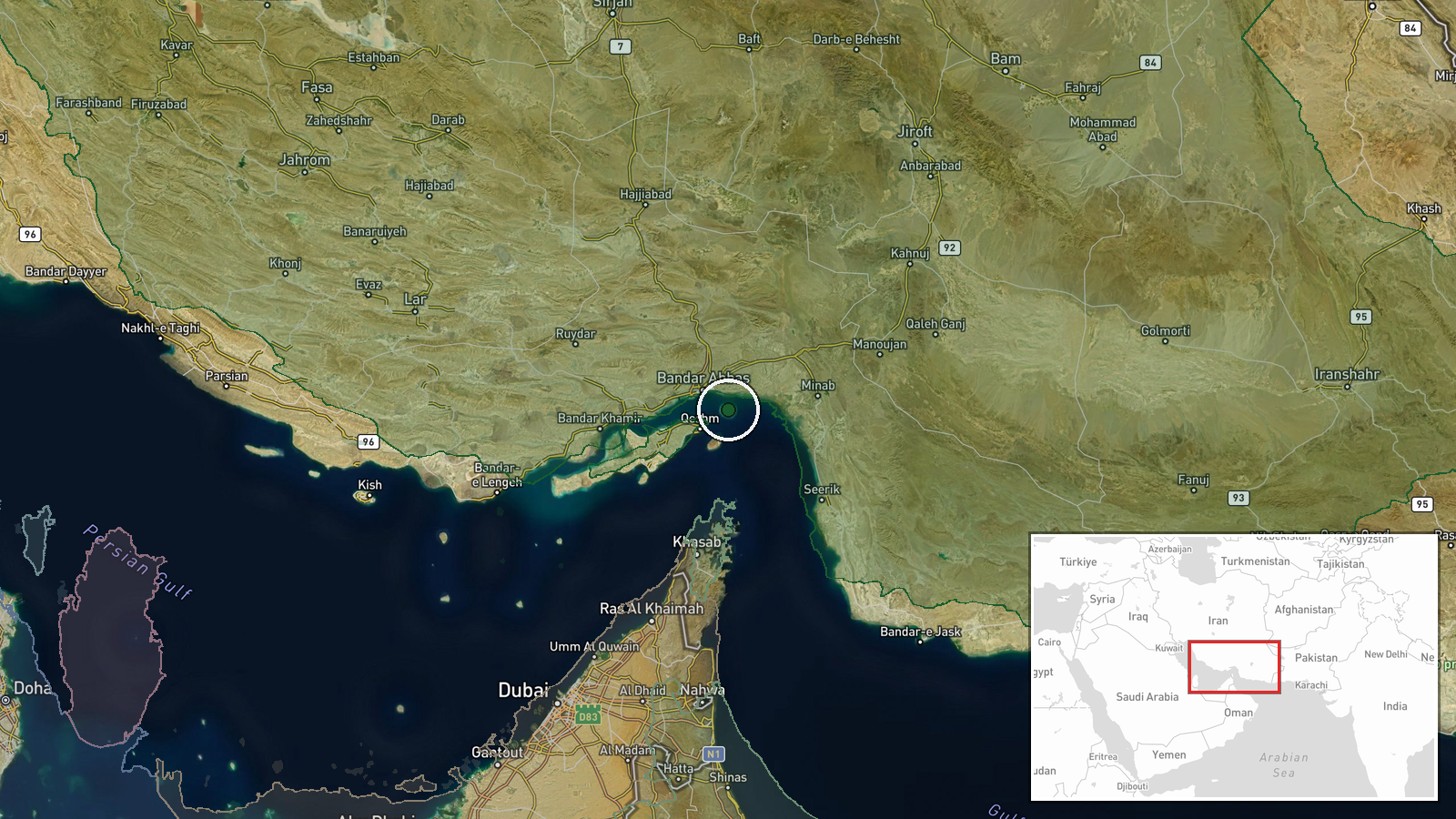
The Strait of Hormuz, located between Iran and Oman at approximately 27.07° N, 56.46° E, forms the narrow chokepoint connecting the Persian Gulf to the Gulf of Oman and Arabian Sea. The region is heavily monitored by both Iranian and U.S. naval forces. Geographic precision is regional rather than pinpoint due to the broad operational environment and lack of specific coordinates in available reporting.
Related events nearby
- Iran's Revolutionary Guards (IRGC) claims ballistic missile strikes on U.S. Navy destroyers USS Delbert D. Bla2026-09-09 00:35 UTC · Ballistic Missile · Strait of Hormuz, Persian Gulf
- Iran launched a second wave of anti-ship ballistic missiles at U.S. Navy vessels in the Strait of Hormuz withi2026-09-08 20:19 UTC · Ballistic Missile · Strait of Hormuz, Persian Gulf
- Iran's IRGC Navy warns all oil tanker crews at ports and anchorages in Kuwait and Bahrain to abandon their ves2026-09-08 20:17 UTC · Statement · Strait of Hormuz, Persian Gulf
- Possible ongoing naval engagement in the Strait of Hormuz between U.S. and Iranian forces. Reports indicate ac2026-09-08 19:34 UTC · Ballistic Missile · Strait of Hormuz, Persian Gulf
- IRGC spokesperson claims capture of advanced U.S. unmanned submarine (Anduril Dive-LD) in Strait of Hormuz, bo2026-09-08 18:56 UTC · Statement · Strait of Hormuz, Persian Gulf
▶ View this event on the live map
Intel Mapper aggregates open-source reports from monitored Telegram and X channels, geolocates them, cross-checks duplicates across sources and assigns a confidence score. Entries are updated as new confirmations arrive. Read how we verify events.