Iran's IRGC claims ballistic missile strikes on U.S. Navy destroyers in Strait of Hormuz
What happened
Iran's Islamic Revolutionary Guard Corps (IRGC) claimed on 9 September that it struck two U.S. Navy destroyers, USS Delbert D. Black (DDG-119) and USS John Paul Jones (DDG-53), with ballistic missiles in the Strait of Hormuz, reporting 'severe damage' to both vessels. The claim was posted via X by @ConflictTR. The U.S. Navy has not confirmed the strikes or any damage to either destroyer as of current reporting.
Context and assessment
The claim fits an escalating pattern of Iranian military actions in the Strait of Hormuz over 9 September. Earlier that day, Iran's IRGC Navy warned oil tanker crews in Kuwait and Bahrain to evacuate their vessels, and reportedly captured a U.S. Anduril Dive-LD autonomous underwater drone. A second wave of anti-ship ballistic missiles was reportedly launched within three days prior, with no hits confirmed. The strikes, if verified, would represent a significant escalation in direct naval confrontation and may signal Iran's attempt to challenge U.S. naval operations or respond to prior incidents. The Strait of Hormuz remains a critical chokepoint for global oil transit, making any sustained military action there strategically significant.
Sources and confidence
The claim originates from a single source: X account @ConflictTR, citing IRGC statements. No independent confirmation from U.S. official sources, defense analysts, or maritime observers has been provided. The confidence score of 6.0 reflects unverified claims without corroboration. Score would rise with U.S. Navy acknowledgment, satellite imagery, or statements from allied naval forces in the region. Confirmation of damage to specific destroyers would substantially increase credibility.
Location
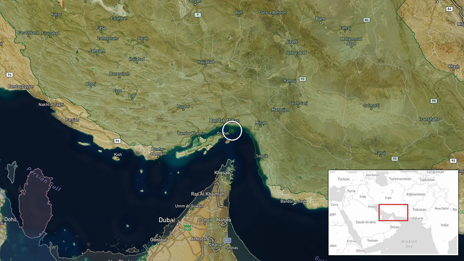
The Strait of Hormuz, Persian Gulf, at approximately 27°04'N 56°28'E. This strategic waterway lies between Iran and Oman, linking the Persian Gulf to the Gulf of Oman and Arabian Sea. The location represents the world's most critical oil transit chokepoint. Precision is regional rather than site-specific, reflecting claim ambiguity regarding exact strike coordinates.
Related events nearby
- Iran claims capture of advanced U.S. next-generation unmanned underwater vehicle (UUV) in the Strait of Hormuz2026-09-09 08:56 UTC · Security · Strait of Hormuz, Persian Gulf
- Iran launched a second wave of anti-ship ballistic missiles at U.S. Navy vessels in the Strait of Hormuz withi2026-09-08 20:19 UTC · Ballistic Missile · Strait of Hormuz, Persian Gulf
- Iran's IRGC Navy warns all oil tanker crews at ports and anchorages in Kuwait and Bahrain to abandon their ves2026-09-08 20:17 UTC · Statement · Strait of Hormuz, Persian Gulf
- Possible ongoing naval engagement in the Strait of Hormuz between U.S. and Iranian forces. Reports indicate ac2026-09-08 19:34 UTC · Ballistic Missile · Strait of Hormuz, Persian Gulf
▶ View this event on the live map
Intel Mapper aggregates open-source reports from monitored Telegram and X channels, geolocates them, cross-checks duplicates across sources and assigns a confidence score. Entries are updated as new confirmations arrive. Read how we verify events.