Iran claims targeting of 19 merchant vessels in Strait of Hormuz over two nights
What happened
Iran's Islamic Revolutionary Guard Corps (IRGC) claimed via state news agency Fars News that it targeted seven merchant vessels transiting the Strait of Hormuz on the night of September 26–27, 2026, and twelve vessels on the preceding night. The IRGC made no specific claims of damage or sinking. The report appeared on social media on September 27 at 17:02 UTC, citing only the state-controlled Fars News Agency as source.
Context and assessment
The Strait of Hormuz remains one of the world's most critical chokepoints, with roughly one-third of global seaborne oil transit passing through its narrows. Iran has periodically claimed or conducted operations against shipping in the waterway, particularly during periods of heightened regional tension. This claim follows the IRGC Navy's reported seizure of a second U.S. REMUS 600 underwater drone in the same strait hours earlier on September 27, suggesting a period of elevated Iranian naval assertiveness. Such claims—whether operationally real, exaggerated for deterrence, or propaganda—typically reflect Iranian efforts to signal power in contested waters and complicate international shipping confidence.
Sources and confidence
Single source: X account @ConflictTR citing Fars News Agency, Iran's state news outlet. No independent corroboration, vessel reports, or third-party maritime authorities have confirmed targeting. Confidence score of 6.0 reflects reliance on state messaging without verification; score could rise with maritime industry confirmation or vessel damage reports, and would lower if contradicted by shipping authorities or satellite data.
Location
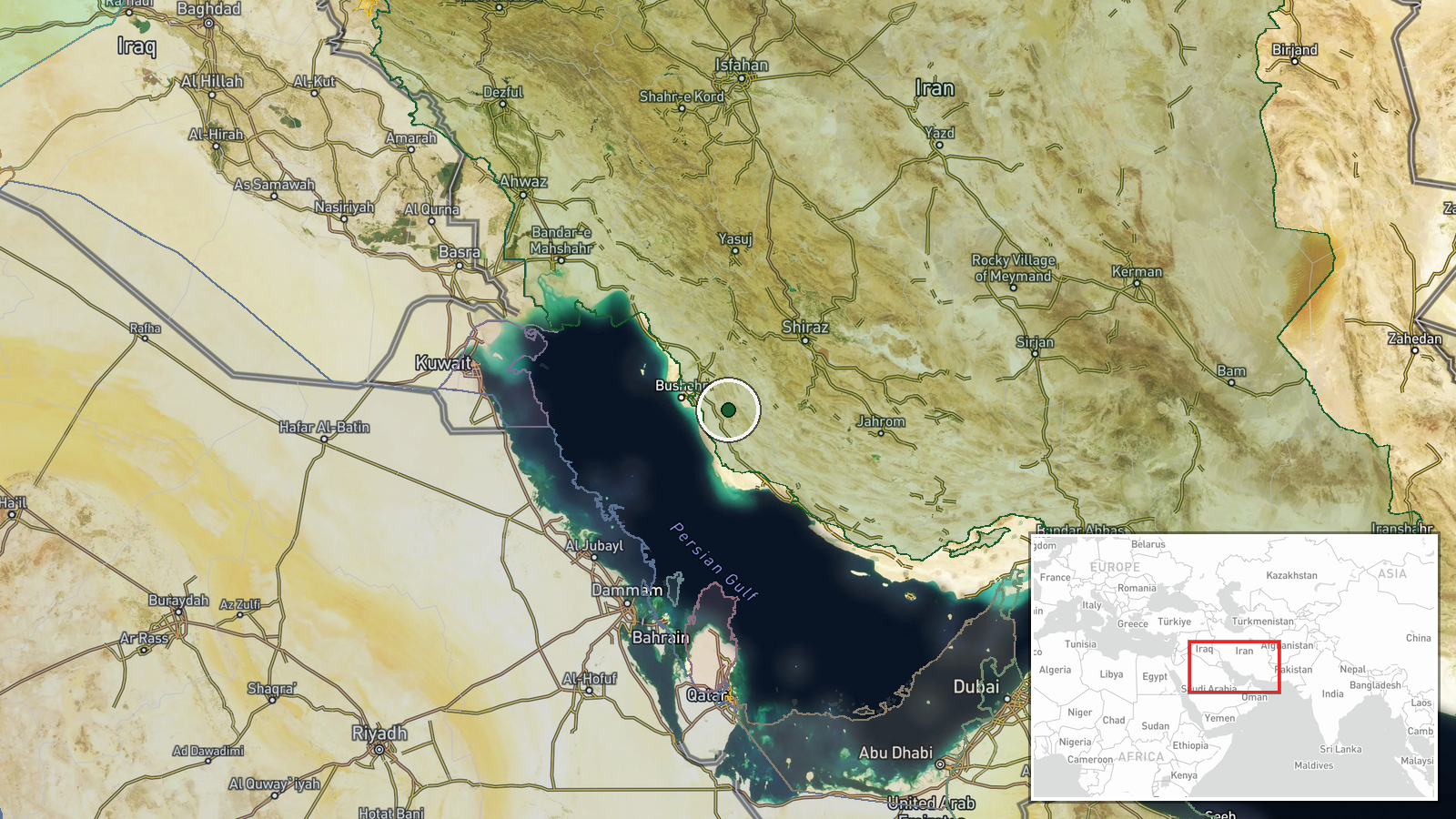
The Strait of Hormuz, the narrow waterway separating Iran from Oman, located at approximately 28.79°N, 51.48°E. The strait is roughly 53 nautical miles wide at its narrowest point. All commercial shipping between the Persian Gulf and the Arabian Sea must transit this chokepoint.
Related events nearby
- Iran's IRGC Navy claims seizure of a second U.S. REMUS 600 underwater surveillance drone in the Strait of Horm2026-09-27 10:40 UTC · Security · Strait of Hormuz
▶ View this event on the live map
Intel Mapper aggregates open-source reports from monitored Telegram and X channels, geolocates them, cross-checks duplicates across sources and assigns a confidence score. Entries are updated as new confirmations arrive. Read how we verify events.