Israeli airstrike strikes residential house in Gaza City's Sabra neighbourhood
What happened
The Israeli military conducted an airstrike on a residential house in the Sabra neighbourhood of Gaza City on 8 October at 20:33 UTC, according to reporting via X (@ConflictTR). The strike targeted a civilian residential structure in a densely populated urban area. No additional details regarding casualties, damage extent, or stated military justification were provided in the available reporting.
Context and assessment
Sabra is a residential neighbourhood in central Gaza City, an area of dense civilian habitation. This airstrike occurs amid a broader pattern of Israeli military operations in Gaza and comes hours after an Israeli official reportedly stated potential necessity to strike hospitals believed linked to Hamas on 8 October. The timing and target selection—a residential house rather than declared military infrastructure—reflects the ongoing difficulty in distinguishing civilian from military objectives in urban warfare. Continued strikes on residential areas in Gaza City underscore the intensity of operations in the territory's largest urban centre, where population density complicates civilian-military distinction.
Sources and confidence
Reported by X account @ConflictTR, which specialises in conflict documentation. Single-source reporting with no cross-confirmation from other channels or independent verification noted. Confidence score of 6.0 reflects limited corroboration; the account's general reliability supports moderate confidence, but independent verification from additional sources or official statements would strengthen assessment. Geotagged coordinates and settlement-level precision support locational accuracy.
Location
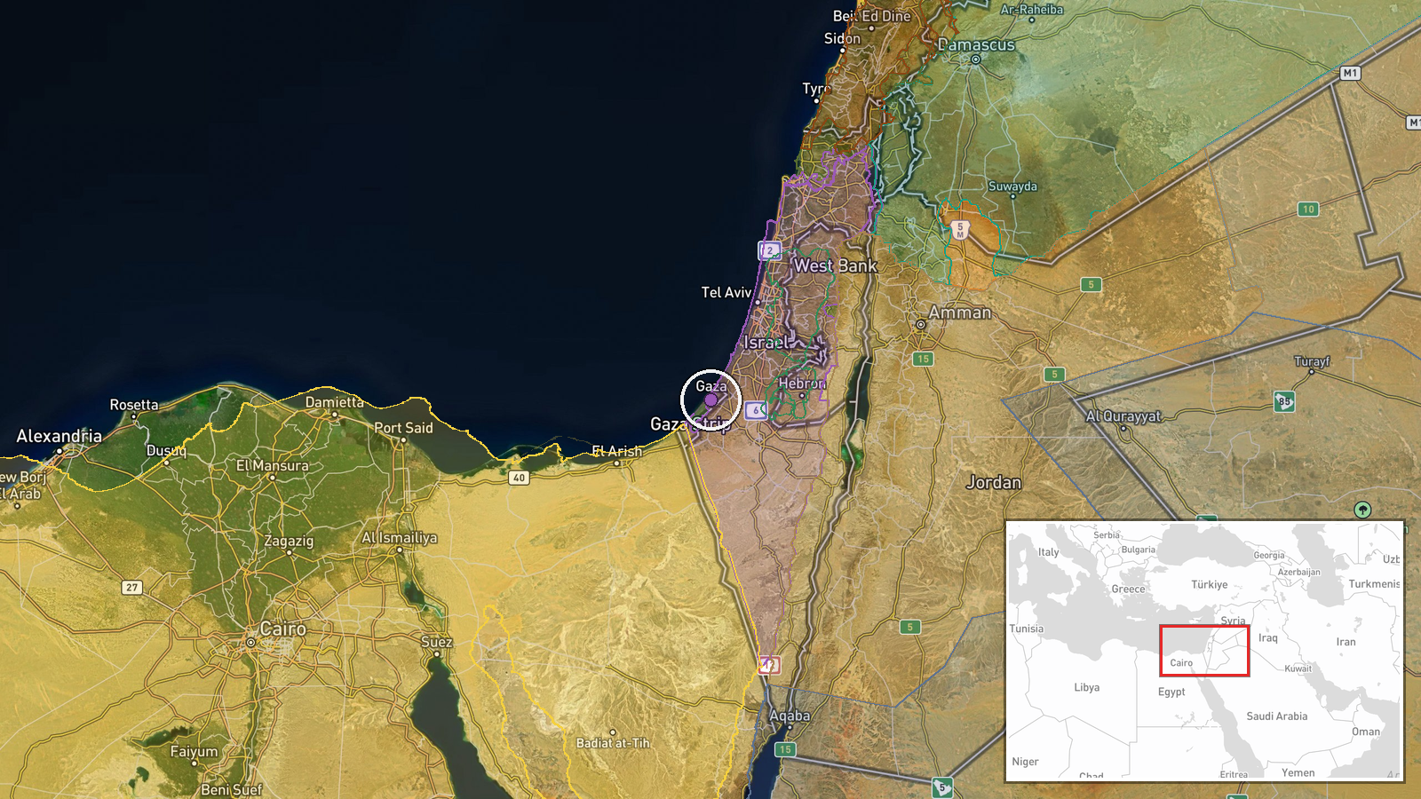
Sabra neighbourhood is located in central Gaza City at approximately 31.51°N, 34.45°E. The neighbourhood is situated within the densely populated urban core of Gaza City, the territory's largest city and primary population centre. Sabra is a residential district characteristic of Gaza City's built environment, with closely spaced residential structures typical of the area.
Related events nearby
- Israeli official states potential necessity to strike hospitals believed linked to Hamas. Conditional threat o2026-10-08 09:27 UTC · Statement · Gaza, Palestine
- Israeli FM Gideon Saar announces UK Consulate General downgrade: 20 British diplomats and Consul General to de2026-10-08 07:01 UTC · Statement · Jerusalem, Israel
- Israeli military chief Lt. Gen. Eyal Zamir warned senior U.S. officials that resuming war with Iran within thr2026-10-08 17:18 UTC · Statement · Jerusalem, Israel
▶ View this event on the live map

Intel Mapper aggregates open-source reports from monitored Telegram and X channels, geolocates them, cross-checks duplicates across sources and assigns a confidence score. Entries are updated as new confirmations arrive. Read how we verify events.