USS Abraham Lincoln carrier strike group concludes extended Middle East deployment
What happened
The USS Abraham Lincoln aircraft carrier strike group has returned to the United States following an extended deployment to the Middle East, reportedly covering operations in the North Arabian Sea and Gulf of Oman region. The deployment lasted 321 days at sea, including 264 consecutive days without port access. The carrier's superstructure reportedly displayed markings indicating engagement with Iranian naval assets during the operation, including submarines and small surface vessels.
Context and assessment
The Abraham Lincoln's return marks the conclusion of a prolonged carrier presence in a region of sustained strategic importance to the United States. The extended deployment and the visible combat markings suggest ongoing naval operations against Iranian maritime capabilities in the Arabian Sea and Persian Gulf approaches. Such deployments typically involve power projection, freedom of navigation operations, and responses to regional threats. The 321-day duration without extended port breaks indicates either intensive operational tempo or deliberate avoidance of regional ports, possibly reflecting tensions with littoral states or operational focus on contested waters.
Sources and confidence
Report sourced from X account @ConflictTR. Single-source reporting limits independent verification of specific operational details and timeline. Related reports from the same date describe the same carrier group's return and visible damage markings, providing some corroboration of the return event itself, though not of underlying operational claims. Confidence score of 6.0 reflects basic event confirmation offset by single-source limitation and low geographic precision.
Location
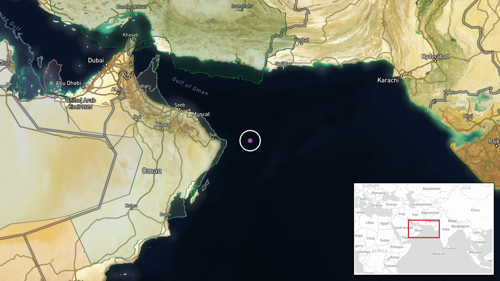
Position estimated at coordinates 22.5°N, 61.0°E in the North Arabian Sea and Gulf of Oman region—contested waters between Iran and the Arabian Peninsula. Geographic precision rated as regional rather than specific. The location encompasses major shipping lanes and strategic waterways critical to global energy transit.
Related events nearby
- USS Abraham Lincoln carrier strike group displays kill marks from Iran operations on ship hull, depicting Iran2026-10-09 08:01 UTC · Aircraft Carrier · North Arabian Sea
- USS Abraham Lincoln carrier strike group returned after 321 days at sea, including 264 consecutive days withou2026-10-09 05:29 UTC · Aircraft Carrier · North Arabian Sea, USS Abraham Lincoln Operating A
▶ View this event on the live map

Intel Mapper aggregates open-source reports from monitored Telegram and X channels, geolocates them, cross-checks duplicates across sources and assigns a confidence score. Entries are updated as new confirmations arrive. Read how we verify events.