Panama-flagged tanker carrying Saudi crude struck by mine in Strait of Hormuz
What happened
A Panama-flagged vessel carrying approximately 2 million barrels of Saudi Arabian crude oil reportedly struck a mine in the Strait of Hormuz on October 11, according to X account @ConflictTR. No immediate reports of casualties or significant structural damage were noted in the initial report. The incident occurred amid a pattern of maritime incidents in the waterway over the preceding 24 hours.
Context and assessment
The Strait of Hormuz remains one of the world's most critical chokepoints for oil transport, with roughly one-third of global seaborne petroleum passing through its narrow waters. This incident follows closely on two other reported strikes in the same waterway—an outbound tanker hit by a projectile on October 10 and an Iranian claim of a supertanker hitting a mine. The clustering of incidents suggests either heightened mine-laying activity, deliberate targeting operations, or both. IRGC video releases of drone attacks against shipping during this period indicate multiple threat vectors active in contested waters. Such incidents typically drive insurance costs higher and reflect escalating tensions over regional maritime security.
Sources and confidence
Reported by X account @ConflictTR, citing Turkish-language source material. Single source report with low geographic precision (region-level). Confidence score 6.3 reflects lack of corroboration from established maritime monitoring bodies like UK MTO or direct shipping line confirmation. Cross-confirmation from Lloyd's List, shipping registries, or official statements from Saudi Aramco would raise confidence; confirmation of vessel identity and damage assessment would strengthen assessment.
Location
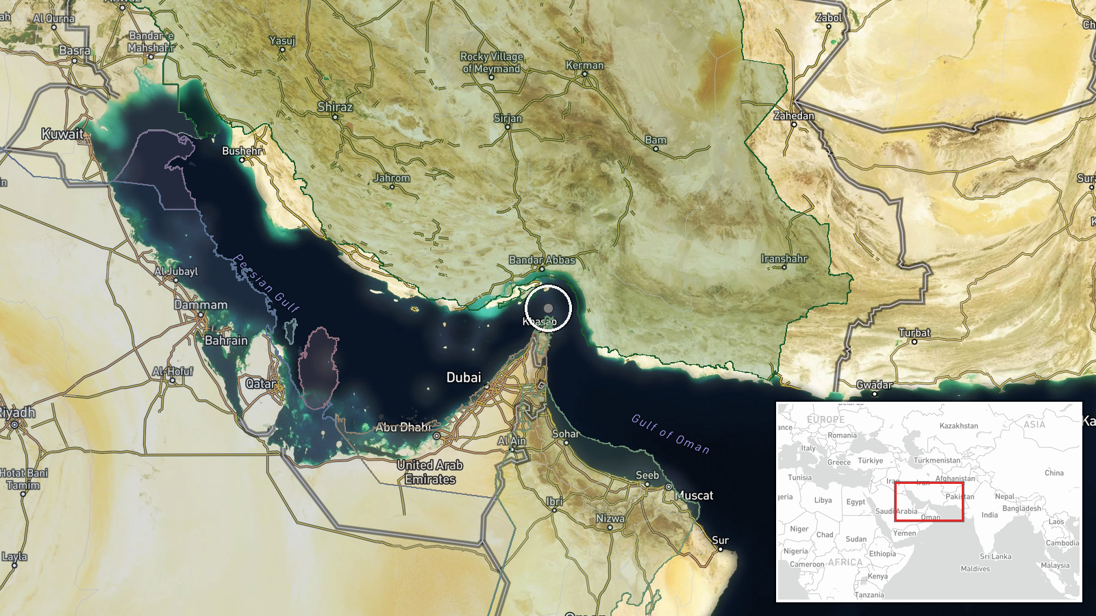
Strait of Hormuz, Persian Gulf, approximately 26.5°N, 56.4°E. The waterway narrows to roughly 21 nautical miles at its narrowest point between Oman and Iran. Precise incident location within the strait cannot be determined from available reporting; general coordinate represents the central channel area. Nearby geography includes Iranian territorial waters to the north and Omani waters to the south.
Related events nearby
- UK Maritime Trade Operations reported an outbound tanker struck by unknown projectile on port side in Strait o2026-10-10 22:11 UTC · Report · Strait of Hormuz, Persian Gulf
- Iran's IRGC claims a supertanker carrying crude oil struck a naval mine while attempting to exit the Strait of2026-10-10 17:07 UTC · Report · Strait of Hormuz, Persian Gulf
- Iranian Revolutionary Guards (IRGC) released video footage demonstrating kamikaze drone attacks against shippi2026-10-10 07:41 UTC · UAS Strike · Strait of Hormuz, Persian Gulf
▶ View this event on the live map

Intel Mapper aggregates open-source reports from monitored Telegram and X channels, geolocates them, cross-checks duplicates across sources and assigns a confidence score. Entries are updated as new confirmations arrive. Read how we verify events.