Yemeni Government Forces Destroy Houthi Armored Vehicles Near Bab el-Mandeb Strait
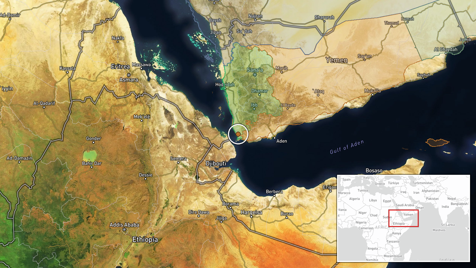
What happened
Yemeni government forces reportedly destroyed Houthi armored vehicles that were attempting to advance toward the Bab el-Mandeb Strait on October 11, 2026. The engagement occurred in the Red Sea region near this strategically critical maritime chokepoint. The report, sourced from X (@ConflictTR), characterizes the action as a combat engagement in which government forces successfully repelled or destroyed the advancing Houthi armor. No specific casualty figures or detailed damage assessments were provided in the available reporting.
Context and assessment
The Bab el-Mandeb Strait represents one of the world's most strategically vital maritime passages, linking the Red Sea to the Indian Ocean and serving as a critical corridor for global shipping and energy transport. Control over approaches to this chokepoint has long been a central objective in Yemen's civil conflict. This engagement occurs amid an intensified pattern of combat activity on October 11, including concurrent Saudi-led coalition airstrikes against Houthi positions in Taiz Governorate and Houthi-controlled territory, as well as Yemeni government deployment of FPV drone strikes. The coordination of multiple attack types suggests escalating military pressure on Houthi forces and reflects the ongoing territorial contest for control of Yemen's western coast and maritime access.
Sources and confidence
Single source: X (@ConflictTR), a Turkish conflict monitoring account. No cross-confirmation from independent observers or additional channels identified. Confidence score of 6.3 reflects limited corroboration and regional-level geographic precision rather than specific site confirmation. Score would increase substantially with reports from additional sources, satellite imagery confirmation, or official government statements. Score would decrease if competing narratives or denials emerged.
Location
Bab el-Mandeb Strait region, Red Sea, between Yemen and Djibouti. Geographic precision designated as regional rather than point-specific; the exact engagement location within this broad maritime area cannot be pinpointed from available data. The strait itself represents a narrow, heavily trafficked waterway approximately 30 kilometers wide at its narrowest point, bordered by Yemeni territory to the south and Djibouti to the north.
Related events nearby
- Saudi-led coalition conducted intensive airstrikes against Houthi military positions in Yemen as part of the F2026-10-11 21:33 UTC · Airstrike · Yemen (Houthi-controlled territory)
- Yemeni government forces deployed FPV kamikaze drone targeting Houthi positions. FPV quadcopter attack on oppo2026-10-11 19:05 UTC · FPV Drone · Yemen (Houthi-controlled territory)
- Intensive airstrikes commenced against Houthi positions along the Taiz frontline. Saudi-led coalition air camp2026-10-11 05:05 UTC · Airstrike · Taiz Governorate, Yemen
▶ View this event on the live map

Intel Mapper aggregates open-source reports from monitored Telegram and X channels, geolocates them, cross-checks duplicates across sources and assigns a confidence score. Entries are updated as new confirmations arrive. Read how we verify events.