Russian forces advance ~5 km² in Oleksiievo-Druzhkivka sector, no settlements captured
What happened
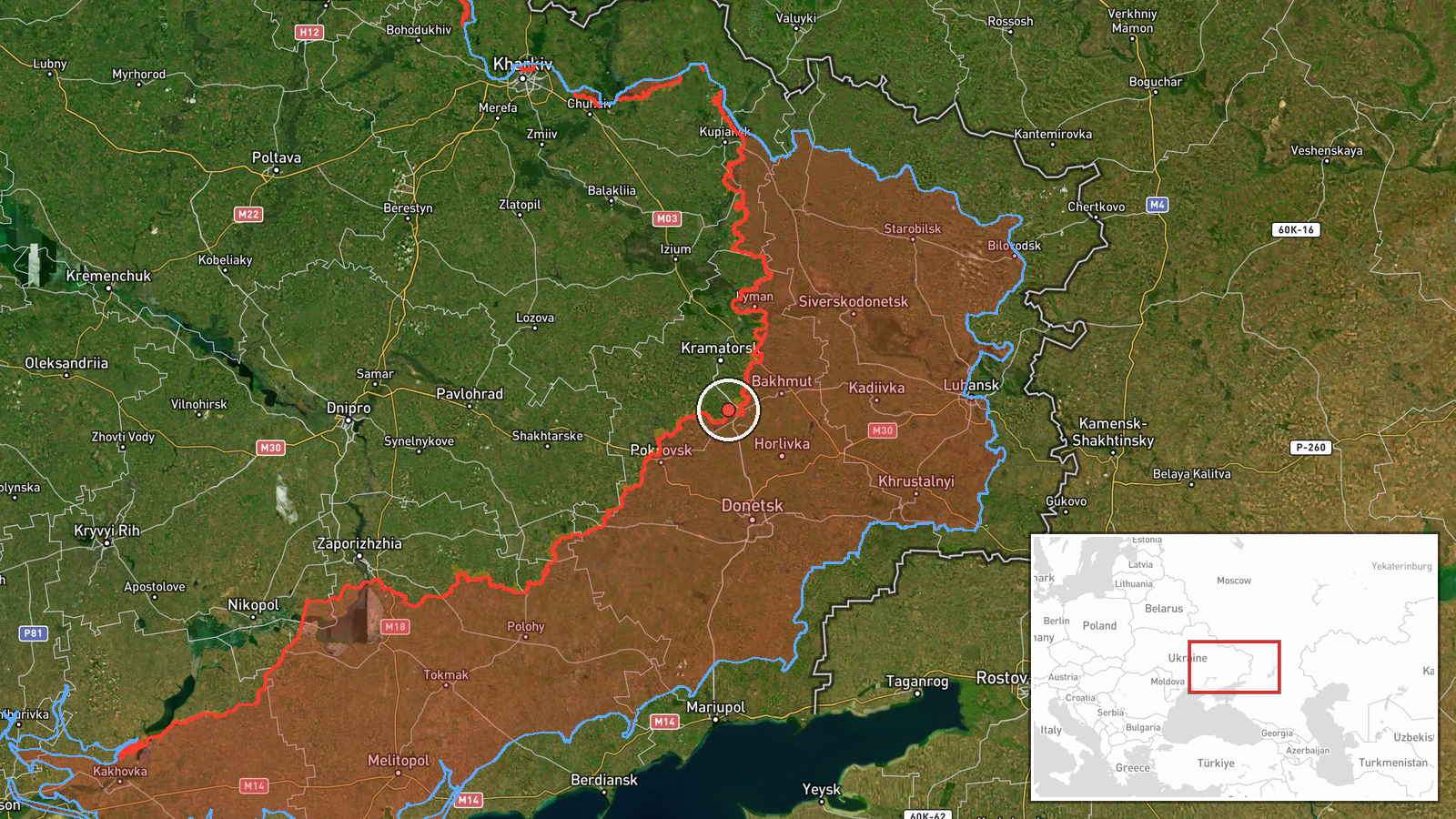
Russian forces reportedly advanced approximately 5 square kilometers in the Oleksiievo-Druzhkivka sector of eastern Ukraine on 10 September, according to DeepState's frontline update. The advance did not result in capture of any settlement center within the sector. The report places the gains in a region spanning the coordinates 48.52°N, 37.63°E. No specific tactical details, unit designations, or casualty figures were disclosed in the available reporting.
Context and assessment
The Oleksiievo-Druzhkivka sector lies within the broader eastern Ukraine frontline where Russian offensive pressure has remained consistent throughout September 2026. A related DeepState report documented 221 Russian combat engagements across multiple frontline sectors on 9 September, suggesting sustained operational tempo. Concurrent Russian drone activity targeting Ukrainian unmanned systems indicates an integrated combined-arms approach. Territorial gains of this scale, while modest, align with the grinding attrition-focused strategy Russia has employed in eastern Ukraine, characterized by incremental advances at high cost rather than breakthrough operations. The absence of settlement captures suggests fighting occurred in open terrain or marginal positions between populated areas.
Sources and confidence
Single-source reporting from DeepStateMAP, a crowdsourced Ukrainian frontline monitoring channel with established track record. Confidence score of 7.5/10 reflects lack of corroborating independent confirmation; DeepState's methodology relies on aggregated visual analysis of satellite imagery and open-source intelligence. Score would increase with confirmation from Ukrainian official military sources or international monitoring; would decrease if competing Russian claims contradict the specific area claimed.
Location
Oleksiievo-Druzhkivka sector encompasses the area of settlements and farmland in Donetsk Oblast, eastern Ukraine, near the coordinates 48.52°N, 37.63°E. The region sits along the contested frontline in the Don River valley plain. Precision assessed as regional rather than point-specific due to sector-scale reporting. Nearby populated centers and terrain features constrain the likely area of advance.
Related events nearby
- Russian forces conducted 221 combat engagements across multiple Ukrainian frontline sectors on 9 September 2022026-09-09 19:07 UTC · Combat · Eastern Ukraine Frontline (Multiple Sectors)
- Multiple reactive (jet-powered) Shahed-136 kamikaze drones launched from Donetsk. Ukrainian air defense respon2026-09-09 17:07 UTC · UAS Strike · Donetsk Oblast, Ukraine
- Russian FPV and kamikaze drones targeted Ukrainian unmanned ground vehicles (UGVs). Ongoing Russian drone camp2026-09-10 00:30 UTC · UAS Strike · Kharkiv Oblast, Ukraine
▶ View this event on the live map
Intel Mapper aggregates open-source reports from monitored Telegram and X channels, geolocates them, cross-checks duplicates across sources and assigns a confidence score. Entries are updated as new confirmations arrive. Read how we verify events.