Ukrainian forces regain ~26 km² in Shandryholove sector, DeepState reports
What happened
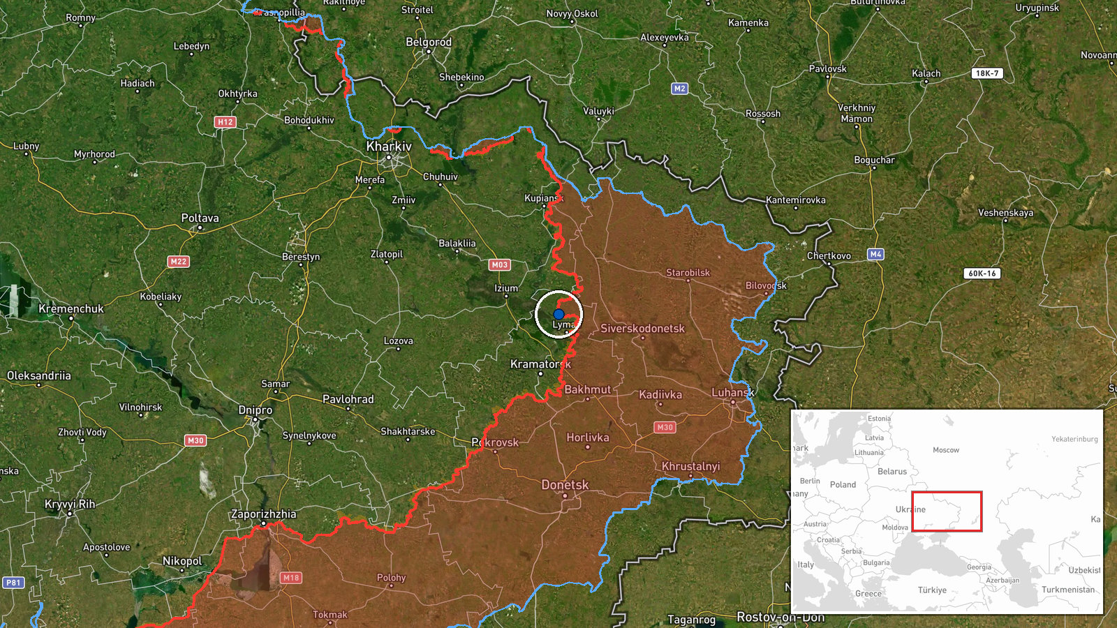
DeepStateMAP's frontline update on 20 September reported that Ukrainian forces regained approximately 26 square kilometers of territory in the Shandryholove sector. The same source indicated that Shandryholove settlement itself was liberated by Ukrainian forces during this operation. The report specifies that no settlement centers other than Shandryholove changed hands in the sector during this period.
Context and assessment
The Shandryholove sector lies in eastern Ukraine's contested borderlands, where frontline positions have remained fluid throughout 2026. This territorial gain coincides with a broader pattern of Ukrainian operational activity evident in recent days: concurrent strikes on Russian air defense systems in Donetsk Oblast and a strike on a UAV manufacturing facility near Siversk suggest Ukrainian forces are maintaining pressure across multiple sectors while targeting Russian logistics and air assets. Ground gains of this scale, if sustained, could indicate either a localized breakthrough or preparation for further advances. The timing and coordination with strikes on rear-area targets may reflect an attempt to degrade Russian air defenses and supply capabilities while pushing forward on the ground.
Sources and confidence
DeepStateMAP provided the sole report of this terrain gain. The source is a widely monitored Ukrainian open-source intelligence channel with established credibility for frontline mapping. Single-source reporting limits independent verification; however, the accompanying liberation of Shandryholove settlement adds corroboration within the same source. Confidence would increase substantially with Russian acknowledgment, geolocated imagery, or reporting from other OSINT networks.
Location
Shandryholove sector is located in eastern Ukraine at approximately 49.09°N, 37.74°E, within the broader Donbas region. The sector designation indicates a bounded area of operations rather than a single point; precision is regional. The settlement of Shandryholove sits in relatively open terrain characteristic of central Donetsk Oblast's steppe landscape.
Related events nearby
- Shandryholove reported liberated by Ukrainian forces (per DeepStateMAP frontline update).2026-09-20 12:20 UTC · Capture · Shandryholove
- Ukrainian forces conducted drone strikes on a Russian UAV manufacturing facility near Siversk, Luhansk Oblast 2026-09-20 09:03 UTC · UAS Strike · Siversk, Luhansk Oblast, Ukraine
- Ukrainian forces released footage of FPV-kamikaze drone strikes targeting Russian air defense systems. Attack 2026-09-20 00:20 UTC · UAS Strike · Donetsk Oblast, Ukraine
- Ukrainian forces destroyed a Russian Nebo-U radar station in the Balky area, Donetsk Oblast on 19-20 September2026-09-20 09:02 UTC · UAS Strike · Balky, Donetsk Oblast, Ukraine
▶ View this event on the live map
Intel Mapper aggregates open-source reports from monitored Telegram and X channels, geolocates them, cross-checks duplicates across sources and assigns a confidence score. Entries are updated as new confirmations arrive. Read how we verify events.