Ukrainian forces reportedly liberate Shandryholove in Donetsk sector advance
What happened
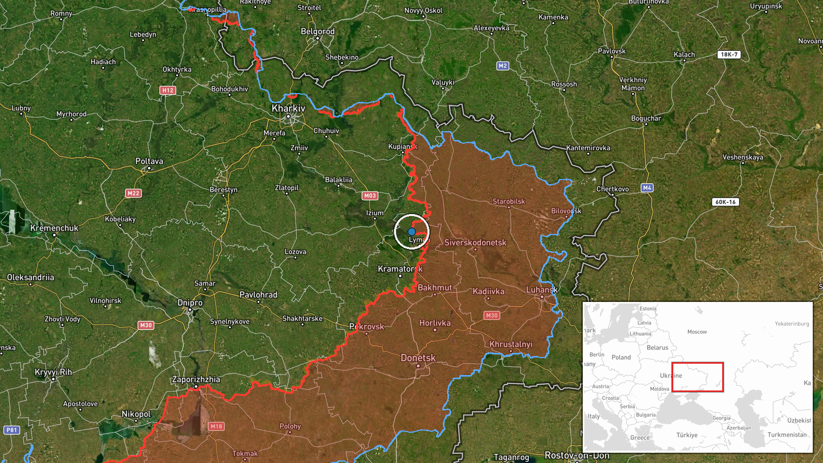
DeepStateMAP's frontline update on 20 September reported that Ukrainian forces have captured Shandryholove, a settlement in Donetsk Oblast. The claim appears in the Ukrainian military monitoring channel's regular situation updates. The timing coincides with reported Ukrainian ground gains of approximately 26 square kilometers in the Shandryholove sector, though related DeepState reporting notes that no settlement center changed hands in this specific sector on the same date, creating some ambiguity about the claim's scope.
Context and assessment
Shandryholove lies in the contested eastern Donetsk Oblast frontier. Ukrainian advances in this sector would extend recent operational momentum across multiple fronts, complementing concurrent drone operations against Russian air defense, radar systems, and UAV manufacturing infrastructure documented on 19–20 September. The reported capture, if confirmed, would represent ground reclamation consistent with Ukrainian efforts to degrade Russian logistics and air capabilities while advancing tactically. The sector has seen sustained fighting; the proximity to Kostyantynivka, a heavily damaged Ukrainian-held city documented a day earlier, suggests this area remains under intense operational focus.
Sources and confidence
Single source: DeepStateMAP, a widely monitored Ukrainian military analysis channel with generally reliable frontline documentation. No independent cross-confirmation in provided data. Confidence of 8.5 reflects the source's established track record but the single-channel reporting and internal inconsistency (sector gains reported but no settlement center change) warrant caution. Confirmation by Ukrainian military official statements or geolocated imagery would substantially raise confidence.
Location
Shandryholove is a settlement in Donetsk Oblast, eastern Ukraine, located at approximately 49.09°N, 37.72°E. It sits in the contested frontier zone where Ukrainian and Russian forces have engaged in sustained ground combat. The settlement's position within the broader Shandryholove sector, which reportedly yielded Ukrainian territorial gains of ~26 km² on this date, places it in the complex terrain of central-eastern Donetsk.
Related events nearby
- Ukrainian forces regained ground (~26 km²) in the Shandryholove sector per DeepState frontline update. No sett2026-09-20 12:20 UTC · Combat · Shandryholove sector, Ukraine
- Ukrainian forces conducted drone strikes on a Russian UAV manufacturing facility near Siversk, Luhansk Oblast 2026-09-20 09:03 UTC · UAS Strike · Siversk, Luhansk Oblast, Ukraine
- Ukrainian forces released footage of FPV-kamikaze drone strikes targeting Russian air defense systems. Attack 2026-09-20 00:20 UTC · UAS Strike · Donetsk Oblast, Ukraine
- Aerial footage documents Kostyantynivka, a key Ukrainian city in Donetsk Oblast, after approximately one year 2026-09-19 13:45 UTC · Report · Kostyantynivka, Donetsk Oblast, Ukraine
- Ukrainian forces destroyed a Russian Nebo-U radar station in the Balky area, Donetsk Oblast on 19-20 September2026-09-20 09:02 UTC · UAS Strike · Balky, Donetsk Oblast, Ukraine
▶ View this event on the live map
Intel Mapper aggregates open-source reports from monitored Telegram and X channels, geolocates them, cross-checks duplicates across sources and assigns a confidence score. Entries are updated as new confirmations arrive. Read how we verify events.