Ukrainian forces gain ~89 km² in Zelena Dolyna sector, settling frontline
What happened
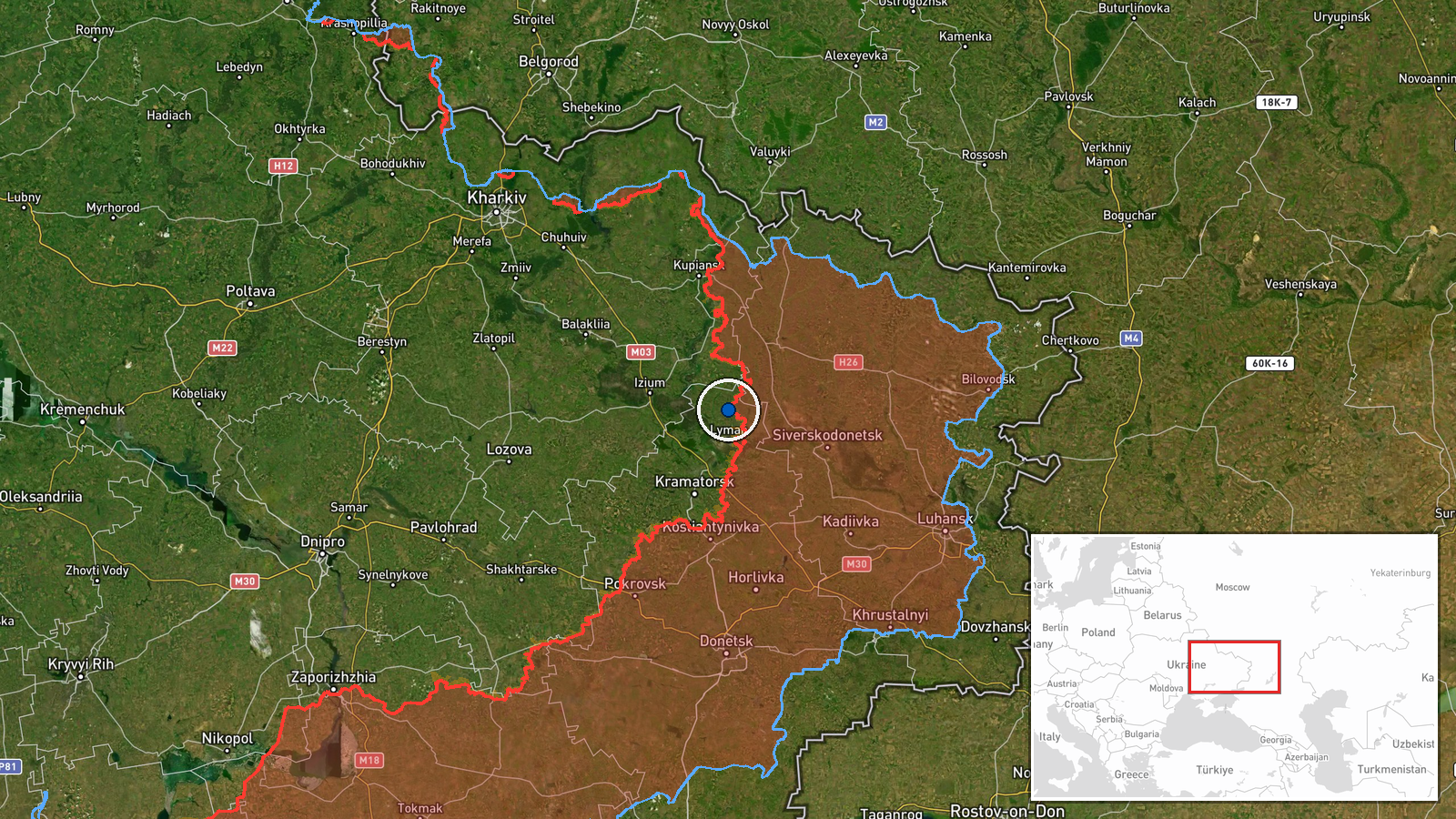
Ukrainian forces reportedly regained approximately 89 square kilometres of territory in the Zelena Dolyna sector, according to a DeepStateMAP frontline update posted on 14 October. The update notes that while significant ground was recovered, no settlement centre in the sector changed hands. Related reports on the same date indicate that the settlements of Zelena Dolyna and Kolodiazi were liberated by Ukrainian forces, suggesting territorial consolidation rather than major breakthrough in this region.
Context and assessment
The Zelena Dolyna sector lies in eastern Ukraine and has seen fluctuating control throughout the ongoing conflict. The reported gain of 89 square kilometres represents a modest but measurable Ukrainian advancement, consistent with patterns of grinding attrition and incremental territorial shifts observed across the front. This operation occurs amid sustained Ukrainian drone and artillery pressure: on 13 October, Russian forces conducted 229 combat clashes nationwide, with Ukraine responding with FPV drone strikes recorded near Yampil'. The absence of a major settlement capture suggests this advance reflects tactical consolidation rather than operational breakthrough, possibly indicating localized Russian withdrawal or repositioning in the sector.
Sources and confidence
Reported by DeepStateMAP, a widely followed Ukrainian crowdsourced frontline mapping project. The confidence score of 7.5 reflects single-source reporting; DeepStateMAP maintains generally high credibility for frontline updates but lacks independent third-party cross-confirmation in this instance. Confidence would increase with corroboration from Russian military bloggers, satellite imagery analysts, or independent observers.
Location
The Zelena Dolyna sector is located in eastern Ukraine at approximately 49.1°N, 37.8°E, in the broader Donetsk region. Zelena Dolyna and Kolodiazi are settlements within this sector. The region's terrain consists of steppe and rolling hills typical of eastern Ukraine's industrial heartland, with limited natural defensive features.
Related events nearby
- Zelena Dolyna reported liberated by Ukrainian forces (per DeepStateMAP frontline update).2026-10-14 12:20 UTC · Capture · Zelena Dolyna
- Kolodiazi reported liberated by Ukrainian forces (per DeepStateMAP frontline update).2026-10-14 12:20 UTC · Capture · Kolodiazi
- Ukrainian FPV kamikaze drone struck a Russian military personnel. Video evidence released showing the FPV dron2026-10-13 23:00 UTC · UAS Strike · Near Yampil', Donetsk, Ukraine (front line, estima
- Ukrainian air monitoring: 1 Russian jet-powered Shahed (Geran-3) drone passing Lazurnyi, heading west.2026-10-13 16:49 UTC · Drone Transit · Lazurnyi, Ukraine
- Russian forces conducted 229 combat clashes across Ukraine on 13 Oct 2026. Russia launched 1 ballistic missile2026-10-14 05:05 UTC · Report · Ukraine (Frontline)
▶ View this event on the live map

Intel Mapper aggregates open-source reports from monitored Telegram and X channels, geolocates them, cross-checks duplicates across sources and assigns a confidence score. Entries are updated as new confirmations arrive. Read how we verify events.