Ukrainian forces report capture of Kolodiazi settlement
What happened
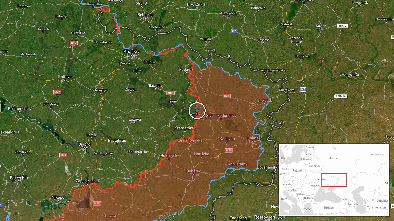
Ukrainian forces reportedly liberated Kolodiazi on 14 October 2026, according to DeepStateMAP's frontline update. The settlement, located in Donetsk Oblast at coordinates 49.087°N, 37.887°E, changed hands as part of Ukrainian operational activity in the region. The report comes amid a broader pattern of Ukrainian ground operations and comes one day after Russian forces conducted over 229 combat clashes across the Ukrainian frontline and launched sustained strikes including airstrikes and kamikaze drone attacks.
Context and assessment
Kolodiazi's reported capture fits within Ukrainian territorial gains documented on 14 October, alongside the liberation of nearby Zelena Dolyna in the same sector. DeepStateMAP reported Ukrainian forces regained approximately 89 square kilometres in the Zelena Dolyna sector that day, though not all through settlement captures. The timing coincides with sustained Russian pressure—229 documented clashes on 13 October and continued drone and air operations—suggesting Ukrainian advances may reflect localized tactical gains or Russian redeployment. The pattern of reported Ukrainian settlement captures against the backdrop of high Russian strike volumes may indicate either Ukrainian exploitation of gaps in Russian defensive lines or Russian prioritization of attrition over territorial retention in this sector.
Sources and confidence
DeepStateMAP provided the primary report via frontline update dated 14 October 2026. Confidence score of 8.5 reflects single-source reporting from a widely-monitored Ukrainian military mapping channel with established track record but no independent cross-confirmation visible in provided data. Confidence would increase with corroborating reports from alternative sources or visual evidence. Independent geotagged imagery or multiple channel confirmation would strengthen assessment.
Location
Kolodiazi is a settlement in Donetsk Oblast, eastern Ukraine, located at approximately 49.087°N, 37.887°E with high geographic precision. It sits within the broader Zelena Dolyna sector where Ukrainian forces reported concurrent territorial gains on 14 October. The settlement's position in Donetsk places it within active frontline territory contested throughout 2026.
Related events nearby
- Ukrainian forces regained ground (~89 km²) in the Zelena Dolyna sector per DeepState frontline update. No sett2026-10-14 12:20 UTC · Combat · Zelena Dolyna sector, Ukraine
- Zelena Dolyna reported liberated by Ukrainian forces (per DeepStateMAP frontline update).2026-10-14 12:20 UTC · Capture · Zelena Dolyna
- Ukrainian FPV kamikaze drone struck a Russian military personnel. Video evidence released showing the FPV dron2026-10-13 23:00 UTC · UAS Strike · Near Yampil', Donetsk, Ukraine (front line, estima
- Ukrainian air monitoring: 1 Russian jet-powered Shahed (Geran-3) drone passing Lazurnyi, heading west.2026-10-13 16:49 UTC · Drone Transit · Lazurnyi, Ukraine
- Russian forces conducted 229 combat clashes across Ukraine on 13 Oct 2026. Russia launched 1 ballistic missile2026-10-14 05:05 UTC · Report · Ukraine (Frontline)
▶ View this event on the live map

Intel Mapper aggregates open-source reports from monitored Telegram and X channels, geolocates them, cross-checks duplicates across sources and assigns a confidence score. Entries are updated as new confirmations arrive. Read how we verify events.