Ukrainian forces reportedly liberate Hrekivka in continued Donetsk operations
What happened
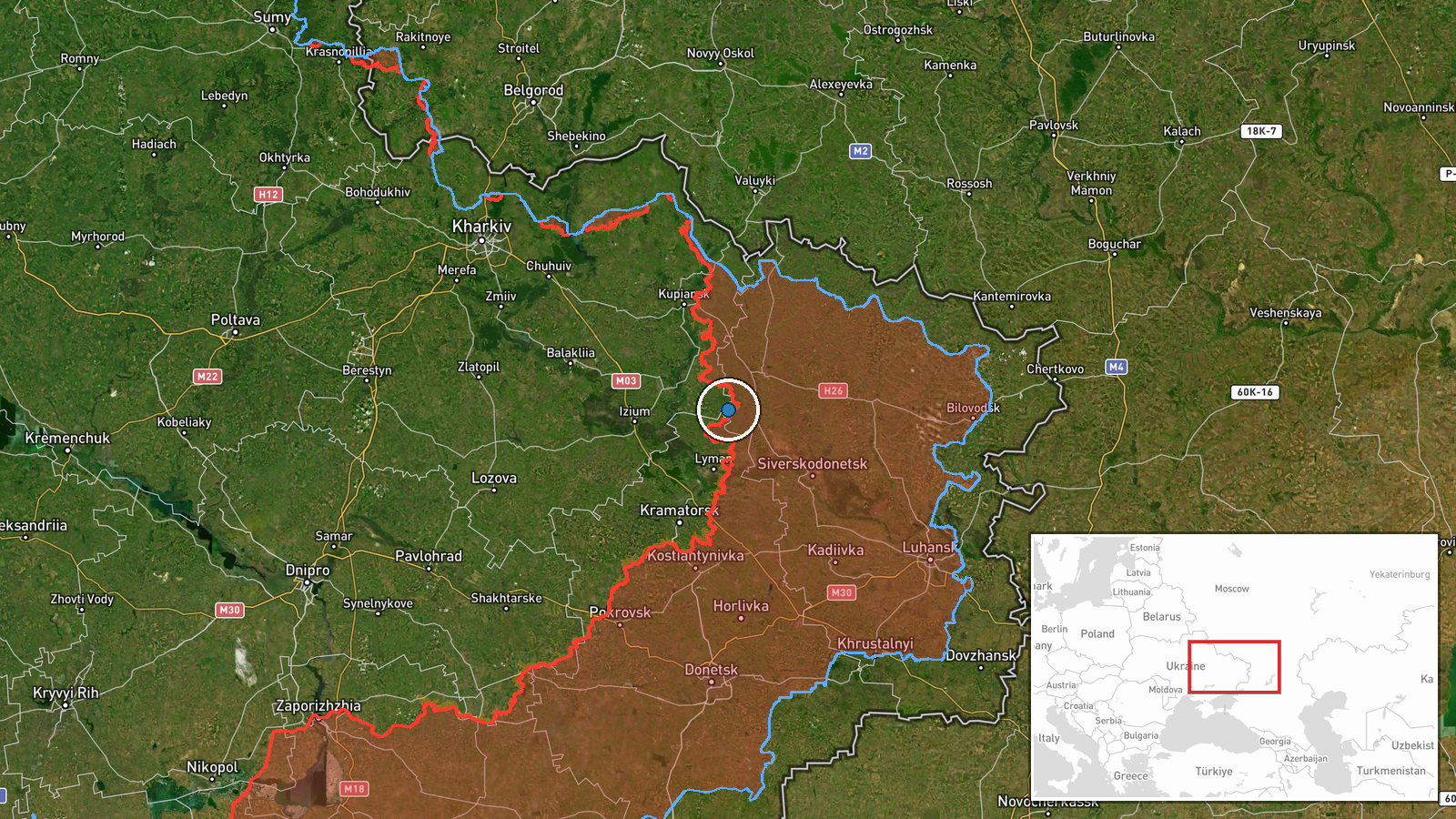
DeepStateMAP reported on 28 September that Ukrainian forces captured Hrekivka, a settlement in Donetsk Oblast. The report came as part of a broader frontline update documenting Ukrainian territorial changes. The exact circumstances of the capture—whether through direct assault, encirclement, or Russian withdrawal—were not specified in the available reporting. No casualty figures were provided.
Context and assessment
Hrekivka's capture fits within a pattern of Ukrainian territorial gains documented on 28 September across multiple sectors of Donetsk Oblast. On the same day, Ukrainian forces regained approximately 43 square kilometers in the Katerynivka sector and conducted operations near Lyman that resulted in the encirclement of Russian personnel and the use of improvised explosive devices against fortifications. These coordinated actions suggest sustained Ukrainian pressure across the eastern front, though Russian forces simultaneously advanced in the Kriva Luka sector. The series of operations indicates Ukrainian forces maintain local initiative in contested areas despite broader strategic stalemate.
Sources and confidence
Sourced solely from DeepStateMAP, a crowdsourced frontline mapping project with Ukrainian orientation. The single-source reporting and lack of independent cross-confirmation account for the moderate confidence score of 8.5. Confidence would increase substantially with corroboration from Russian military sources, international observers, or additional independent channels; it would decrease if subsequent updates contradicted the claim or provided evidence of capture reversal.
Location
Hrekivka is a settlement in Donetsk Oblast, determined via settlement-level geographic precision. The location sits within the eastern Ukrainian conflict zone where Russian and Ukrainian forces compete for territorial control. Coordinates place it approximately 37 kilometers east-northeast of the regional administrative center Pokrovsk.
Related events nearby
- Ukrainian forces regained ground (~43 km²) in the Katerynivka sector per DeepState frontline update. No settle2026-09-28 12:20 UTC · Combat · Katerynivka sector, Ukraine
- Ukrainian forces under Operation Vivaldi encircled and captured approximately 250 Russian soldiers in the Lyma2026-09-28 08:36 UTC · Combat · Lyman, Donetsk Oblast, Ukraine
- Ukrainian forces employed a Soviet-era APC rigged with an IED as a ramming charge against Russian fortificatio2026-09-28 12:22 UTC · Combat · Lyman, Donetsk Oblast, Ukraine
- Russian forces advanced (~6 km²) in the Kriva Luka, Donetsk Oblast, Ukraine sector per DeepState frontline upd2026-09-28 00:20 UTC · Combat · Kriva Luka, Donetsk Oblast, Ukraine sector, Ukrain
- Donbas Battalion (Ukraine) neutralized Russian infiltrators who had penetrated into Mykolaivka via a special o2026-09-27 20:38 UTC · Security · Mykolaivka, Donetsk Oblast, Ukraine
▶ View this event on the live map
Intel Mapper aggregates open-source reports from monitored Telegram and X channels, geolocates them, cross-checks duplicates across sources and assigns a confidence score. Entries are updated as new confirmations arrive. Read how we verify events.