Drone strike on military sites in El Daein, Sudan, reportedly kills five and wounds 20
What happened
Darfur24, a Sudanese news outlet, reported that a drone strike on Monday hit military positions in El Daein, the main town of East Darfur state, killing five people and wounding 20. Citing medical sources, the outlet said the casualties included civilians, some of whom were described as seriously injured. The Arabic text indicates that local residents were also quoted, but the excerpt available cuts off before their accounts. The report does not identify the drone operator or say which armed group the targeted positions belonged to. The event is timed at 19:06 UTC on 19 October 2026, and the casualty figures come from medical sources cited by a single outlet rather than from independent verification.
Context and assessment
El Daein sits in the southern part of Darfur, a region that has seen repeated fighting since the wider Sudanese conflict between the army and the Rapid Support Forces broke out in 2023. Both sides have been widely reported to use drones, so the strike fits a broader pattern of aerial and long-range attacks in western and southern Sudan rather than an isolated incident. A related event logged the same day reports South Sudanese refugees arriving at East Darfur camps in recent weeks, fleeing drought and spreading fighting in Kordofan and Darfur. That context matters because a town that hosts displaced people and also contains military positions is exposed to civilian harm when strikes target nearby sites. The presence of civilians among the wounded suggests the targeted positions may be close to populated areas. Operationally, the pattern may point to contested control of supply routes and garrisons in East Darfur, although the available reporting does not establish the purpose of the strike or the attacker's objectives.
Sources and confidence
Only one channel, Darfur24, has reported this event, so cross-confirmation is absent and the confidence score of 6.0 reflects a single-source report with a plausible medical basis but no independent check. Confidence would rise with confirmation from a second Sudanese outlet, a wire service, a named hospital, or a UN or humanitarian body such as OCHA, particularly if they supply casualty figures or dated imagery. It would fall if the outlet later corrected the figures or if local officials disputed the account. The casualty numbers are attributed to unnamed medical sources and should be treated as provisional.
Location
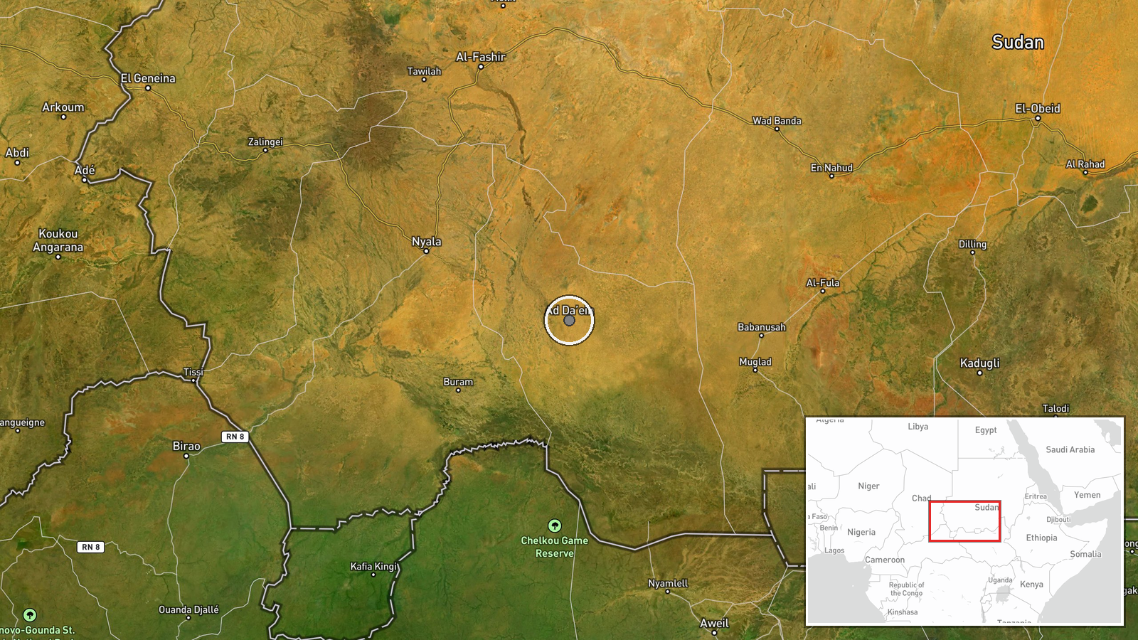
The location is recorded at settlement precision, placing the event in El Daein town in East Darfur state, and the location confidence is rated high because the report names the town directly. The coordinates fall within the populated area of the town rather than a specific facility, which is why the strike site itself cannot be pinpointed from the data. El Daein lies in semi-arid savanna country in southern Darfur, an agricultural and trading area linked by roads to other towns and to the border region with South Sudan.
Related events nearby
- Large numbers of South Sudanese refugees arriving at East Darfur camps in recent weeks, fleeing drought and sp2026-10-19 13:18 UTC · Displacement · Ed Daein, East Darfur, Sudan
▶ View this event on the live map

Intel Mapper aggregates open-source reports from monitored Telegram and X channels, geolocates them, cross-checks duplicates across sources and assigns a confidence score. Entries are updated as new confirmations arrive. Read how we verify events.