Israeli forces shell Al-Samadaniyah ash-Sharqiyah in central Quneitra countryside
What happened
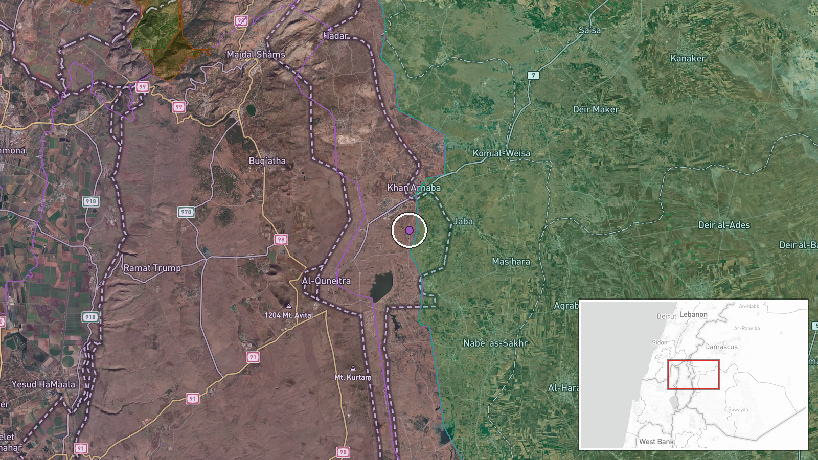
Israeli military forces conducted artillery shelling in the vicinity of Al-Samadaniyah ash-Sharqiyah village in central Quneitra countryside on September 6, 2026 at approximately 05:54 UTC. Local sources reported the strike via Telegram. No immediate casualty figures were reported in the account. The strike targeted the surrounding area rather than a specified military position.
Context and assessment
The shelling represents a continuation of sustained Israeli military operations in southwestern Syria's Quneitra Governorate near the Golan Heights. Related events from September 5 document multiple artillery strikes across the region, including strikes near Bayt Jinn and Al-Rafid village, alongside reported ground force infiltration of Um Bathneh. This pattern suggests coordinated pressure across Quneitra's central and southern areas, possibly part of broader operational objectives in the buffer zone between Israeli-controlled territory and Syrian government-held areas. The timing aligns with reported diplomatic discussions regarding post-war strategy in Syria.
Sources and confidence
Local Syrian sources reported the incident via Telegram channel @AJSyriaNow. The report remains single-sourced without cross-confirmation from additional independent channels or Israeli military statements. Confidence is moderate (7.5/10) due to single-source attribution and lack of casualty or damage details. Confirmation from additional Syrian, Lebanese, or international media sources would increase confidence; Israeli military acknowledgment would further strengthen assessment.
Location
Al-Samadaniyah ash-Sharqiyah is a village in central Quneitra Governorate, southwestern Syria, located at approximately 33.16°N, 35.89°E near the Israeli-Syrian buffer zone in the Golan Heights region. The settlement sits within disputed or contested territory subject to Israeli military operations in the post-2023 period.
Related events nearby
- Israeli military personnel spotted establishing control checkpoints on Syrian territory near Damascus. Visual 2026-09-06 15:07 UTC · Deployment · Quneitra, Quneitra Governorate, Syria
- Students return to classrooms in Qunaytra as new academic year begins, resuming educational activities post-co2026-09-06 12:19 UTC · Humanitarian Aid · Qunaytra, Qunaytra Governorate, Syria
- Israeli artillery and gunfire targeted Quneitra Countryside in southern Syria amid escalating military tension2026-09-06 20:13 UTC · Artillery · Quneitra Countryside, Quneitra Governorate, Syria
- Syrian Interior Ministry security forces arrested two individuals in Al-Kiswah, Rif Dimashq, with weapons, amm2026-09-06 14:28 UTC · Security · Al-Kiswah, Rif Dimashq Governorate, Syria
- Israeli artillery shelling reported in southern Syria's Daraa region alongside discussion of weakening securit2026-09-06 12:03 UTC · Artillery · Daraa Governorate, Syria
▶ View this event on the live map
Intel Mapper aggregates open-source reports from monitored Telegram and X channels, geolocates them, cross-checks duplicates across sources and assigns a confidence score. Entries are updated as new confirmations arrive. Read how we verify events.