Israeli Air Force strikes former military positions on Mount Hermon near Damascus
What happened
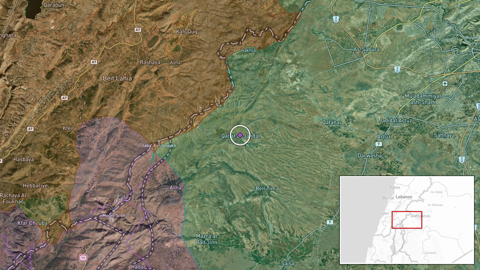
The Israeli Air Force reportedly conducted airstrikes targeting former military positions near Qalaat Jindal on Jebel al-Sheikh (Mount Hermon) in Rif Dimashq governorate, southwest of Damascus, on 20 September at 11:47 UTC. The target described as a 'former' military installation suggests structures no longer in active use at the time of the strike, according to reporting from Syria Now via Telegram.
Context and assessment
Mount Hermon's strategic elevation and proximity to Damascus make military installations there operationally significant for air defense and surveillance. The strike occurs amid apparent Syrian security operations targeting former regime military officials—two retired commanders were arrested within the preceding day—suggesting potential instability in command structures or asset control. Israeli military activity in the Golan Heights and southern Lebanon has remained elevated, with a patrol deployment from Tel Ahmar reported earlier that morning. The characterization of targets as 'former' positions may indicate Israel's assessment that certain Syrian assets remain potential threats despite their nominal deactivation.
Sources and confidence
Single source: Telegram channel @AJSyriaNow (Syria Now). No cross-confirmation from Israeli military statements or independent observers reported. Confidence score of 7.5 reflects the single-source reporting and lack of secondary confirmation, typical for real-time strike claims from Syrian channels. Confirmation from IDF statements or visual evidence would substantially raise confidence.
Location
Qalaat Jindal, a settlement on Jebel al-Sheikh (Mount Hermon) in Rif Dimashq governorate approximately 40 kilometers southwest of Damascus. Mount Hermon is the region's highest elevation at 2,814 meters, straddling the Syria-Lebanon border. Coordinates determined to exact precision (33.4227472°N, 35.9614889°E) from settlement location.
Related events nearby
- Syrian Interior Ministry arrested Zakia Muhammad Sunun, a former Ba'athist air force brigadier and operations 2026-09-20 11:16 UTC · Security · Damascus, Syria
- Syrian Interior Security Forces arrested retired Brigadier General Ahmad Muhammad Ismail, a former senior comm2026-09-19 19:09 UTC · Security · Damascus, Syria
- Syrian Energy Minister Muhammad al-Bashir addresses parliament on energy sector reconstruction: Syria needs 242026-09-20 10:01 UTC · Statement · Damascus, Syria
- Israeli military patrol of 8 armored vehicles with troops deployed from Tel Ahmar base toward villages of Kudn2026-09-20 10:43 UTC · Deployment · Tel Ahmar, Golan Heights, Syria
- Two Israeli soldiers lightly wounded when IDF engineering vehicle struck Hezbollah explosive charge in souther2026-09-19 18:23 UTC · Combat · Southern Lebanon Security Zone
▶ View this event on the live map
Intel Mapper aggregates open-source reports from monitored Telegram and X channels, geolocates them, cross-checks duplicates across sources and assigns a confidence score. Entries are updated as new confirmations arrive. Read how we verify events.