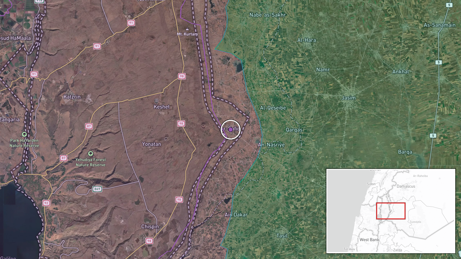
Israeli artillery shells agricultural area near Rafid in Syria's Quneitra Governorate
What happened
Israeli artillery reportedly targeted southern agricultural lands near Rafid village in Quneitra Governorate, Syria, on 20 September at approximately 13:30 UTC. The strike hit farming areas rather than built-up zones. The report, sourced from the Telegram channel Syria Now, does not specify the type of artillery used or report any immediate damage or casualties. The shelling occurred amid broader Israeli military activity in the region.
Context and assessment
Rafid lies in southern Quneitra, near the Israeli-controlled Golan Heights and close to the Lebanese border. The strike fits a pattern of Israeli military operations across the Syria-Lebanon-Golan nexus on 20 September: an Israeli patrol deployed from Tel Ahmar toward southern Quneitra villages earlier that morning, while airstrikes targeted former military positions on Mount Hermon (Jebel al-Sheikh) and southern Lebanon. Israeli forces have conducted intermittent strikes in Syrian territory in recent years, often targeting positions associated with Iranian or Lebanese militant groups. Agricultural areas near the border region may be struck incidentally during operations or deliberately if assessed as hosting military infrastructure.
Sources and confidence
Single source: Telegram channel @AJSyriaNow (Syria Now), an Arab media outlet. Confidence score 7.5 reflects corroboration by related events on the same date and location plausibility, but relies on one reporting channel with no cross-confirmation from Israeli, Syrian, or international sources. Score would rise with confirmation from additional channels or official statements; would lower if related military activity is not independently verified.
Location
Rafid village, Quneitra Governorate, southwestern Syria, near the Golan Heights frontier with Israel. Coordinates place the site approximately 8 km south of Quneitra city and roughly 15 km north of the Israeli-controlled Golan. The agricultural lands targeted lie in relatively flat terrain typical of the region. Geo-precision marked exact based on settlement location.
Related events nearby
- Israeli military patrol of 8 armored vehicles with troops deployed from Tel Ahmar base toward villages of Kudn2026-09-20 10:43 UTC · Deployment · Tel Ahmar, Golan Heights, Syria
- Video documentation shows two Israeli tanks and two military armored vehicles advancing into Wadi al-Ruqqad re2026-09-20 15:09 UTC · Combat · Wadi al-Ruqqad, Daraa Countryside, Syria
- Syrian authorities expanded Naseeb Border Crossing with Jordan, improving border-crossing infrastructure, oper2026-09-20 14:14 UTC · Humanitarian Aid · Naseeb Border Crossing, Daraa, Syria
- Israeli Air Force conducted airstrikes on former military positions near Qalaat Jindal on Jebel al-Sheikh (Mou2026-09-20 11:47 UTC · Airstrike · Jebel al-Sheikh (Mount Hermon), Rif Dimashq, Syria
- Israel conducted airstrikes against targets in southern Lebanon. No casualty or damage figures provided in the2026-09-20 00:13 UTC · Airstrike · Southern Lebanon
▶ View this event on the live map
Intel Mapper aggregates open-source reports from monitored Telegram and X channels, geolocates them, cross-checks duplicates across sources and assigns a confidence score. Entries are updated as new confirmations arrive. Read how we verify events.