Israeli airstrikes hit western Daraa from Golan Heights, amid intensified operations
What happened
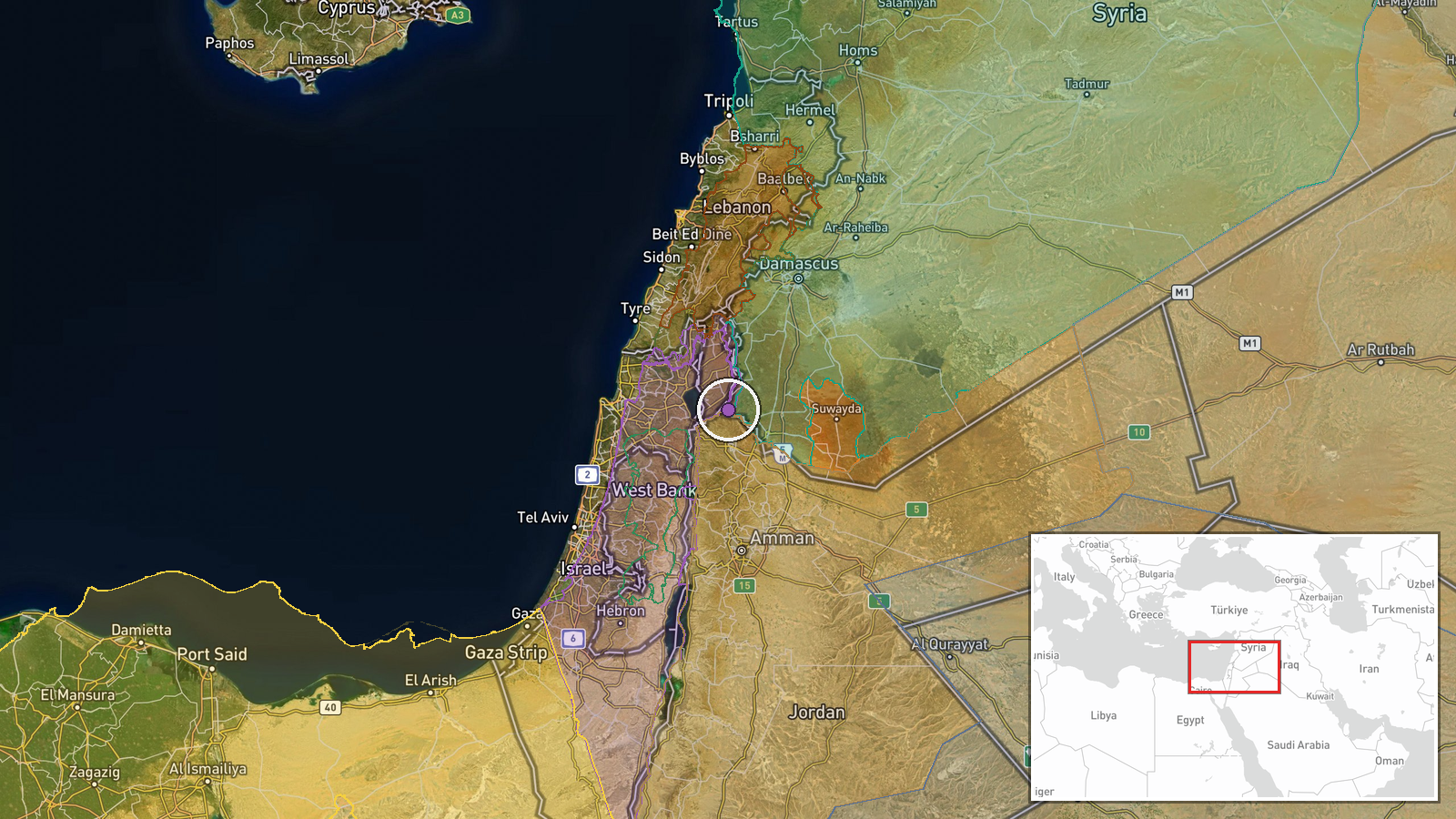
Israeli military aircraft conducted airstrikes on the Daba al-Mughr area near Abidin in the Yarmouk Basin, western Daraa Countryside, Syria on September 21. According to Telegram channel @AJSyriaNow, the strikes involved illumination bombs and ordnance. The airstrikes originated from the Israeli-occupied Golan Heights. No immediate casualty or damage figures were reported.
Context and assessment
The strikes on western Daraa occur within a pattern of intensified Israeli military activity in southern Syria over the past 24 hours. Related events include tank and armored vehicle incursions into Wadi al-Ruqqad on September 20, artillery shelling of Rafid in Quneitra, and a deployed patrol from Tel Ahmar base toward villages in southern Quneitra. The Yarmouk Basin and western Daraa have historically been contested areas sensitive to Israeli security concerns regarding cross-border activity. The use of illumination ordnance suggests either night operations or reconnaissance activity rather than primary strike objectives, though full operational intent remains unclear from available reporting.
Sources and confidence
Single-source reporting from Telegram channel @AJSyriaNow. No cross-confirmation from other channels or independent verification documented. Confidence score of 7.5 reflects the account's access to regional developments but reliance on a single source. Verification through satellite imagery, additional eyewitness accounts, or Israeli military statements would increase confidence. Contradictory reports or source retraction would lower it substantially.
Location
Daba al-Mughr, a settlement area west of Abidin village in the Yarmouk Basin region of western rural Daraa Countryside, Syria. Located at approximately 32.76°N, 35.83°E. The Yarmouk Basin sits along the Syrian-Israeli border zone, with the occupied Golan Heights to the southwest. The area is situated roughly 70 kilometers south of Damascus and represents terrain historically significant to Israeli border security operations.
Related events nearby
- Video documentation shows two Israeli tanks and two military armored vehicles advancing into Wadi al-Ruqqad re2026-09-20 15:09 UTC · Combat · Wadi al-Ruqqad, Daraa Countryside, Syria
- Israeli artillery shelling targets southern agricultural lands of Rafid village in Quneitra Governorate, Syria2026-09-20 13:30 UTC · Artillery · Rafid, Quneitra, Syria
- Israeli military patrol of 8 armored vehicles with troops deployed from Tel Ahmar base toward villages of Kudn2026-09-20 10:43 UTC · Deployment · Tel Ahmar, Golan Heights, Syria
- Syrian authorities expanded Naseeb Border Crossing with Jordan, improving border-crossing infrastructure, oper2026-09-20 14:14 UTC · Humanitarian Aid · Naseeb Border Crossing, Daraa, Syria
- Unknown explosion reported in Al-Harak town, eastern Daraa Countryside. Origin and responsible party unconfirm2026-09-21 00:22 UTC · Explosion · Al-Harak, Daraa Countryside, Daraa Governorate, Sy
▶ View this event on the live map
Intel Mapper aggregates open-source reports from monitored Telegram and X channels, geolocates them, cross-checks duplicates across sources and assigns a confidence score. Entries are updated as new confirmations arrive. Read how we verify events.