Al-Ashara Bridge in Deir ez-Zor sustains damage amid elevated Euphrates water levels
What happened
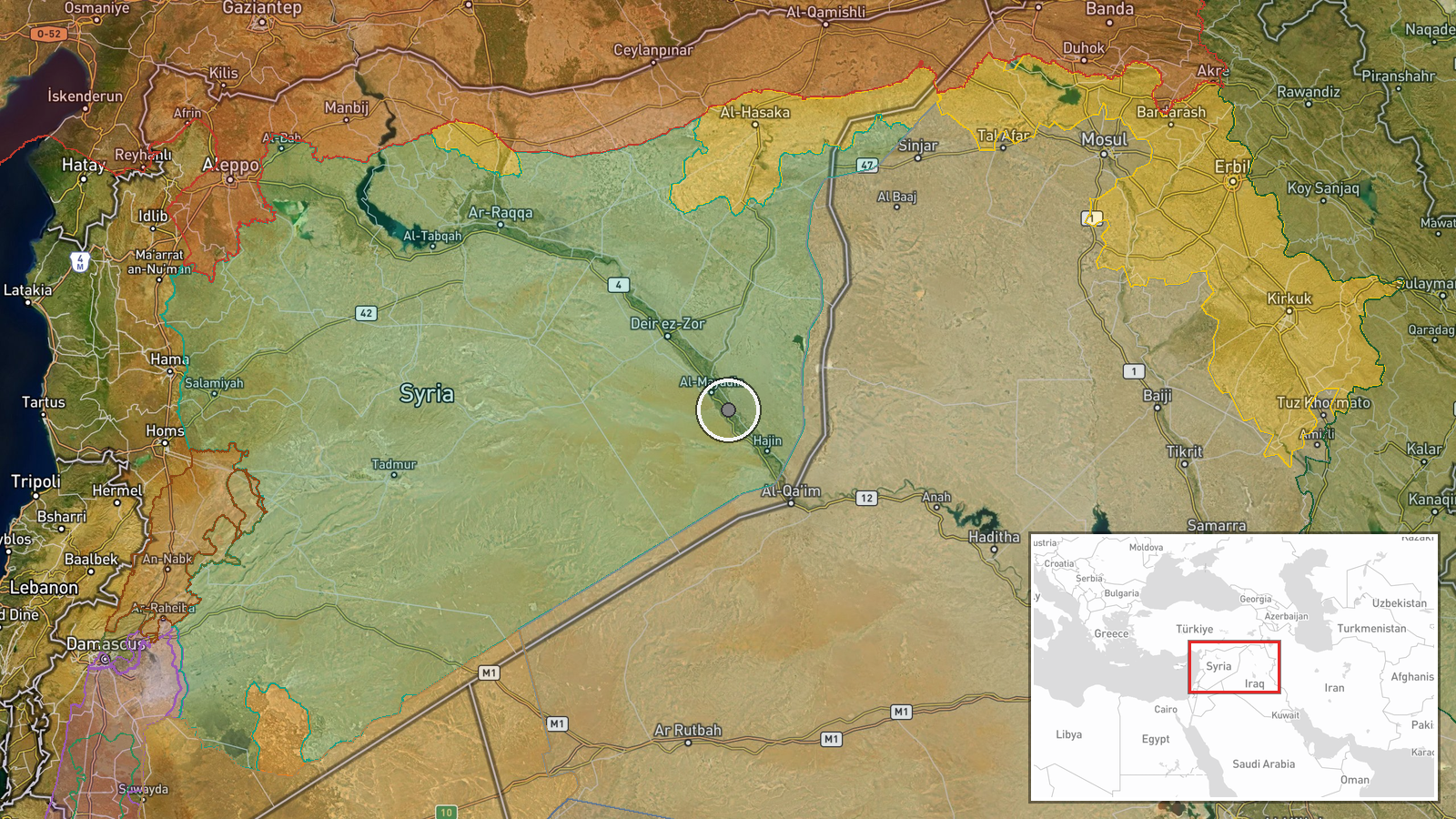
Part of the Al-Ashara earthen bridge in Deir ez-Zor, Syria sustained damage on September 28, coinciding with elevated Euphrates River water levels, according to a report from Telegram channel @AJSyriaNow. The report attributed the damage to natural flooding conditions rather than military action. The extent of structural compromise and repair timeline were not specified in the available reporting.
Context and assessment
The Al-Ashara Bridge crossing the Euphrates in eastern Deir ez-Zor is a critical transportation link in a region where river crossings control movement between population centers and supply routes. The timing coincides with a broader pattern of infrastructure activity in the governorate: heavy engineering equipment arrived the same day in Al-Mayadin for bridge rehabilitation work. Elevated river levels during seasonal fluctuations or dam releases can stress aging earthen structures, particularly in areas where maintenance capacity has been strained by years of conflict. The simultaneous presence of construction assets suggests regional authorities may be preparing for potential cascading infrastructure failures.
Sources and confidence
Single source report from Telegram channel @AJSyriaNow on September 28. No corroborating reports from other channels or independent verification currently available. Confidence score of 7.5 reflects the credible channel but unconfirmed single-source status. Cross-confirmation from additional local sources or satellite imagery would raise confidence; contradictory reporting of military involvement would lower it.
Location
Al-Ashara Bridge crosses the Euphrates River in Deir ez-Zor governorate, eastern Syria (34.92°N, 40.56°E). The earthen structure connects settlements on both riverbanks in a sparsely populated region. Nearby Al-Mayadin lies approximately 15 kilometers downstream, where parallel bridge rehabilitation efforts were reportedly underway.
Related events nearby
- Heavy engineering equipment arrived in Deir ez-Zor countryside for preparation and rehabilitation of Al-Mayadi2026-09-28 09:22 UTC · Humanitarian Aid · Al-Mayadin, Deir ez-Zor, Syria
- HTS Interior Security released Eid Hamid Al-Abdullah, a youth kidnapped in Al-Busirah, after 12 hours in custo2026-09-28 06:22 UTC · Security · Al-Busirah, Deir ez-Zor, Syria
- Syrian Government Social Affairs & Labor Directorate launched voluntary family return convoy from Al-Madina Al2026-09-28 14:44 UTC · Humanitarian Aid · Deir ez-Zor, Syria
- Syrian Internal Security Forces conducted multi-governorate security operation dismantling ISIS cell. Seized e2026-09-27 18:42 UTC · Security · Multiple Governorates, Syria
▶ View this event on the live map
Intel Mapper aggregates open-source reports from monitored Telegram and X channels, geolocates them, cross-checks duplicates across sources and assigns a confidence score. Entries are updated as new confirmations arrive. Read how we verify events.