Two HTS engineers injured in mine blast during demining operation in Deir ez-Zor
What happened
Two military engineers belonging to HTS engineering and mine-clearance teams were injured when an improvised explosive device detonated near their vehicle in the Ishlah area of rural Deir ez-Zor Governorate on October 2. The incident occurred during ongoing counter-IED clearance operations in the region. According to the Telegram channel Syria Now, the explosion struck a military vehicle assigned to HTS's demining units, though specific details on injury severity were not provided.
Context and assessment
Deir ez-Zor Governorate, Syria's easternmost province bordering Iraq, remains heavily contaminated with mines and improvised explosive devices left from years of conflict. HTS-led engineering teams have been systematically clearing such ordnance to restore civilian access and economic activity, including recent pipeline repairs in the broader region. The timing of this incident reflects the ongoing hazards faced by HTS personnel conducting these clearance operations, which are essential to stabilizing eastern Syria but expose teams to residual explosive threats planted by prior occupants. Concurrent HTS deployments in Al-Hasakah to the north suggest broader consolidation efforts across northeastern Syria.
Sources and confidence
Single source report via Telegram channel @AJSyriaNow, dated October 2, 2026. No cross-confirmation from independent outlets or competing sources. Confidence score of 7.5 reflects the reliability of the reporting channel but limits verification. Confirmation from HTS officials or secondary media reports would raise confidence; independent video or medical records would further substantiate casualty details.
Location
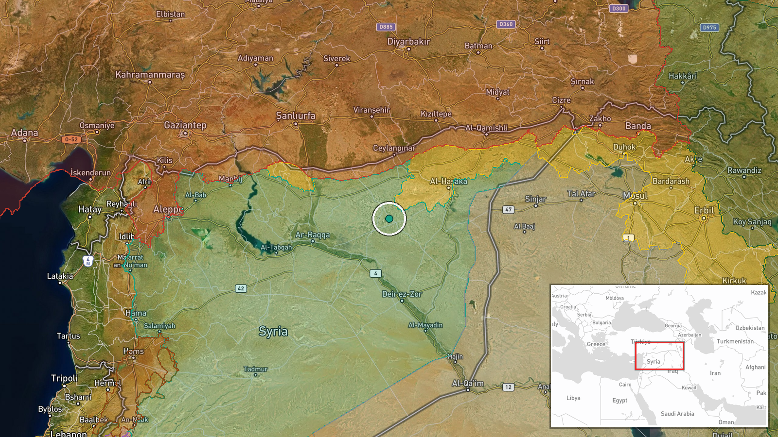
Ishlah area (also transliterated as Ishlah or Al-Hasiniyah) in rural Deir ez-Zor Governorate, northeastern Syria. Located approximately 36.19°N, 39.98°E, the region lies in the arid steppe east of the Euphrates River valley. Precision is region-level due to lack of satellite or detailed ground confirmation, though the settlement name provides geographic anchoring in one of Syria's least densely populated provinces.
Related events nearby
- Local Arab population in Hasakah (northeastern Syria) removes SDF/YPG flags from public spaces, signaling civi2026-10-02 11:59 UTC · Security · Al-Hasakah, Hasakah Governorate, Syria
- Internal Security Forces (HTS) deployed patrols throughout Al-Hasakah city to reinforce stability and maintain2026-10-02 10:32 UTC · Security · Al-Hasakah, Hasakah Governorate, Syria
- Syrian Petroleum Company completed maintenance and repair of the Jubba gas pipeline in Al-Shula, Deir ez-Zor a2026-10-02 09:20 UTC · Humanitarian Aid · Al-Shula, Deir ez-Zor Governorate, Syria
- Al-Qamishli International Airport rehabilitation works enter final stages ahead of return to full operational 2026-10-02 12:07 UTC · Humanitarian Aid · Al-Qamishli International Airport, Al-Hasakah, Syr
▶ View this event on the live map
Intel Mapper aggregates open-source reports from monitored Telegram and X channels, geolocates them, cross-checks duplicates across sources and assigns a confidence score. Entries are updated as new confirmations arrive. Read how we verify events.