Israeli forces resume fortification work on Sofa 53 road in southern Quneitra
What happened
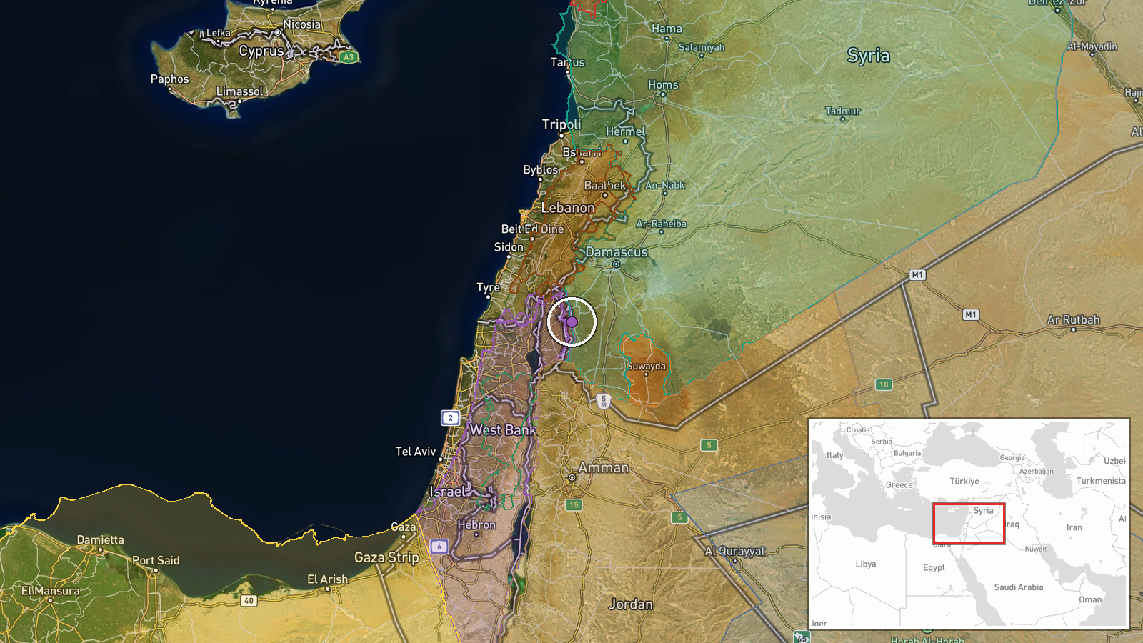
Israeli occupation forces reportedly resumed construction activities on Sofa 53 road near Al-Asha village in southern Quneitra Governorate on 4 October. According to a Telegram report, military vehicles entered the area and began excavating trenches and constructing earthen fortifications. The operation occurred as part of ongoing Israeli military presence in the demilitarized zone separating Israeli-held territory from Syrian-controlled areas.
Context and assessment
The Sofa 53 road lies within the buffer zone established following the 1974 disengagement agreement, where Israeli forces maintain a significant military footprint. This activity follows a pattern of intensified Israeli operations across Quneitra and Daraa governorates over the preceding 24 hours, including detention operations in Al-Hamidiyah and artillery strikes on Sida Al-Hanout and Maaria. Fortification construction may indicate efforts to consolidate control over strategic positions, establish new observation points, or prepare defensive positions along the zone. Such engineering work typically signals longer-term operational planning rather than immediate tactical response.
Sources and confidence
Single source from Telegram channel @AJSyriaNow, reporting in Arabic with operational detail. No cross-confirmation from other channels or international outlets documented. Confidence score of 7.5 reflects single-source reporting; confirmation from additional independent sources or satellite imagery would substantiate claims. Military engineering activities are typically corroborated through multiple intelligence channels.
Location
Sofa 53 road near Al-Asha village in southern Quneitra Governorate, coordinates 33.095°N, 35.921°E. Located in the Israeli-controlled buffer zone of the Golan Heights plateau, approximately 15 km south of the main Quneitra settlement. Terrain comprises open agricultural land with limited civilian presence, typical of demilitarized areas.
Related events nearby
- Israeli occupation forces detained a young man during an incursion into Al-Hamidiyah village in rural Quneitra2026-10-03 12:46 UTC · Security · Al-Hamidiyah, Quneitra Governorate, Syria
- Israeli forces conducted artillery strikes on Sida Al-Hanout village in Quneitra Governorate, causing damage t2026-10-03 21:26 UTC · Artillery · Sida Al-Hanout, Quneitra Governorate, Syria
- Israeli occupation forces conducted an incursion into Wadi al-Raqad area in western rural Daraa, inspecting a 2026-10-03 16:37 UTC · Security · Wadi al-Raqad, Daraa Governorate, Syria
- Israeli occupation forces conducted artillery strikes on Maaria village in Daraa Governorate. International co2026-10-03 18:07 UTC · Artillery · Maaria, Daraa Governorate, Syria
- Israeli artillery shelled the edges of Maaria village in western rural Daraa, Syria. No casualties reported in2026-10-03 11:37 UTC · Artillery · Maaria, Daraa Governorate, Syria
▶ View this event on the live map
Intel Mapper aggregates open-source reports from monitored Telegram and X channels, geolocates them, cross-checks duplicates across sources and assigns a confidence score. Entries are updated as new confirmations arrive. Read how we verify events.