Israeli forces detonate abandoned building in western rural Damascus during incursion
What happened
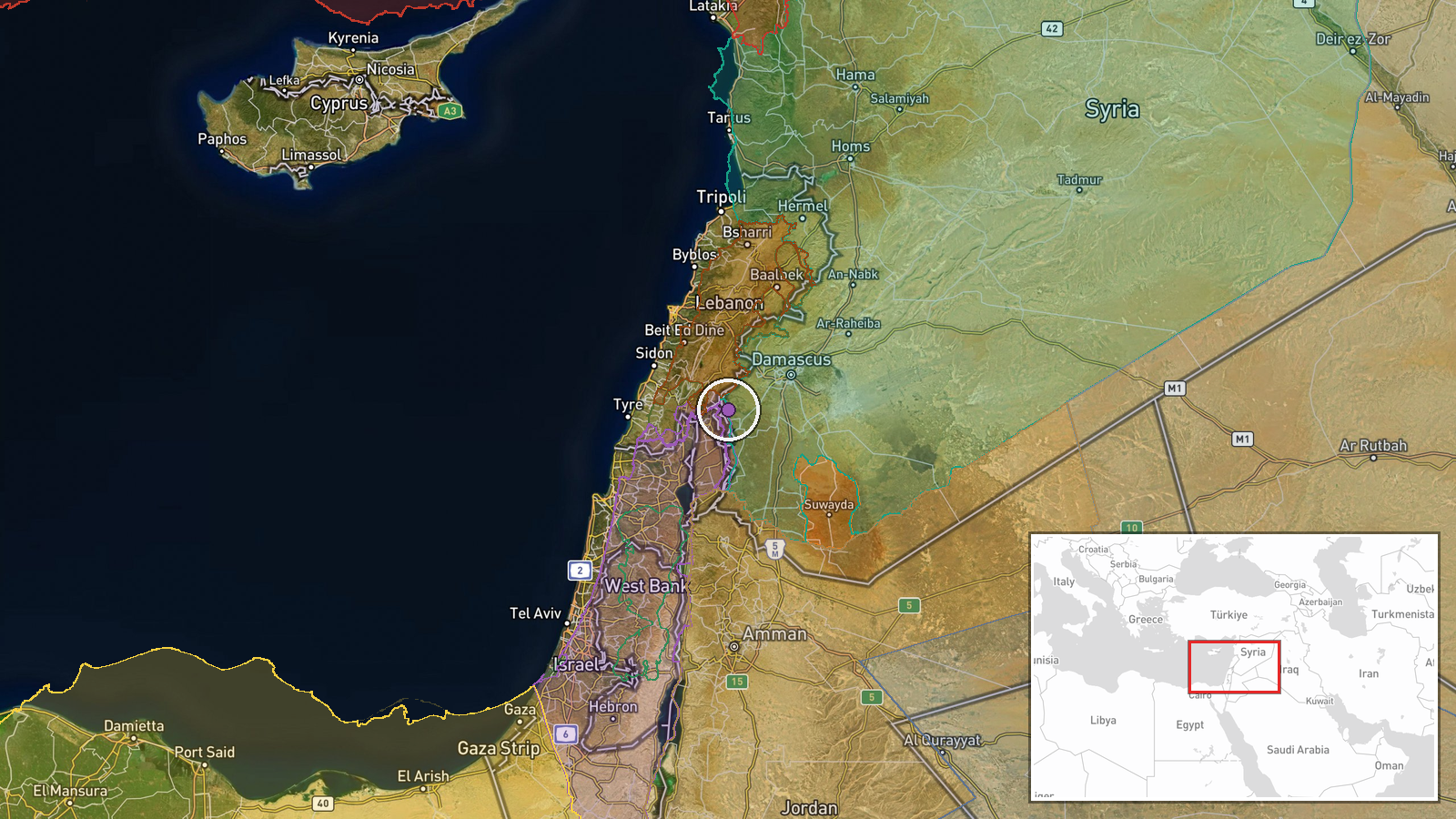
Israeli occupation forces detonated an abandoned building located in agricultural lands between Bayt Jan village and Bayt Jan farm in western rural Damascus (Rif Dimashq) on October 5, reportedly during an incursion into the area. The structure was unoccupied at the time of the demolition. The report was sourced from Syrian state news channels and conflict monitoring accounts on social media.
Context and assessment
The demolition occurs amid an intensified pattern of Israeli military activity across southern Syria's Golan Heights and surrounding regions during early October 2026. Related incidents on October 4–5 include Israeli operations at Project Sofa 53 near Quneitra, illumination fire near Al-Hamidiyah, and multiple confrontations with infiltrators in the security zone. The destruction of structures in agricultural areas may indicate Israeli forces are clearing terrain, establishing positions, or denying resources in areas of reported military incursion. The timing and location suggest this action is part of a broader operational posture in Syrian territory near the Israeli-occupied Golan.
Sources and confidence
Two sources reported the event: Telegram channel @AJSyriaNow and X account @ConflictTR. The confidence score of 7.5 reflects corroboration across two independent channels but limited detail on circumstances and no independent verification from additional sources. Confirmation from Israeli military statements or Syrian civil defense would raise confidence; contradictory reporting or clarification that the structure was occupied would lower it.
Location
Bayt Jan village and its associated farm in western rural Damascus (Rif Dimashq Governorate), approximately 33.31°N, 35.88°E. The site lies in agricultural lands in the western suburbs of Damascus, in terrain between populated settlements and farmland near the broader Golan Heights security zone where Israeli operations have intensified.
Related events nearby
- Israeli forces killed four narco-terrorists attempting to infiltrate a military position in southern Syria's G2026-10-05 02:42 UTC · Security · Kafr Hawar, Quneitra Governorate, Syria
- Israeli forces dropped illumination rounds over agricultural land near Al-Hamidiyah village, sparking fires. I2026-10-04 21:58 UTC · Security · Al-Hamidiyah, Quneitra, Syria
- Israeli 'Project Sofa 53' military operations advance south of Quneitra with ongoing excavation and earthwork 2026-10-04 17:53 UTC · Deployment · Quneitra Governorate, Golan Heights, Syria-Israel
- Jordan's Foreign Ministry condemns Israel's resumption of operations on 'Line 53' in Quneitra, Syria, calling 2026-10-04 16:14 UTC · Statement · Quneitra Governorate (Line 53), Golan Heights, Syr
- Israeli forces shot and killed an individual attempting to infiltrate an Israeli military position in southern2026-10-04 21:43 UTC · Security · Quneitra Governorate, Golan Heights, Syria
▶ View this event on the live map
Intel Mapper aggregates open-source reports from monitored Telegram and X channels, geolocates them, cross-checks duplicates across sources and assigns a confidence score. Entries are updated as new confirmations arrive. Read how we verify events.