Israeli forces conduct multi-day incursions across Quneitra and rural Damascus
What happened
Over two consecutive days, Israeli forces reportedly carried out multiple ground incursions, gunfire exchanges, and military movements across Quneitra Governorate and rural Damascus (Rif Dimashq) in southern Syria. Units from the Israeli Defense Force's Carmeli Brigade engaged in combat operations and security zone clearing activities along the Syria-Israel border region. The operations followed earlier incidents involving attempted infiltrations near Israeli military positions in the Golan Heights area.
Context and assessment
The operations reflect an intensification of Israeli military activity in southern Syria's demilitarized zone, particularly in Quneitra—a strategic buffer area between the Israeli-occupied Golan Heights and Syrian territory. Recent related incidents include a fatal shooting of an infiltrator on October 4th, ongoing earthwork and excavation works tied to 'Project Sofa 53,' a building demolition in agricultural lands, and an airstrike on a civilian vehicle in Bayt Jan. These activities suggest Israeli forces are expanding ground presence and conducting clearing operations in the region, possibly aimed at securing perimeter areas and preventing unauthorized crossings into Israeli-controlled territory.
Sources and confidence
Report sourced from Telegram channel AJ Syria Now on October 5th. Single-source reporting limits independent cross-confirmation; the account provides regional security updates but carries inherent limitations in verification. Confidence score of 7.5 reflects consistent framing with related events over the same period but dependence on one channel. Higher confidence would require corroboration from additional news agencies or independent monitors.
Location
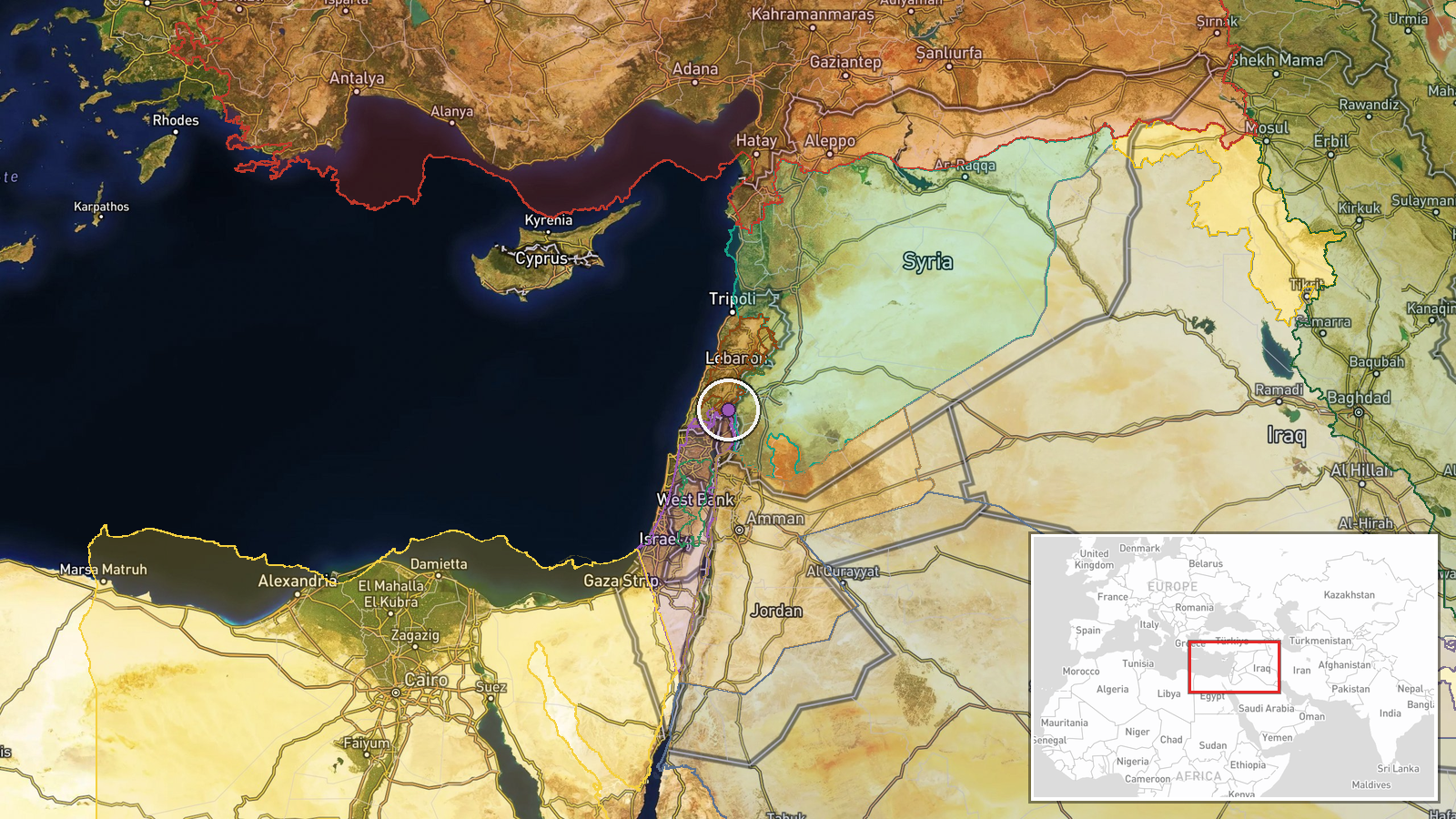
Quneitra Governorate in southern Syria, encompassing the Golan Heights border zone and extending into rural Damascus (Rif Dimashq). The region sits directly adjacent to Israeli-occupied territory and UN-patrolled demilitarized zones. Specific village locations mentioned in related events include Bayt Jan and Kafr Hawar, situated in western portions of the operational area near the border fence.
Related events nearby
- Israeli forces shot and killed an individual attempting to infiltrate an Israeli military position in southern2026-10-04 21:43 UTC · Security · Quneitra Governorate, Golan Heights, Syria
- Israeli 'Project Sofa 53' military operations advance south of Quneitra with ongoing excavation and earthwork 2026-10-04 17:53 UTC · Deployment · Quneitra Governorate, Golan Heights, Syria-Israel
- Israeli occupation forces detonated an abandoned building in agricultural lands between Bayt Jan village and B2026-10-05 06:49 UTC · Combat · Bayt Cin, Rif Dimashq Governorate, Syria
- Israeli forces conducted an airstrike targeting a civilian vehicle in Bayt Jan village, Rif Dimashq (Damascus 2026-10-05 12:14 UTC · Airstrike · Bayt Jan, Rif Dimashq, Syria
- Israeli forces killed four narco-terrorists attempting to infiltrate a military position in southern Syria's G2026-10-05 02:42 UTC · Security · Kafr Hawar, Quneitra Governorate, Syria
▶ View this event on the live map
Intel Mapper aggregates open-source reports from monitored Telegram and X channels, geolocates them, cross-checks duplicates across sources and assigns a confidence score. Entries are updated as new confirmations arrive. Read how we verify events.