Israeli reconnaissance aircraft conduct surveillance over southern Quneitra near Golan demarcation line
What happened
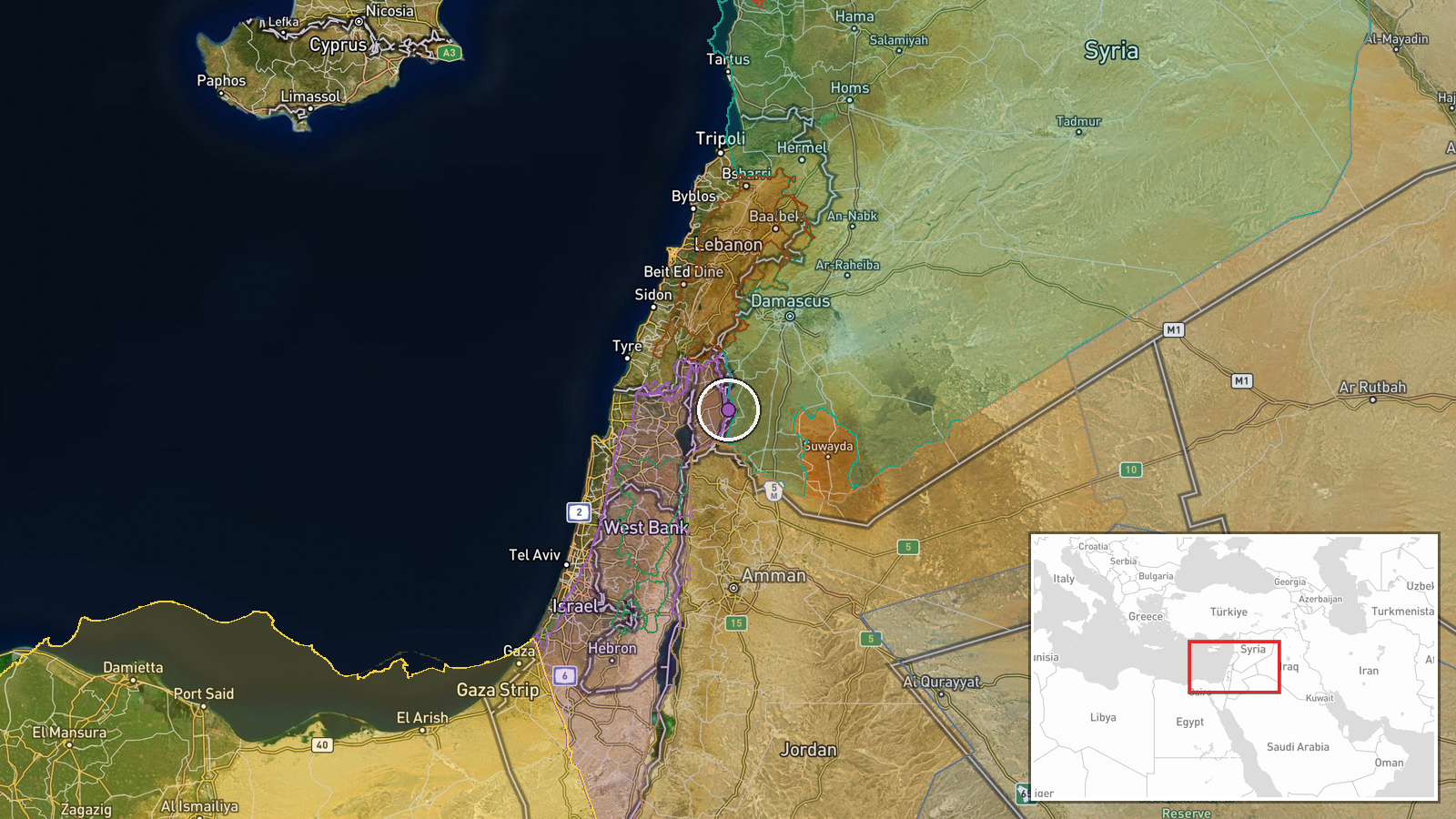
Four Israeli reconnaissance aircraft reportedly conducted aerial surveillance over Al-Assbah village in southern Quneitra Governorate on 9 October at approximately 1300 UTC. The village lies on the demarcation line separating Syrian territory from the Israeli-occupied Golan Heights. The report was published by the Syria Now Telegram channel without specification of aircraft type, mission duration, or operational outcome.
Context and assessment
The reconnaissance flight occurs within a pattern of heightened Israeli military activity in the Quneitra Governorate during early October. Related reports indicate an Israeli artillery strike on a facility near Suwaysa on 8 October and a brief ground incursion near Tel Karum the same day. Aerial surveillance of the demarcation zone typically precedes or accompanies ground operations or is conducted as routine monitoring. The timing suggests Israeli forces may be conducting systematic reconnaissance of Syrian positions near the Golan, possibly to assess military posture or gather intelligence on regional developments following broader regional tensions.
Sources and confidence
Single source: Telegram channel @AJSyriaNow (Syria Now). No independent cross-confirmation reported. Confidence score of 7.5 reflects the established credibility of the source channel but lack of corroboration from additional outlets. Confirmation from Israeli military statements or multiple independent Syrian sources would raise confidence; absence of follow-up reporting or clarification on aircraft type and mission would lower it.
Location
Al-Assbah village, southern Quneitra Governorate, Syria, located at the demarcation line with the Israeli-occupied Golan Heights. The settlement lies in the strategic border zone between Syrian and Israeli-controlled territory. Precision: settlement-level based on named location reference. Geographic coordinates: 32.98°N, 35.89°E.
Related events nearby
- Israeli forces conducted an artillery strike on an abandoned military facility on the outskirts of Suwaysa, Qu2026-10-08 17:13 UTC · Artillery · Suwaysa, Quneitra, Syria
- Israeli military officer Capt. Eliav Haim Tzapalamus, 21, from Haifa, killed when his Humvee overturned in sou2026-10-08 18:14 UTC · Security · Southern Lebanon
- Demonstrations in Al-Hasakah's Freedom Square demanding expansion of Syrian state authority and institutional 2026-10-09 12:36 UTC · Statement · Damascus, Syria
- Demonstrations across Hasakah Governorate and its countryside demanding Syrian state authority extend to the e2026-10-09 11:14 UTC · Statement · Damascus, Syria
- Aerial footage shows worshippers gathering at the Umayyad Mosque in Aleppo for the first Friday prayer followi2026-10-09 10:45 UTC · Statement · Damascus, Syria
▶ View this event on the live map

Intel Mapper aggregates open-source reports from monitored Telegram and X channels, geolocates them, cross-checks duplicates across sources and assigns a confidence score. Entries are updated as new confirmations arrive. Read how we verify events.