Israeli patrol interrogates farmers in western Daraa, restricts valley access
What happened
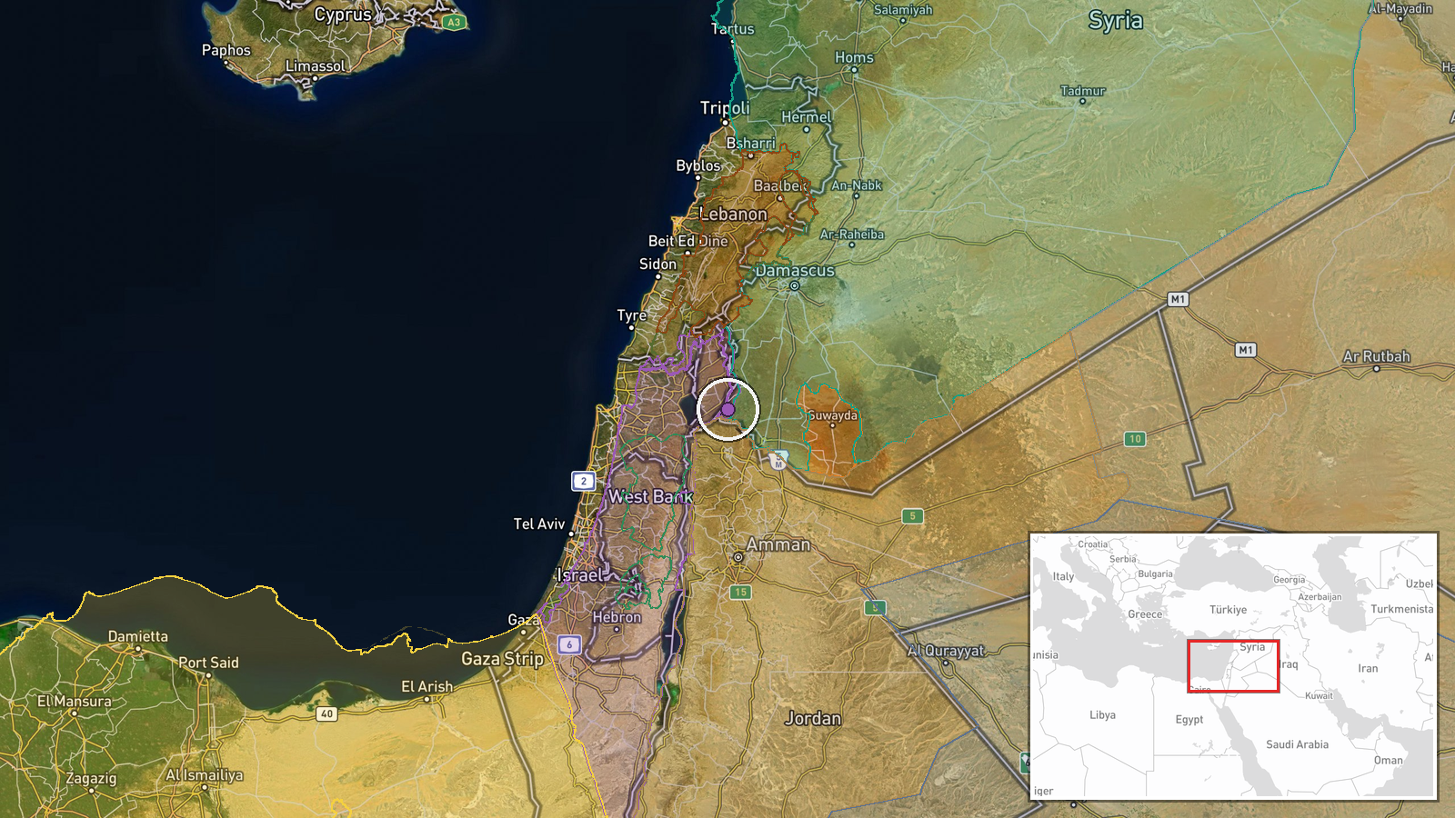
Israeli occupation forces conducted a patrol comprising two vehicles through Jumlah village in western rural Daraa on 10 October, according to Syria Now correspondent. The patrol interrogated local farmers and imposed restrictions on civilian movement to and from Wadi al-Ruqqad valley. The operation occurred along the Arneh-Darbal road in western rural Damascus countryside, in an area near the demarcation line with Israeli-controlled territory.
Context and assessment
Jumlah lies in the contested border zone between Syrian territory and Israeli-held Golan Heights, an area where Israeli armed forces maintain regular security operations. The reported movement restrictions and farmer interrogations align with a documented pattern: the UN Human Rights Commission recorded approximately 280 Israeli armed incursions into Syria during September 2024, including raids, home searches, and civilian movement controls. This incident follows aerial reconnaissance over nearby Al-Assbah village on 9 October, suggesting sustained Israeli security activity in rural Quneitra and Daraa. Such operations typically aim to gather intelligence and enforce de facto control over border-adjacent areas, though their immediate tactical objective remains unclear from available reporting.
Sources and confidence
Single source: Telegram channel @AJSyriaNow (Syria Now correspondent). No cross-confirmation from additional channels reported. Confidence score of 7.5 reflects the single source and typical reliability of Syria Now reporting, offset by lack of independent verification. Confirmation from Syrian military or humanitarian sources, or video documentation, would strengthen confidence.
Location
Jumlah village, western rural Daraa governorate, near the Quneitra border. Patrol route: Arneh-Darbal road in western rural Damascus countryside. The area sits in the demilitarized zone and adjacent Syrian territory near Israeli-controlled Golan Heights, approximately 3–5 km from the demarcation line. Wadi al-Ruqqad valley, the target of movement restrictions, runs through this border-proximate region.
Related events nearby
- Four Israeli reconnaissance aircraft conducting aerial surveillance over Al-Assbah village in southern Quneitr2026-10-09 12:59 UTC · Combat Aircraft · Al-Assbah, Quneitra, Syria
- Two customs police officers wounded in armed ambush near Izra Bridge (Daraa) while escorting transit convoy. U2026-10-09 21:19 UTC · Security · Izra Bridge, Izra Bridge, Daraa
- UN Human Rights Commission documented ~280 Israeli armed incursions into Syria in September 2024. Operations i2026-10-09 15:20 UTC · Security · Syria (Golan Heights / Occupied Territory)
- Syrian Foreign Ministry condemns Houthi attack on King Khalid International Airport in Riyadh that killed 3 Sa2026-10-09 17:15 UTC · Statement · Damascus, Syria
- Demonstrations in Al-Hasakah's Freedom Square demanding expansion of Syrian state authority and institutional 2026-10-09 12:36 UTC · Statement · Damascus, Syria
▶ View this event on the live map

Intel Mapper aggregates open-source reports from monitored Telegram and X channels, geolocates them, cross-checks duplicates across sources and assigns a confidence score. Entries are updated as new confirmations arrive. Read how we verify events.