Israeli forces fire on farmers in Beit Jan farmland west of Damascus
What happened
Israeli occupation forces reportedly infiltrated agricultural land in the Krom Mazra'a area near Beit Jan, west of Damascus, on 13 October and opened fire on farmers working in the fields. Local sources published the account via Telegram. No casualty figures or details of the engagement outcome were provided in the report.
Context and assessment
The incident occurs amid an intensified pattern of Israeli military operations across southern and southwestern Syria. On 12 October alone, Israeli forces conducted an airstrike on a military barracks at Tel Harbon near Beit Jan, penetrated Breqaa village in Quneitra with armored vehicles performing house-to-house searches, and advanced into Wadi al-Raqad in rural Daraa. These operations suggest a sustained campaign targeting facilities and areas near the Golan Heights buffer zone. The targeting of farmers may reflect broader reconnaissance or deterrence activities in contested border regions, though the operational significance remains unclear.
Sources and confidence
Single source: Telegram channel @AJSyriaNow. No cross-confirmation from other regional channels or international monitors reported. Confidence score 7.6 reflects single-source reporting without independent verification. Corroboration from Syrian government or humanitarian organizations, or additional regional accounts, would strengthen confidence. Video or eyewitness testimony would raise reliability.
Location
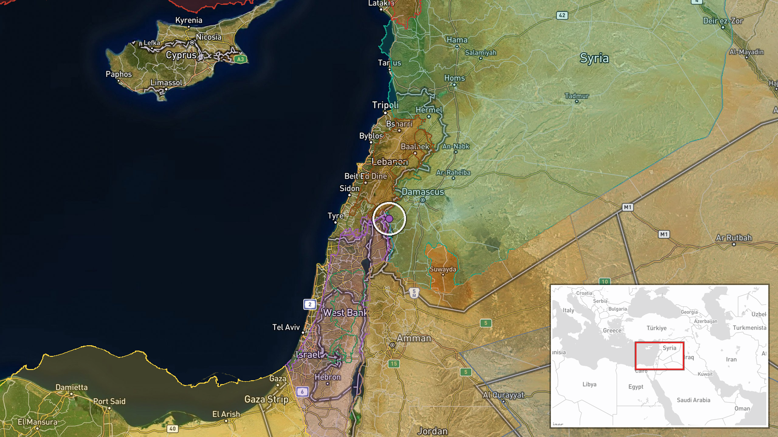
Beit Jan settlement, Rif Dimashq (Damascus Countryside) governorate, southwestern Syria, approximately 15 km west of Damascus city center. The Krom Mazra'a farmland lies in agricultural terrain west of the settlement. The area sits within the demilitarized zone established after the 1973 war, near the Israeli-occupied Golan Heights.
Related events nearby
- Israeli Air Force conducted airstrike and detonated an abandoned military barracks at Tel Harbon near Beit Jan2026-10-12 14:50 UTC · Airstrike · Tel Harbon, Beit Jan, Rif Dimashq, Syria
- Israeli military patrol comprising 4 armored vehicles penetrated Breqaa village in Quneitra Governorate and co2026-10-12 17:16 UTC · Security · Breqaa, Quneitra Governorate, Syria
- Israeli occupation forces advance into Wadi al-Raqad outskirts in rural Daraa via multiple military vehicles. 2026-10-12 15:54 UTC · Combat · Wadi al-Raqad, Daraa Governorate, Syria
- A 14-year-old student was killed and 24 wounded when an unexploded BRB1 submunition from a Hezbollah Grad rock2026-10-12 15:25 UTC · Explosion · Mitzpe Pe'er Lookout, Ramim Ridge, Upper Galilee,
- IDF statement clarifies unidentified object detected in northern Israel was likely a harmless balloon or hot-a2026-10-13 06:41 UTC · Statement · Northern Israel
▶ View this event on the live map

Intel Mapper aggregates open-source reports from monitored Telegram and X channels, geolocates them, cross-checks duplicates across sources and assigns a confidence score. Entries are updated as new confirmations arrive. Read how we verify events.