Heavy rainfall damages Al-Khan bridge in Deir ez-Zor; Syrian emergency crews restore access
What happened
Syrian emergency and disaster management authorities reported that heavy rainfall on the night of October 12 caused flash flooding that damaged portions of the Al-Khan bridge spanning a wadi in Al-Tabni, Deir ez-Zor Governorate. The structural damage cut road access between the town and surrounding settlements. Emergency response teams conducted emergency repairs and reinforcement work using earth materials to restore civilian passage, according to the Deir ez-Zor Directorate of Emergency and Disaster Management via Telegram.
Context and assessment
The Al-Tabni area lies in eastern Syria's Deir ez-Zor Governorate, a region with limited transportation infrastructure where bridge failures can isolate communities. The incident follows broader heavy rainfall across northeastern Syria documented on October 13 in the same governorate, suggesting a regional weather event. Related flooding reports from Wadi al-Shula indicate water accumulation across the area. Functional road access in this region is operationally significant for civilian movement and supply routes. While the damage appears environmental rather than conflict-related, infrastructure vulnerability remains relevant to humanitarian access and population movement in an area where displacement operations were recently announced.
Sources and confidence
Single source: Deir ez-Zor Emergency and Disaster Management Directorate via Telegram channel @AJSyriaNow. No cross-confirmation from independent monitors. Confidence score of 7.6 reflects official Syrian government reporting on a non-contested infrastructure issue without corroborating media coverage. Score would increase with photographs or secondary humanitarian organization verification; would decrease if flooding claims were contradicted by meteorological data.
Location
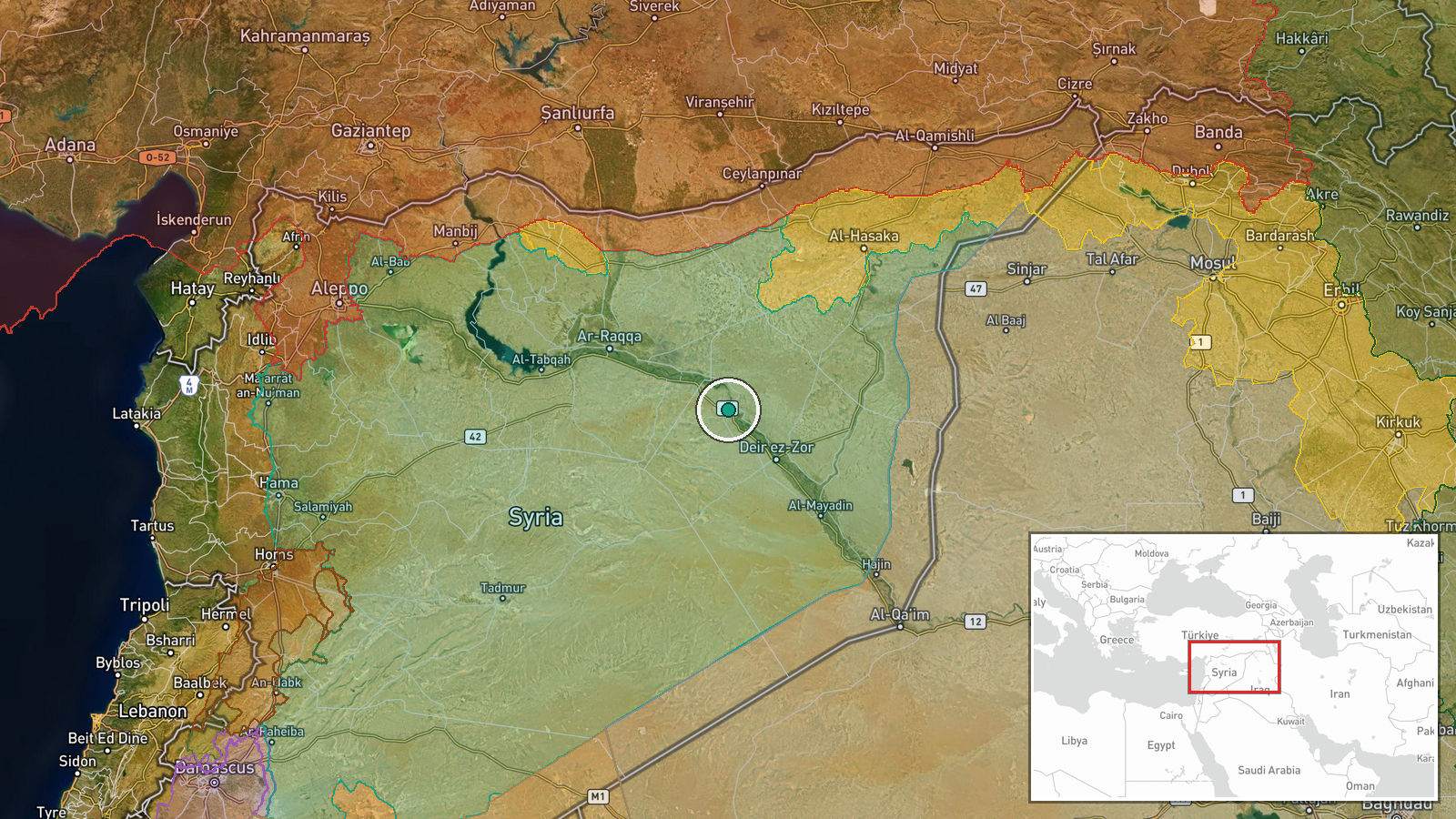
Al-Tabni (also transliterated Al-Tabniyeh) is a town in Deir ez-Zor Governorate, northeastern Syria, located at approximately 35.6°N, 39.8°E. The Al-Khan bridge crosses a wadi (seasonal watercourse) serving as a connection between the town and surrounding villages. The precision is regional given the wadi context rather than pinpoint coordinates.
Related events nearby
- Oil tanker explosion reported in Deir ez-Zor city, eastern Syria. No casualties or additional details availabl2026-10-12 22:23 UTC · Explosion · Deir ez-Zor, Deir ez-Zor Governorate, Syria
- Heavy rainfall across Syria yesterday caused water accumulation in Wadi al-Shula, Deir ez-Zor Governorate. Met2026-10-13 10:25 UTC · Report · Wadi al-Shula, Deir ez-Zor Governorate, Syria
- Syrian government announces return of approximately 450 displaced families from Ras al-Ayn to their original a2026-10-12 17:22 UTC · Displacement · Ras al-Ayn, Hasakah Governorate, Syria
▶ View this event on the live map

Intel Mapper aggregates open-source reports from monitored Telegram and X channels, geolocates them, cross-checks duplicates across sources and assigns a confidence score. Entries are updated as new confirmations arrive. Read how we verify events.