Israeli forces expel shepherds, fire on water tank in Golan Heights village
What happened
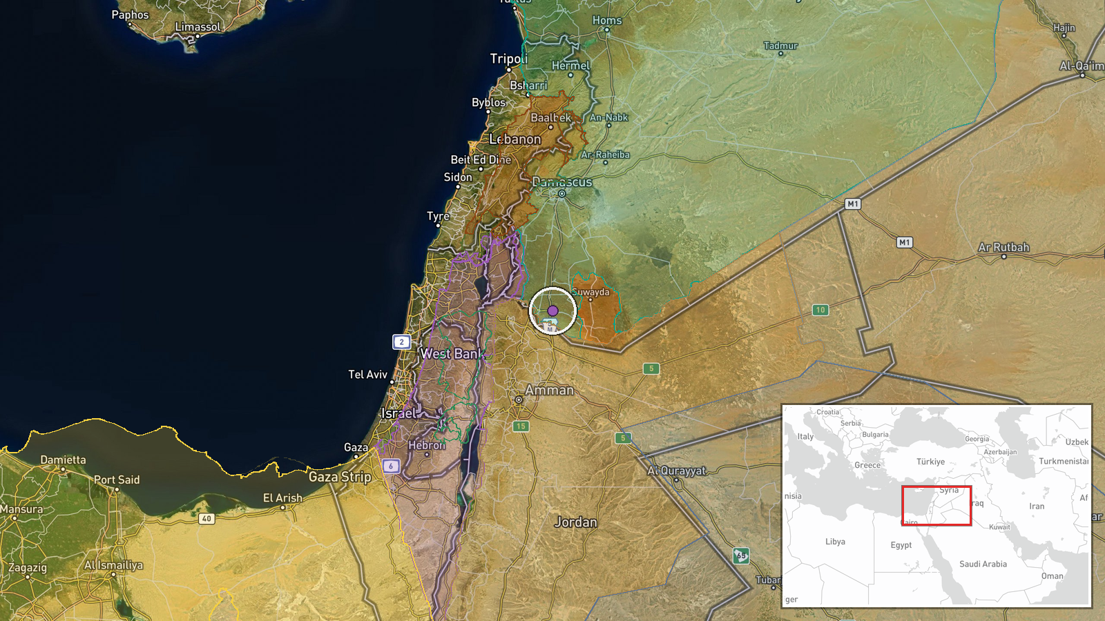
Israeli military forces entered Saida village in the Golan Heights region of southern Syria on October 14, reportedly expelling shepherds and firing on a water tank before withdrawing from the area. The operation occurred in Daraa Governorate near the Quneitra border region. No confirmed casualties were reported in connection with the incident. The report originates from a Syrian news channel monitoring Israeli military activity in the occupied territory.
Context and assessment
The incident in Saida is part of a broader pattern of Israeli military operations across the Syrian Golan Heights and southern Lebanon in mid-October. Related operations on the same day included a multi-vehicle patrol in Wadi al-Raqad west of Daraa that detained civilians, and an Israeli Brigade 810 operation in Shebaa village, Lebanon that recovered explosive devices and a militant staging position. These coordinated activities suggest sustained Israeli security operations targeting infrastructure and perceived security threats across the occupied and contested territories. The targeting of civilian water infrastructure may reflect concerns over supply lines or unauthorized use of facilities in areas under Israeli control.
Sources and confidence
Single source: Telegram channel @AJSyriaNow (Syria Now correspondent). No cross-confirmation from Israeli military statements or independent observers reported. Confidence score of 7.6 reflects the plausibility of the incident within documented operational patterns but limited source diversity. Corroboration from Israeli military sources or additional independent reporting would increase confidence; contradictory statements would lower it.
Location
Saida village is located in the Golan Heights region of Daraa Governorate, southern Syria, approximately 32.63°N, 36.23°E. The settlement sits in terrain typical of the occupied Golan, near the administrative border with Quneitra Governorate. The village lies within territory under Israeli military control since 1967.
Related events nearby
- Israeli military patrol with five vehicles infiltrated Wadi al-Raqad area west of Daraa. Three vehicles raided2026-10-14 06:21 UTC · Security · Wadi al-Raqad, Daraa, Syria
- Israeli occupation forces established a military checkpoint in Briqah village, Quneitra Governorate, as part o2026-10-13 15:15 UTC · Security · Briqah, Quneitra, Syria
- Israeli Brigade 810 completed operation in Shebaa village, southern Lebanon. IDF forces located and seized an 2026-10-14 06:26 UTC · Security · Shebaa, South Lebanon, Lebanon
- Israel deployed David's Sling air defense system to its northern region, likely in response to escalating Hezb2026-10-14 12:18 UTC · Deployment · Northern Israel
- Syrian Foreign Minister Asaad al-Shaibani reiterates condemnation of Iranian and Houthi attacks, stating regio2026-10-13 19:47 UTC · Statement ·
▶ View this event on the live map

Intel Mapper aggregates open-source reports from monitored Telegram and X channels, geolocates them, cross-checks duplicates across sources and assigns a confidence score. Entries are updated as new confirmations arrive. Read how we verify events.