Israel deploys David's Sling air defense system to northern region
What happened
Video footage shared on X reportedly shows Israel deploying David's Sling, its medium-range air defense system, to the northern region on October 14. David's Sling is designed to intercept aircraft, cruise missiles, and incoming projectiles at ranges of 40 to 300 kilometers. The deployment follows escalating military activity along Israel's northern border with Lebanon and in the Syrian Golan Heights over the preceding 24 hours.
Context and assessment
The deployment appears responsive to mounting security tensions in northern Israel and Syria. On October 14 alone, Israeli forces conducted multiple operations in southern Lebanon and Daraa province, including a raid in Shebaa that targeted a reported Hezbollah staging position and weapons cache. An Israeli Defense Minister statement on October 14 warned of severe consequences if Hezbollah joined Iranian attacks on Israel. David's Sling, typically positioned for strategic air defense, would bolster Israel's layered defense architecture amid threats from both Iranian and Hezbollah air capabilities. The system's deployment to a broad northern region suggests preparation for potential aerial threats rather than response to an imminent specific attack.
Sources and confidence
Report originated from X account @ConflictTR. Single source submission with low confidence rating (6.1/10) reflects the absence of corroborating reports from Israeli military sources, Western media, or other independent channels. Confidence would increase substantially with confirmation from IDF statements, satellite imagery analysis, or reports from established news agencies. Visual verification of the platform's specific location would also strengthen assessment reliability.
Location
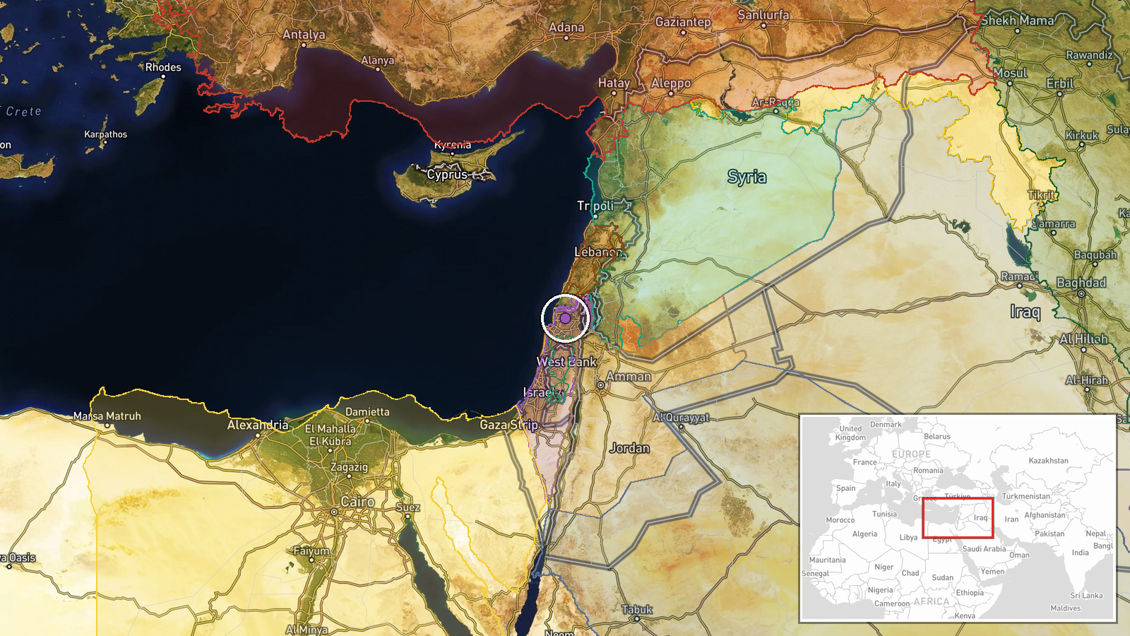
Northern Israel, determined at regional precision level rather than specific settlement or facility. The coordinates (32.95°N, 35.3°E) place the reference in northern Galilee region near the Lebanese border. Nearby terrain includes the Golan Heights to the east and valleys running north toward the Lebanese frontier, strategically significant for air defense placement.
Related events nearby
- Israeli occupation forces established a military checkpoint in Briqah village, Quneitra Governorate, as part o2026-10-13 15:15 UTC · Security · Briqah, Quneitra, Syria
- Israeli Brigade 810 completed operation in Shebaa village, southern Lebanon. IDF forces located and seized an 2026-10-14 06:26 UTC · Security · Shebaa, South Lebanon, Lebanon
- Israeli military patrol with five vehicles infiltrated Wadi al-Raqad area west of Daraa. Three vehicles raided2026-10-14 06:21 UTC · Security · Wadi al-Raqad, Daraa, Syria
- Israeli forces expelled shepherds and fired on a water tank in Saida village (Golan Heights) before withdrawin2026-10-14 12:17 UTC · Security · Saida, Daraa, Syria
- Israeli Defense Minister Israel Katz threatens severe military consequences for Hezbollah if it joins Iran in 2026-10-14 10:35 UTC · Statement · Beirut's southern suburbs (evacuation warning)
▶ View this event on the live map

Intel Mapper aggregates open-source reports from monitored Telegram and X channels, geolocates them, cross-checks duplicates across sources and assigns a confidence score. Entries are updated as new confirmations arrive. Read how we verify events.