Images show Israeli-built earth berms on the Hadar-Tarnanga road in Quneitra, southern Syria
What happened
Footage and images circulated on Telegram by the channel @AJSyriaNow show earth berms, known in the source as sawatir, that Israeli occupation forces reportedly built on the Hadar-Tarnanga road in the Quneitra countryside of southern Syria. The report was posted on 17 October 2026 at 16:35 UTC. The original Arabic wording describes the structures as earth barriers erected by Israeli occupation forces on the road between Hadar and Tarnanga in the Quneitra countryside. The post does not give the number of berms, their length, or whether they were built on a particular day. It is a single-channel report, and no independent outlet has yet been identified as confirming it. The event is categorized as a deployment, reflecting the placement of military earthworks rather than any reported exchange of fire.
Context and assessment
Quneitra is the Syrian governorate along the 1974 disengagement line on the Golan Heights, and Israeli forces have operated in its buffer zone and beyond since December 2024. Earth berms are a low-cost way to block vehicle movement, screen observation points and channel traffic, so their appearance on a rural road suggests a longer-term posture rather than a brief patrol. The related reports from the same day point the same way. A temporary checkpoint was reportedly set up in al-Ajraf village at 07:56, and a patrol reportedly advanced into the Razzaniyeh and Abu Mudhara farms west of Sidon al-Golan at 10:20. On 16 October, forces were reportedly besieging the al-Mantara dam as its reservoir fell to dead level. Taken together, these reports describe ground control being extended and consolidated across the Quneitra countryside. Operationally, the berms may indicate an intention to limit access along this axis, control movement between villages, or hold terrain for a period. Those readings are inferences, not confirmed intent, and a berm on one road does not by itself establish a broader plan.
Sources and confidence
The event rests on one Telegram channel, @AJSyriaNow, with a source count of one. The channel is cited as the sole source, and no wire service, satellite imagery provider or local monitor has been found to repeat the claim. The confidence score is 7.8, which is moderately high for a single channel. That score likely reflects that the report includes visual material, which can be checked against location and date, and that it fits a documented pattern of nearby activity reported the same day. It stays below higher levels because the channel is not independently verified and the imagery's date and exact location have not been confirmed by a second party. Geolocation of the berms to the Hadar-Tarnanga road, or independent satellite confirmation, would raise confidence. Evidence that the material was older, or that the road description is wrong, would lower it.
Location
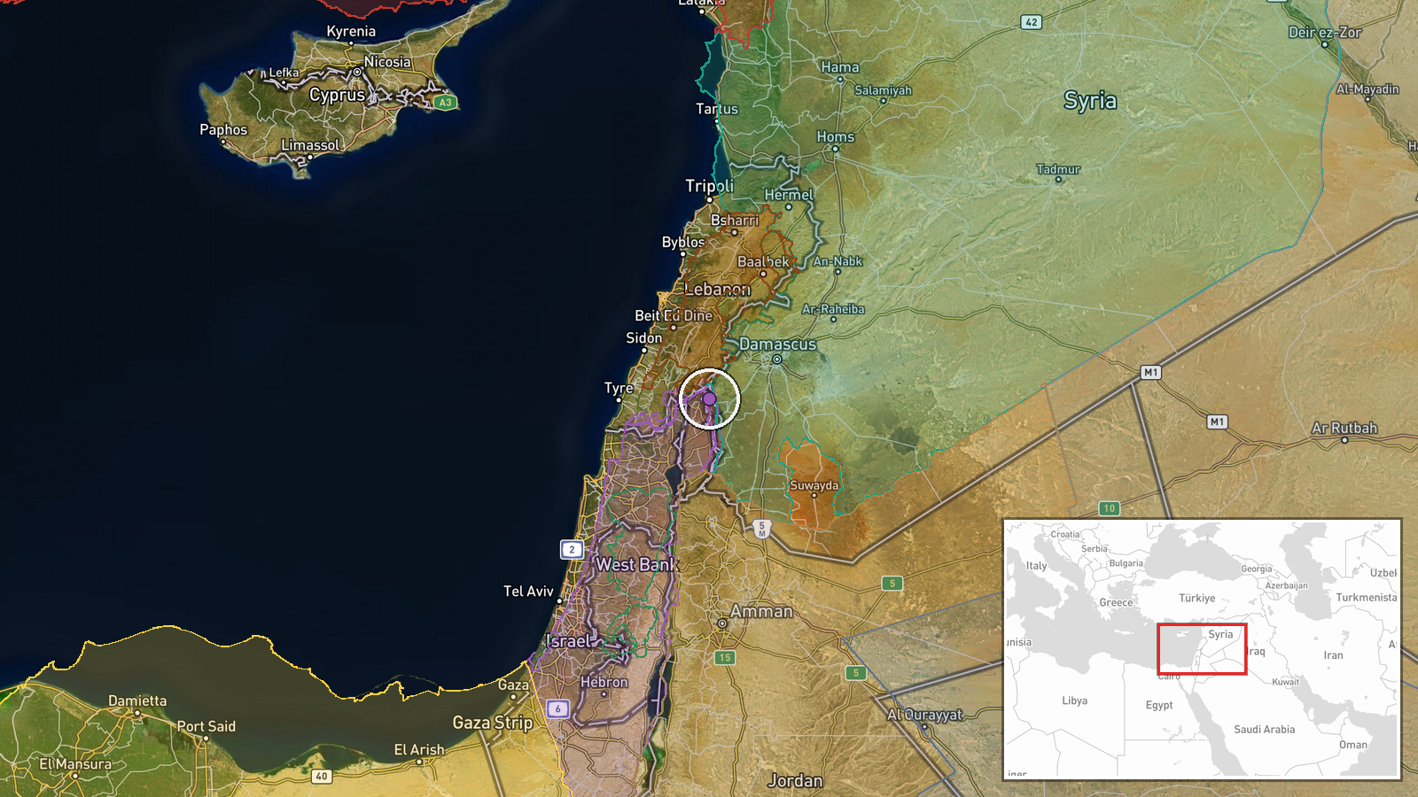
The coordinates place the event at settlement-level precision on the Hadar-Tarnanga road, in the Quneitra Governorate of southern Syria, rather than at a precise point on the road. Hadar is a Druze-majority village on the Golan Heights near the Israeli-held zone, and Tarnanga lies to the southwest in the Quneitra countryside. The terrain is an open upland plateau of basalt soils, orchards and farmland, with the Mount Hermon massif to the west and the Yarmouk basin to the south. Nearby features include the al-Mantara dam area and the buffer-zone line established after 1974. The road itself is a local route, so the exact berm position within the road corridor is not established by the report.
Related events nearby
- Israeli occupation forces set up a temporary checkpoint in al-Ajraf village, Quneitra countryside, per local s2026-10-17 07:56 UTC · Security · Al-Ajraf, Quneitra Countryside, Syria
- Israeli occupation force patrol advanced into Razzaniyeh and Abu Mudhara farms west of Sidon al-Golan in south2026-10-17 10:20 UTC · Security · Razzaniyeh Farm, South Quneitra, Syria
- Israeli reconnaissance aircraft reported flying over the city of Nawa in western Daraa countryside.2026-10-17 10:56 UTC · Combat Aircraft · Nawa, Daraa Governorate, Syria
- Gunfire and explosions heard in Damascus; Syrian security forces reportedly fired at an unidentified aerial ob2026-10-16 20:39 UTC · Security · Damascus, Syria
- Syrian FM al-Shaibani at OIC Council of Foreign Ministers: any Israeli annexation of the Golan is void under U2026-10-17 16:37 UTC · Statement · Damascus, Syria
▶ View this event on the live map

Intel Mapper aggregates open-source reports from monitored Telegram and X channels, geolocates them, cross-checks duplicates across sources and assigns a confidence score. Entries are updated as new confirmations arrive. Read how we verify events.