Israeli reconnaissance aircraft reportedly flying over Nawa, western Daraa countryside
What happened
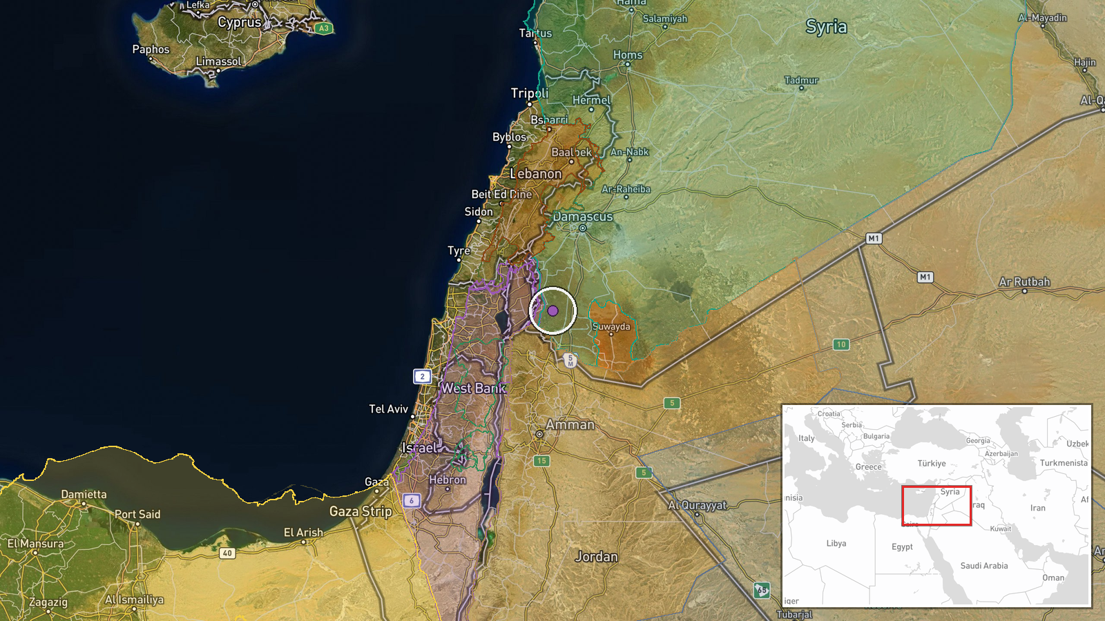
A single Telegram channel, @AJSyriaNow, reported that an Israeli reconnaissance aircraft was flying over the city of Nawa in the western countryside of Daraa in southern Syria. The report was published on 17 October 2026 at 10:56 UTC. The original Arabic wording describes the aircraft as belonging to the Israeli occupation and says it was flying in the airspace above the city. That phrasing points to a surveillance overflight rather than a strike, and the post reports no impact, damage, or munitions use. It does not give altitude, duration, flight path, or whether the sighting came from residents or from another method of identification. No casualties are mentioned. The event is classed as a combat aircraft incident, but the underlying description is limited to the presence of the aircraft overhead.
Context and assessment
Nawa lies within a southern Syrian zone where Israeli military activity has been frequent since the collapse of the Assad government in late 2024, when Israeli forces moved beyond the 1974 disengagement line in the Golan area. The related reports from the same day and the day before show a consistent pattern. On 16 October, reconnaissance overflights were reported across Daraa Governorate airspace, described as intensive. The same day, Israeli forces reportedly besieged the al-Mantara dam in Quneitra, and ground units advanced into Mazraat al-Hanut, where they reportedly fired on shepherds. On 17 October, a patrol advanced into the Razzaniyeh and Abu Mudhara farms west of Sidon al-Golan, and a temporary checkpoint was set up in al-Ajraf. Taken together, the sequence suggests persistent surveillance paired with ground presence across a broad area, rather than an isolated flight. Aerial reconnaissance of this kind typically supports route monitoring, observation of ground movements, and cueing for forces on the ground. Any operational intent beyond observation cannot be established from these reports alone.
Sources and confidence
The report rests on one Telegram channel, @AJSyriaNow, and the event has not been independently confirmed by a second source at the time of writing. The confidence score of 7.8 reflects a credible-sounding local report with a specific location and time, offset by the single-channel origin, the absence of imagery or flight data, and the vague wording about the aircraft's behaviour. Confidence would rise if a second local outlet, a regional monitor, or publicly available flight tracking corroborated the overflight, or if photographs or video were published with a verifiable location. It would fall if later reporting could not place an aircraft over Nawa at that time, or if the channel's earlier posts were found to be inaccurate.
Location
The coordinates correspond to the settlement of Nawa, placed at settlement-level precision with high location confidence. Nawa sits in the western part of Daraa countryside on the Hauran plain, a largely open, agricultural basaltic landscape northwest of Daraa city. The Golan Heights and the Quneitra area, where the related events were reported, lie to the west and southwest. Because the report names the city directly, the pinpoint is taken from the settlement rather than from a facility or road.
Related events nearby
- Israeli occupation force patrol advanced into Razzaniyeh and Abu Mudhara farms west of Sidon al-Golan in south2026-10-17 10:20 UTC · Security · Razzaniyeh and Abu Mudhara farms, west of Sidon al
- Israeli forces reportedly besiege al-Mantara dam in Quneitra as the reservoir reaches dead level.2026-10-16 16:48 UTC · Security · Al-Mantara Dam, Quneitra Governorate, Syria
- Intensive Israeli military reconnaissance aircraft flights reported over Daraa Governorate airspace, southern 2026-10-16 11:56 UTC · Combat Aircraft · Daraa Governorate, Syria
- Israeli occupation forces set up a temporary checkpoint in al-Ajraf village, Quneitra countryside, per local s2026-10-17 07:56 UTC · Security · Al-Ajraf, Quneitra Countryside, Syria
- Sweida governor urges dialogue with the Syrian government to halt bloodshed, guarantee rights, and address gri2026-10-17 11:16 UTC · Statement · As-Suwayda, Suwayda Governorate, Syria
▶ View this event on the live map

Intel Mapper aggregates open-source reports from monitored Telegram and X channels, geolocates them, cross-checks duplicates across sources and assigns a confidence score. Entries are updated as new confirmations arrive. Read how we verify events.