Israeli forces detain young man after checkpoint at Al-Alam roundabout, Quneitra, Syria
What happened
A post on the Telegram channel @AJSyriaNow, citing local sources, reports that Israeli forces detained a young man after he passed through a temporary checkpoint the forces had set up at the Al-Alam roundabout in the countryside of Quneitra, southwestern Syria. The original Arabic wording, which says Israeli occupation forces are holding a young man after he crossed a temporary checkpoint, indicates the detention followed his passage through the checkpoint. The report gives no details on the man's identity, the reason for his detention, how long he was held, or whether he was later released. The incident is dated 19 October 2026 at 18:59 UTC. The account rests on a single channel and had not been independently confirmed at the time of writing.
Context and assessment
Quneitra governorate sits along the 1974 disengagement line on the Golan Heights, and Israeli forces have operated inside the United Nations-monitored buffer zone and nearby high ground since the collapse of the Assad government in December 2024. A checkpoint at a rural junction would fit a pattern of controlling movement on local roads rather than a fixed military position. The same day's related events suggest a broader security tempo. Israeli ground forces reportedly advanced into Burj al-Zaraa on the outskirts of Darbel on Mount Hermon, roughly 30 kilometres to the northwest, and Israeli drone and airstrike activity was reported in southern Lebanon. In Daraa, a Syrian official called Israeli violations against southern residents a red line, and a senior Syrian official in Damascus alleged Israeli encouragement of Druze armed groups in al-Sweida. Taken together, the checkpoint may reflect screening or territorial control in the southwest rather than an isolated arrest. The detention itself is too thinly sourced to show intent or scale.
Sources and confidence
The only source is one Telegram channel, @AJSyriaNow, which relayed unnamed local sources. Its original Arabic post is available, so the wording can be checked, but no second outlet, eyewitness account, or Israeli military statement has been located for this incident. The confidence score of 7.6 reflects a plausible, specific report from a channel with a track record in the Syrian file, offset by single-source status and the lack of named witnesses. Confidence would rise with corroboration from a wire service, local Syrian media, or video or photo evidence of the checkpoint or detention. It would fall if the channel retracted the item or if local officials denied that any detention took place.
Location
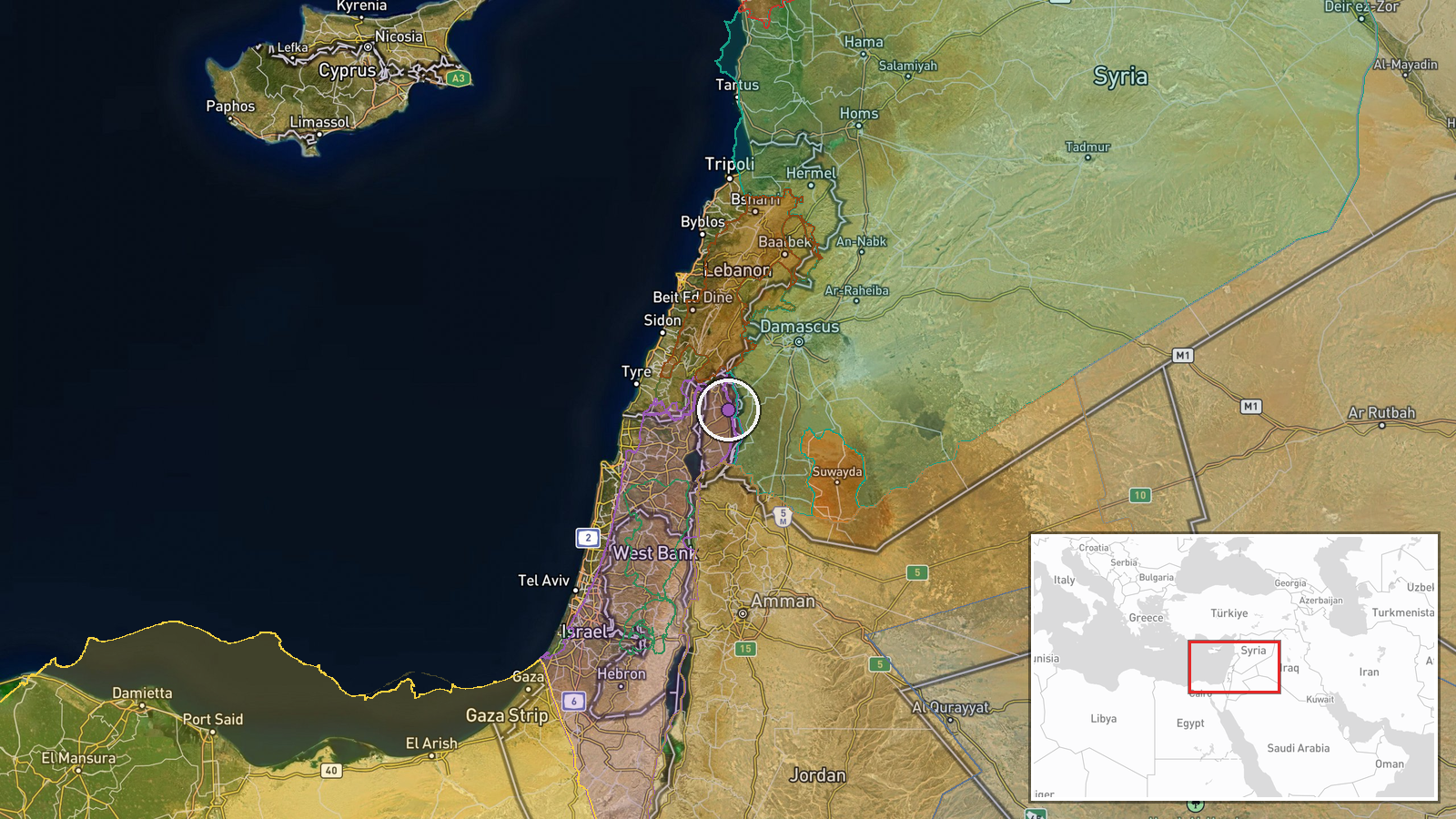
The point is placed at the Al-Alam roundabout, a named local junction, so precision is recorded at settlement level rather than exact building or road-segment level. The coordinates are approximate and may sit a few hundred metres from the actual junction. The area lies in the rural Quneitra countryside on the Syrian side of the Golan Heights, close to the buffer zone and the Israeli-held side of the ceasefire line. Mount Hermon and its foothills rise to the southwest, and the terrain is mostly open farmland and hills with a network of local roads.
Related events nearby
- Israeli forces advance into Burj al-Zaraa on the outskirts of Darbel in Mount Hermon, western Rif Dimashq.2026-10-19 07:54 UTC · Combat · Burj al-Zaraa, near Darbel, Rif Dimashq, Syria
- Israeli military drone dropped bombs on a house in Lebanon; the munitions failed to detonate.2026-10-19 13:05 UTC · UAS Strike · Near Kfar Shouba, Nabatieh, Lebanon (front line, e
- Explosions reported in Tebnine, southern Lebanon, following reports of Israeli Defense Forces (IDF) strikes. I2026-10-19 16:14 UTC · Airstrike · Tebnine, Lebanon
- Laith al-Balous declares Israeli violations against southern Syrian residents a red line.2026-10-19 17:32 UTC · Statement · Daraa, Syria
- Senior Syrian official claims Damascus expects Druze armed groups in al-Sweida to attack government forces, wi2026-10-19 18:17 UTC · Statement · Damascus, Syria
▶ View this event on the live map

Intel Mapper aggregates open-source reports from monitored Telegram and X channels, geolocates them, cross-checks duplicates across sources and assigns a confidence score. Entries are updated as new confirmations arrive. Read how we verify events.