Israeli forces reportedly advance into Burj al-Zaraa near Darbel, western Rif Dimashq
What happened
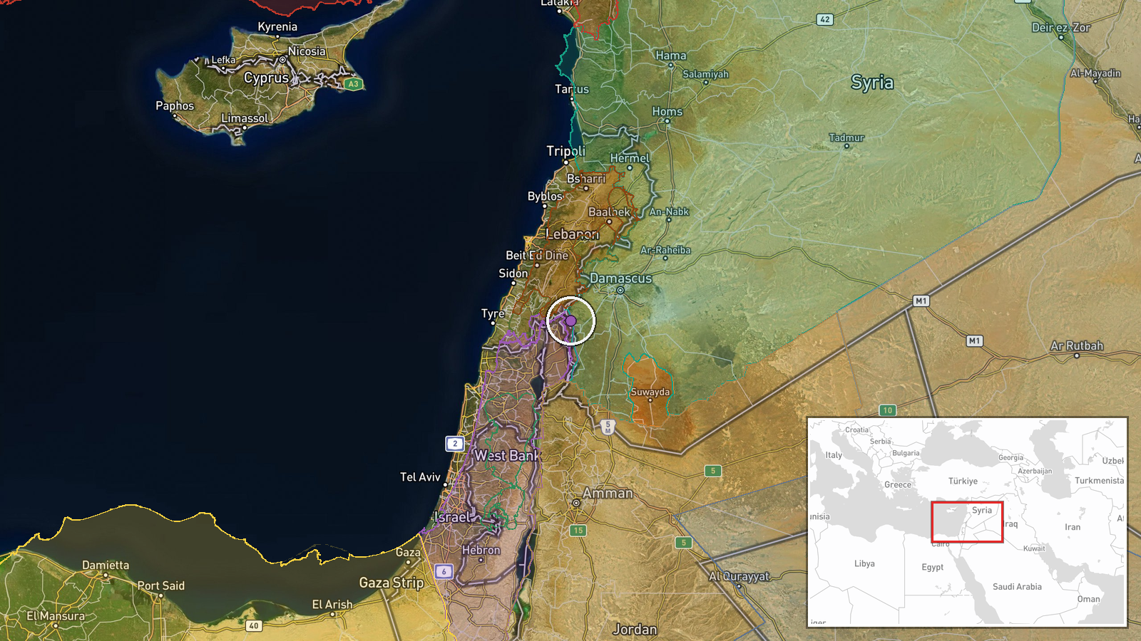
A single Telegram channel, @AJSyriaNow, reported on 19 October 2026 at 07:54 UTC that Israeli forces were advancing into Burj al-Zaraa, on the outskirts of the town of Darbel on Mount Hermon in the western countryside of Rif Dimashq, Syria. The original Arabic post, attributed to its correspondent, uses the verb 'tatawaghal' (penetrating or incursion) and gives no figures for troop numbers, vehicles, casualties, or duration. The post does not say whether the advance met resistance or whether forces stayed in the area. The wording describes movement into the locality rather than a named clash, so the report should be read as an account of ground presence and not of a confirmed engagement.
Context and assessment
Darbel sits on the western slopes of the Mount Hermon massif, close to the Syrian-Israeli frontier in the Golan. Since December 2024, when Syrian government forces lost control of the area after the fall of the Assad government, Israeli troops have moved beyond the 1974 disengagement zone into southwestern Syria, and reports of ground activity in Quneitra and Daraa have been frequent. The related events from the previous two days fit this pattern: overflights and ground incursions reported near Majdal Shams on 18 October, a two-tank advance with a temporary checkpoint at al-Hurriya that same afternoon, a checkpoint and passerby searches at al-Ajrafa, and reported bulldozing and tree removal across the Quneitra and Daraa countryside since 17 October. Taken together, these reports suggest a sustained effort to establish or expand a physical presence on high ground overlooking the approaches to the Golan and the Damascus countryside. Operationally, a push onto Mount Hermon foothills could be aimed at observation posts, route control, or securing terrain, but the reports do not establish intent, and the single-source nature of this item means its place in the pattern rests on consistency rather than corroboration.
Sources and confidence
The event rests on one Telegram channel, @AJSyriaNow, which is labeled as a Syria correspondent source. No second outlet, official statement, or geolocated footage has been identified for this specific locality. The confidence score of 7.6 reflects a named, consistently reporting channel whose wording is specific and whose claims are consistent with several related reports from the same area over the previous two days, while being held below the mid-range because there is no independent confirmation. Confidence would rise with corroboration from additional Syrian or regional outlets, verified images or video placed at Burj al-Zaraa, statements from local residents, or an Israeli military acknowledgement. It would fall if the channel is found to have recycled older material or if imagery shows the activity at a different site.
Location
The location is a settlement-level placement. Coordinates correspond to Burj al-Zaraa, a locality described in the source as on the outskirts of Darbel, rather than a surveyed facility or a precisely fixed military position. The area lies on the western and southwestern slopes of the Mount Hermon massif in Rif Dimashq, a terrain of ridges, valleys, and orchards at elevation. The Golan Heights frontier and the Israeli-held zone lie a short distance to the southwest, and Mount Hermon's higher peaks rise to the east and north.
Related events nearby
- Intense Israeli overflights and continuing ground incursions reported in southern Syria; no specific locality 2026-10-18 18:55 UTC · Combat · Near Majdal Shams, Quneitra, Syria (front line, es
- Israeli forces advanced with two tanks on the outskirts of al-Hurriya village in Quneitra countryside, set up 2026-10-18 15:26 UTC · Tank · Al-Hurriya, Quneitra, Syria
- AJSyria asks about the circumstances of Israeli forces abducting dozens of Syrians in southern Syria; a link p2026-10-18 15:16 UTC · Security · Al-Hurriya, Quneitra Governorate, Syria
- Israeli forces set up a temporary checkpoint in al-Ajrafa village, central Quneitra countryside, and are searc2026-10-18 12:36 UTC · Security · Al-Ajrafa, Quneitra Governorate, Syria
- Israeli forces conducted incursions, bulldozing and uprooting trees across the Quneitra and Daraa countryside 2026-10-18 14:11 UTC · Security · Quneitra Countryside, Quneitra Governorate, Syria
▶ View this event on the live map

Intel Mapper aggregates open-source reports from monitored Telegram and X channels, geolocates them, cross-checks duplicates across sources and assigns a confidence score. Entries are updated as new confirmations arrive. Read how we verify events.